Aqua Map Boating
Marine navigation and fishing
How much does Aqua Map Boating cost?
Prices are current as of 30 Sept 2026.
8 subscriptions from $9.99
In the United States, Aqua Map Boating has 8 subscriptions priced $9.99 – 49.99. It comes with a 14 days free trial.
| Subscription | Period | Price |
|---|---|---|
| Canada - nautical charts | AnnualTrial: 14 days | $9.99 |
| US - Nautical & Lakes charts | AnnualTrial: 14 days | $9.99 |
| Aqua Map Expert | AnnualTrial: 14 days | $14.99 |
| Bermuda - nautical charts | AnnualTrial: 14 days | $14.99 |
| Caribbean South Nautical chart | AnnualTrial: 14 days | $14.99 |
| US & Canada - nautical charts | AnnualTrial: 14 days | $14.99 |
| Aqua Map Master | AnnualTrial: 14 days | $24.99 |
| Bahamas - Explorer Charts | AnnualTrial: 14 days | $49.99 |
2 one-time purchases from $49.99
In the United States, Aqua Map Boating has 2 one-time purchases priced $49.99 – 139.99.
| Product | Price |
|---|---|
| US & Canada - Nautical chart | $49.99 |
| Bahamas - Explorer Chartbooks | $139.99 |
10+ alternatives to Aqua Map Boating
| Aqua Map Boating |   iNavX: Marine Navigation iNavX: Marine Navigation |   i-Boating: Marine Charts & Gps i-Boating: Marine Charts & Gps |   Navily Navily |   PRO CHARTS - Marine Navigation PRO CHARTS - Marine Navigation | 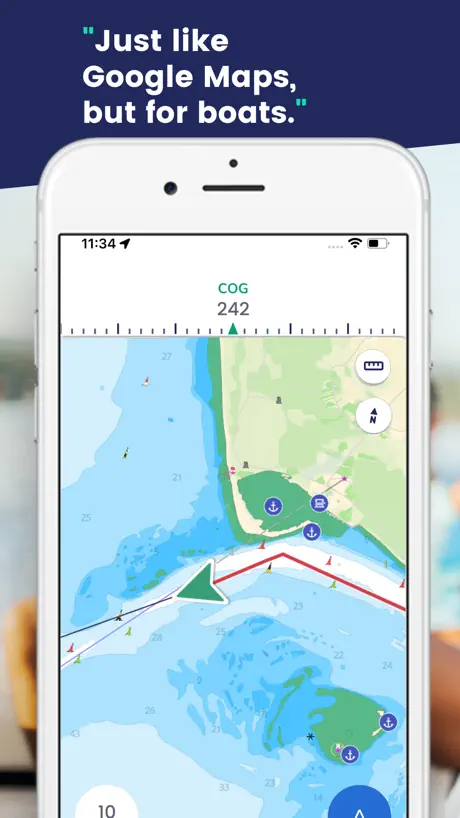  Savvy Navvy: Boat Navigation Savvy Navvy: Boat Navigation | 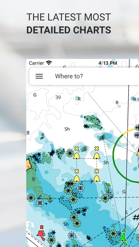  C-MAP: Boating C-MAP: Boating | 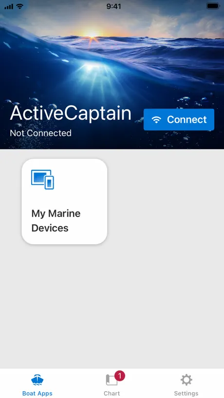  ActiveCaptain® ActiveCaptain® |   Wavve Boating: GPS, Map, Chart Wavve Boating: GPS, Map, Chart |   Navionics® Boating Navionics® Boating |   Argo Navigation: Boat GPS, Map Argo Navigation: Boat GPS, Map | |
|---|---|---|---|---|---|---|---|---|---|---|---|
| Rating / 5 | 4.7 | 4.7 | 4.5 | 4.8 | 4.5 | 4.6 | 4.5 | 4.0 | 4.7 | 3.0 | 4.9 |
| Reviews | 19K | 28K | 28K | 21K | 14K | 13K | 10K | 9.5K | 8.7K | 8K | 6.8K |
| Released | 2014 | 2019 | 2015 | 2014 | 2011 | 2019 | 2015 | 2017 | 2017 | 2014 | 2019 |
| Monthly price | — | $9.99 | — | — | $2.99 | — | $1.99 | — | $9.99 | — | $2.99 |
| Annual price | $14.99 | $59.99 | — | $18.49 | $29.99 | $129.00 | $18.99 | $99.99 | $69.99 | $49.99 | $9.99 |
| One-time price | $49.99 | — | $19.99 | $17.99 | $4.99 | — | — | $99.99 | — | — | — |
The going rate for each plan in United States, in its own currency, shaded from the cheapest price on the row to the dearest.
Aqua Map Boating reviews
4.7 out of 5, based on 18,786 reviews.
What people like
- Bathymetric depth data is incredibly accurate.
- Very affordable with no hidden traps.
- Developer listens to feedback and fixes bugs.
- Excellent for researching anchorages and marinas.
What they complain about
- Auto routing is missing or dangerous.
- Chart quality varies wildly by region.
- Syncing data between devices is broken.
- Subscription model hides features behind paywalls.
Good on a tablet or I-Pad
We use Aquamap on an I-Pad with an external GPS (Bad Elf). Works great and is easy to plan routes, up-date etc. I intended on using it as a supplement to our Garmin, but found I like the clarity, detail and size of the screen much better than the older Garmin unit we own. I now use it as our primary navigation plotter and the Garmin is now the backup & radar only. I can up-date Aquamap from my house using our wi-fi and can plan/enter routes while comfortably sitting in my living room, deck or anywhere. ‘Au Kai 25’ C-Dory
Glitchy
App freezes from time to time. Not very easy to use
James Cummings
A section that was evidently uncharted in Georgian Bay caused me to run aground. I get that it was captain error, but still very frustrating. Other than that, the app got us half way around America’ Great Loop without incident.
Owner
Hard to operate.
Page not found
Frustrating message when I attempt to register my GEC account when I activate the link to confirm in your email.
Great addition to charts
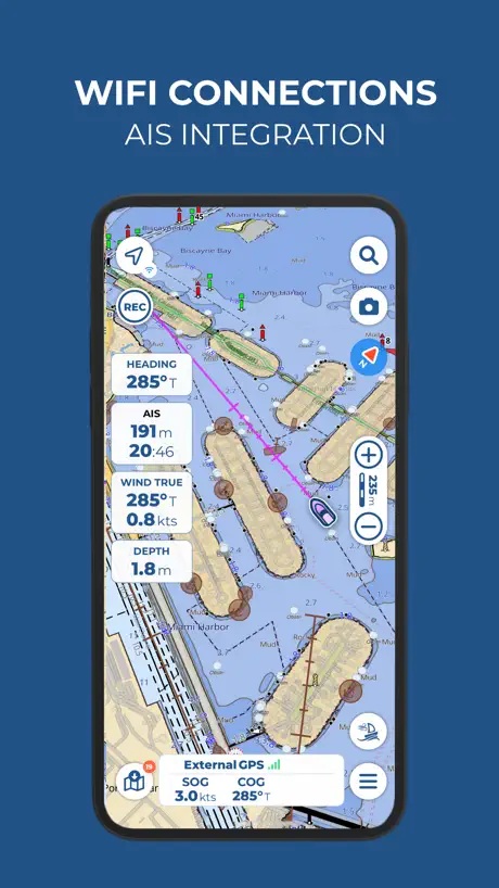
I have a Raymarine chart plotter that broke and a friend recommended aqua maps + it is affordable and no subscription traps, I like that active map with ais boats shown - I have loaded it on my tablet and phone
Not intuitive
Not intuitive for new users. …still trying to log in. …I think!
good with caveats
overall the app is quite good. developer is good about fixing hiccups. app easy to use. Explorer for Bahamas is nice. However, recent change: now is subscription to access online satellite. which would be ok if the satellite wasnt years old and not very high resolution.
Frustrated
Continually says it can’t properly down load maps. No response from developer
Great
More reliable than my depth finder
SEABEE
I have tried ALL OF THEM! I love my Garmin, but for sonar purposes, AQUA MAP IS THE BEST!!!
Want to cancel free trial
Can’t find place to cancel free trial
All Good but one thing
Love the app…graphics and content are great…I only wish it would auto route like Active Captain and Navionics.
Missing markets
Looks good but here in Australia gippsland lakes there are lots of missing markers. Will have to uninstall
Maps bundles by country are ridiculous.
I live and cruise on Canada’s southwest coast with occasional forays into the US. What is the point of having access to the Great Lakes or East Coast. Map bundles for North America should be West Coast, Central, and East Coast. Otherwise this a competent chart plotter app. I prefer how it deals with AIS compared to Navionics.
Great map
👍
From Top to Bottom
What was one of, if not, the best nav app, has decayed into one of, if not, the worst apps for marine navigation. I’ve used this app on multiple devices for many years. In just the last year the app has declined. It seems like every button click adds more cost. Then the glitches, with the new features, that just are not ready for prime time. Stop, the new features are not working. Stop, nickel and dimeing u to death.
Faroes charts
The charts for the Faroes are useless with roads on the sea and little detail…. You’d get more from a wall map of the world! UK seem better and look like they are based on Admiralty charts, but as you can get a full set of the real thing from Memory map id go for that. Thanks for response on fact you do not have the data from Danish hydrographic office. Comment on Admiralty charts is they look and feel like UKHO charts, but noted you have all the data on Aqua map.
My region map need update
I’m from the Maldives and the Maldivian map was just trash for me. Maybe due to lack of people here using the app. I had to pay $15 to try the map and it gives 14 day free trial but the free trial starts 1 year after you paid for the app. Like if I pay 2025 Jan, the free trial really starts Jan 2026 because it doesn’t refund even if I didn’t like the app. It’s false advertising on that part. Maybe can say “Buy 1 year and get 2 weeks free” that would be more accurate. Hopefully the devs would care enough to update the maps. Thanks
Amazing in some ways
The bathymetrics of this app are just amazing. The most accurate I found so far. The routes are difficult to manage if you want to make changes. The menus don’t have the natural intuitive approach that you will find on Navionics. It would be so nice to be able to create a route list and be able to edit it and order it for long trips, I didn’t find a way to do that.
Love it
Love it for tall ships
Satellite images
Unsatisfactory! After downloading the satellite images, we lost some level of zoom. When offline. We did not have that issue last year. We are now paying more for that option and getting less. We were in the middle of coral heads and luckily we had good satellite imagery on Iboating/Navionics. You can’t expect boaters to be online all the time when navigating.
Great user interface - poor chart alignment
Where RMS maps are overlaid on top of the native chart, the alignment is often very inaccurate. I would prefer to be able to toggle the RMS maps off (similar to satellite view). I’ve commented on this before and it still hasn’t been fixed.
Leider kein Probeabo
Ich habe die App installiert weil es ein zweiwöchiges Probeabo geben sollte aber anscheinend muss man gleich bezahlen. So ganz gefällt mir die App nicht da zb die Naturschutzgebietsgrenze der Kornaten nicht zu finden war.
Auto routing?
When will you offer full autorouting like Navionics?
Great map for Bahamas
I cruised the Bahamas by sailboat for the last six months and used Aqua Maps. It provided great intel on anchorages and safe routes. Pair this with your Navionics, and you have the perfect setup.
Constant errors attempting to download map tiles! SLOOOOW DOWNLOADING TOO!
I’ve more than adequate storage & network throughput, low latency, YET ERROR AFTER ERROR trying to download map tiles! Unacceptable! Get rid of the whole Tile method if it’s too complicated for you!
Amazing app - very impressed
I only downloaded today. I spent several hours getting used to it and customising it to suit my cruising area, which is from Brixham round North Devon, St David’s bay, IOM to Fleetwood and Cumbria. It was easy to add all my favourite marinas, routes and waypoints. Level of detail is fantastic even at highest zoom levels. It’s nice to be able to overlay satellite images and add your own photos. It’s well worth several times the price. Things I’d like to see: tidal and wind overlays. But wonderful as is.
No info without a subscription!
Am looking for an alternative as current provider just doubled my subscription cost but this app requires a subscription to try it! App is downloadable but there is no charting data available without a subscription, not sure how you are suppose to evaluate it!
No Auto Routing for trip planning?????
Great app but for premium membership fee one would think I would not have to tap in multiple waypoints to get out islands and hazards to get to final destination. Come on, even Navionics provides auto routing. I enter my boat draft, air height and how far I want to be away from shore etc. and Navionics will give me a suggested route as well as provide how much fuel I will burn and time at my selected speed and fuel per mile. You can do better Aqua Map, please….
6+ Year User
I have been using Aqua Map for over six years now. Five times Boston to Florida trips on the ICW and seven trips to the Bahamas… this has got to be one of the best apps for boating! Full-time live aboard Leopard 45.
Godawful UI
Purposely awful UI and design that’s only fixed when you pay for a subscription. They were even sneaky enough to make the map go completely black the closer you zoomed in, effectively making the app useless.
Just great
I used it for backup and now it’s my go-to app for the Bahamas.
Buggy
There’s something seriously wrong with the touch on iPhone. It takes several tries to register a touch to move/zoom the map. I really like the colour compared to navionics. However I’m not paying for it unless this gets fixed soon.
Decent but has flaws
Has a good map but does not track in a consistent manner and won’t sync automatically across devices
It’s got it all
The perfect companion for cruisers and cruisers alike. Keep this app on your phone or tablet as a redundant navigation system. Use it to investigate marinas and anchorages Map your routes automatically Get it. It’ll become your new best friend.
Can’t rely on this app
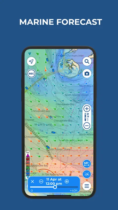
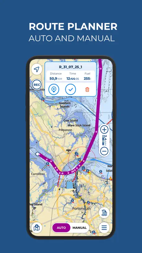
Route Planner in this app is outright dangerous - it plotted a route that would cross a traffic separation scheme at a long diagonal, instead of a right angle, as legally required by COLREGs Rule 10c. The features are otherwise very basic or of questionable quality. I noticed that in some spots map rendering is buggy - depth contours are broken and shifted. I had high hopes for this app originally, especially for an inexpensive access to the US and Canada maps. But after seeing those issues I don’t feel I can rely on it for navigating safely and cancelled my subscription. The app needs serious improvements in functionality and quality control.
Mise en évidence des reliefs
Certaines cartes ont des lignes au dessus des basses eaux (sort de l’eau avec la marée) qui ne sont pas de couleur différente aux autres mesures de profondeur ce qui peut mettre la confusion
manque
manque trop de détails aucun rapide inscris pour le riviere
Trial
Trying to out from a recommendation from a friend as they claim it’s more accurate with depths. The accuracy remains to be seen but navionics seems way more intuitive and user friendly.
Extraordinary
Aquamap is the best chartplotter I have used — and I have used a lot of them. They all take time to get to know. Aquamap too. But a lot of it is intuitive, and worth the effort. It has a ton of features, including some forms of remote access, great integration of AIS and weather, access to all sort of nautical information, and active captain, which is not quite what it once was but is still helpful. It is also inexpensive — quite remarkably cheap. Best of all, Aquamap clearly was not produced in some basement, by some nerd who was trying to make some money to buy more silly computer games. The team is responsive, listens to ideas (honestly, they had already thought about everything I have suggested to this point) and continues to be innovative. I have convinced many fellow sailers to try it. None has been disappointed.
needs lots of improvements
tracks and data in a single account are not synchronized in different devices… sharing data is painful…
problème
Seul les grand lac sont bien définis dommage
Deleting this app
Doesn’t work properly. I couldn’t get it to recognize that I was in the water, my boat icon in the app never moved from land even though I was in the water the whole time I was using it. Useless.
Poor charts for UK waters
An interesting app and easy to see why its so popular in the USA. Unfortunately, the quality of charts for UK are very poor which is surprising considering all the great features of this app.
AQUA MAP
I used so far iSailor as additional navigation; all of the sudden when entering a depth challenging port in the BAHAMAS it stopped showing my boat on the chart. No way to update; correct etc. So I went to AQUA MAP which I also had as back up. Now researching & focusing on AQUA MAP I realize it has way more options, information than iSailor. I will remove iSailor from ALL my navigation back up devices as unreliable.
Very Difficult app
Even with the tutorial, which is not comprehensive, I am unable to figure out how to chart a trip. I reached out to their help desk and waiting for a reply☹️
Good charts
It has all the nautical charts for the lakes and rivers in Ontario, Canada. I use it primarily for fishing trips. The maps need to be downloaded in sections before using. I tried it on iOs 9 (iPhone 4s) and iOs 11 (iPhone SE) and it works flawlessly on both devices. Not many useless bells and whistles (like finding “friends”) which is a positive thing. I compared it to a few other apps , but either they didn’t have the charts for the rivers and small bodies of water, or they were significantly more expensive. I wish it was not subscription based but a full purchase, so it loses a star for that.
Meilleur source de cartes
Martin: I have on board Garmin, Raymarine (Navionic) and Aqua Map. This last one, is the most acurate of all. It is also the most easy to use when it’s time to make the itinary. I recommand strongly this app.
So so
I downloaded this for a chart of my local lake but the chart quality is horrible can’t read any depths, looks terrible zoomed in. It does have a red rectangle outlining the lake maybe there’s a problem with that particular chart.
Aqua Map Boating price by country
An annual subscription costs $4.59 in Turkey and $60.56 in Colombia — 13× more for the same thing. Below is the going rate for each plan in every country that sells it — the middle price of what the app charges there, in the country's own currency with the dollar equivalent beneath it.
| Country | Annual | One-time |
|---|---|---|
| Afghanistan | $39.99 | — |
| Albania | $49.99 | — |
| Algeria | $39.99 | — |
| Angola | $39.99 | — |
| Anguilla | $39.99 | — |
| Antigua And Barbuda | $39.99 | — |
| Argentina | $24.99 | — |
| Armenia | $49.99 | — |
| Australia | A$22.99$16.08 | — |
| Austria | €24.99$28.43 | — |
| Azerbaijan | $39.99 | — |
| Bahamas | $39.99 | $149.99 |
| Bahrain | $39.99 | — |
| Barbados | $49.99 | — |
| Belarus | $49.99 | — |
| Belgium | €19.99$22.74 | — |
| Belize | $39.99 | — |
| Benin | $49.99 | — |
| Bermuda | $34.99 | — |
| Bhutan | $39.99 | — |
| Bolivia | $39.99 | — |
| Bosnia & Herzegovina | €44.99$51.18 | — |
| Botswana | $39.99 | — |
| Brazil | R$77.90$14.95 | — |
| British Virgin Islands | $39.99 | — |
| Brunei Darussalam | $39.99 | — |
| Bulgaria | €24.99$28.43 | — |
| Burkina Faso | $39.99 | — |
| Cambodia | $39.99 | — |
| Cameroon | $49.99 | — |
| Canada | CA$19.49$13.73 | CA$69.99$49.29 |
| Cape Verde | $39.99 | — |
| Cayman Islands | $39.99 | — |
| Chad | $39.99 | — |
| Chile | CLP 14,990$15.59 | — |
| China | CN¥98.00$14.58 | — |
| Colombia | COP 199,900$60.56 | — |
| Congo | $39.99 | — |
| Congo, Democratic Republic | $39.99 | — |
| Costa Rica | $19.99 | — |
| Cote Divoire | $49.99 | — |
| Croatia | €24.99$28.43 | — |
| Cyprus | €44.99$51.18 | — |
| Czech Republic | CZK 499.00$23.26 | — |
| Denmark | DKK 195.00$29.68 | — |
| Dominica | $39.99 | — |
| Dominican Republic | $34.99 | — |
| Ecuador | $39.99 | — |
| Egypt | EGP 1,999.99$38.41 | — |
| El Salvador | $39.99 | — |
| Estonia | €19.99$23.22 | — |
| Fiji | $39.99 | — |
| Finland | €19.99$22.74 | — |
| France | €15.49$17.62 | — |
| Gabon | $39.99 | — |
| Gambia | $39.99 | — |
| Georgia | $49.99 | — |
| Germany | €19.99$22.74 | — |
| Ghana | $49.99 | — |
| Greece | €39.99$45.49 | — |
| Grenada | $39.99 | — |
| Guatemala | $39.99 | — |
| Guinea-bissau | $39.99 | — |
| Guyana | $39.99 | — |
| Honduras | $39.99 | — |
| Hong Kong | HK$148.00$18.88 | — |
| Hungary | HUF 9,990$30.95 | — |
| Iceland | $29.99 | — |
| India | ₹3,999.00$41.63 | — |
| Indonesia | IDR 399,000$22.19 | — |
| Iraq | $39.99 | — |
| Ireland | €19.99$22.74 | — |
| Israel | ₪119.90$39.06 | — |
| Italy | €19.99$22.74 | — |
| Jamaica | $39.99 | — |
| Japan | ¥6,000$38.14 | — |
| Jordan | $39.99 | — |
| Kazakhstan | KZT 19,990.00$45.36 | — |
| Kenya | $49.99 | — |
| Kosovo | €44.99$51.18 | — |
| Kuwait | $39.99 | — |
| Kyrgyzstan | $39.99 | — |
| Lao Peoples Democratic Republic | $39.99 | — |
| Latvia | €44.99$51.18 | — |
| Lebanon | $39.99 | — |
| Liberia | $39.99 | — |
| Libya | $39.99 | — |
| Lithuania | €24.99$28.43 | — |
| Luxembourg | €15.49$17.62 | — |
| Macao | $39.99 | — |
| Macedonia | $39.99 | — |
| Madagascar | $39.99 | — |
| Malawi | $39.99 | — |
| Malaysia | MYR 199.90$49.00 | — |
| Maldives | $34.99 | — |
| Mali | $39.99 | — |
| Malta | €19.99$22.74 | — |
| Mauritania | $39.99 | — |
| Mauritius | $39.99 | — |
| Mexico | MX$499.00$27.88 | — |
| Micronesia | $39.99 | — |
| Moldova | $49.99 | — |
| Mongolia | $39.99 | — |
| Montenegro | €39.99$45.49 | — |
| Montserrat | $39.99 | — |
| Morocco | $39.99 | — |
| Mozambique | $39.99 | — |
| Myanmar | $39.99 | — |
| Namibia | $39.99 | — |
| Nauru | $39.99 | — |
| Nepal | $49.99 | — |
| Netherlands | €19.99$22.74 | — |
| New Zealand | NZ$22.99$12.99 | — |
| Nicaragua | $39.99 | — |
| Niger | $39.99 | — |
| Nigeria | NGN 69,900.00$52.58 | — |
| Norway | NOK 249.00$26.13 | — |
| Oman | $39.99 | — |
| Pakistan | PKR 9,900$35.75 | — |
| Palau | $39.99 | — |
| Panama | $14.99 | — |
| Papua New Guinea | $39.99 | — |
| Paraguay | $39.99 | — |
| Peru | PEN 149.90$43.83 | — |
| Philippines | ₱1,990.00$31.84 | — |
| Poland | PLN 99.99$26.81 | — |
| Portugal | €14.99$17.05 | — |
| Qatar | QAR 149.99$41.21 | — |
| Romania | RON 119.99$25.86 | — |
| Russia | RUB 1,490.00$17.66 | — |
| Rwanda | $39.99 | — |
| Sao Tome & Principe | $39.99 | — |
| Saudi Arabia | SAR 149.99$40.00 | — |
| Senegal | $49.99 | — |
| Serbia | €44.99$51.18 | — |
| Seychelles | $39.99 | — |
| Sierra Leone | $39.99 | — |
| Singapore | SGD 59.98$46.86 | — |
| Slovakia | €24.99$29.02 | — |
| Slovenia | €24.99$28.43 | — |
| Solomon Islands | $39.99 | — |
| South Africa | ZAR 299.99$18.28 | — |
| South Korea | ₩55,000$40.47 | — |
| Spain | €14.99$17.05 | — |
| Sri Lanka | $39.99 | — |
| St. Kitts and Nevis | $39.99 | — |
| St. Lucia | $39.99 | — |
| St. Vincent & The Grenadines | $39.99 | — |
| Suriname | $39.99 | — |
| Swaziland | $39.99 | — |
| Sweden | SEK 169.00$16.97 | — |
| Switzerland | CHF 18.00$21.63 | — |
| Taiwan | NT$790.00$24.83 | — |
| Tajikistan | $39.99 | — |
| Tanzania | TZS 99,900.00$37.74 | — |
| Thailand | THB 1,490.00$44.36 | — |
| Tonga | $39.99 | — |
| Trinidad and Tobago | $34.99 | — |
| Tunisia | $39.99 | — |
| Turkey | TRY 224.99$4.59 | — |
| Turkmenistan | $39.99 | — |
| Turks and Caicos | $39.99 | — |
| Uganda | $49.99 | — |
| Ukraine | $19.49 | — |
| United Arab Emirates | AED 54.99$14.98 | — |
| United Kingdom | £19.99$26.51 | — |
| United States | $14.99 | $49.99 |
| Uruguay | $39.99 | — |
| Uzbekistan | $39.99 | — |
| Vanuatu | $39.99 | — |
| Venezuela | $39.99 | — |
| Vietnam | ₫999,000$38.55 | — |
| Yemen | $39.99 | — |
| Zambia | $49.99 | — |
| Zimbabwe | $49.99 | — |
Aqua Map Boating FAQ
- Is Aqua Map Boating free?
- Yes. The app and its basic features are free, in all 175 countries it sells in. Premium features are paid: they start from $9.99 (US), across 8 subscriptions and 2 one-time purchases.
- Does Aqua Map Boating have a free trial?
- Yes — a 14 days free trial (US).
- Where is Aqua Map Boating cheapest?
- An annual subscription costs TRY 224.99 (≈$4.59) in Turkey and COP 199,900 (≈$60.56) in Colombia, its cheapest and dearest countries.
- What are the best alternatives to Aqua Map Boating?
- iNavX: Marine Navigation (4.7 from 28,413 reviews, premium from $9.99), i-Boating: Marine Charts & Gps (4.5 from 27,897 reviews, premium from $19.99) and Navily (4.8 from 20,835 reviews, premium from $9.49).
Aqua Map Boating download
Last updated 9 days ago.
Aqua Map Boating sells in 175 countries. It was released 11 years and 11 months ago, on 15 Oct 2014. It holds a 4.7 rating from 18,786 reviews.
Supports 8 languages: English, Dutch, French, German, Italian, Portuguese, Spanish, Swedish.
How much does Aqua Map Boating make?
Third-party estimates for the last 30 days, worldwide — not the store's own figures, which Apple publishes for nobody.
Revenue by plan
- Annual 94%
- One-time 6%
Revenue by country
- United States 80%
- Canada 7%
- Italy 3%
- Germany 3%