
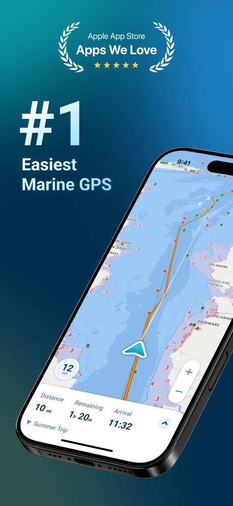
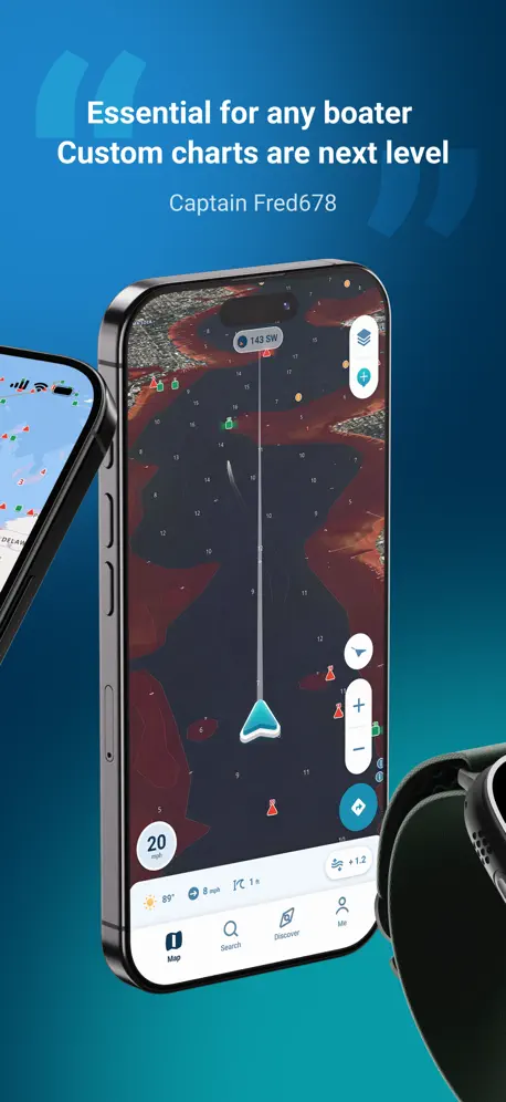
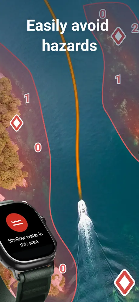
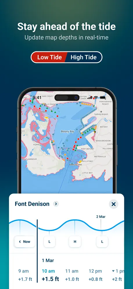
Wavve Boating: GPS, Map, Chart
Marine Navigation, Depth, Tide
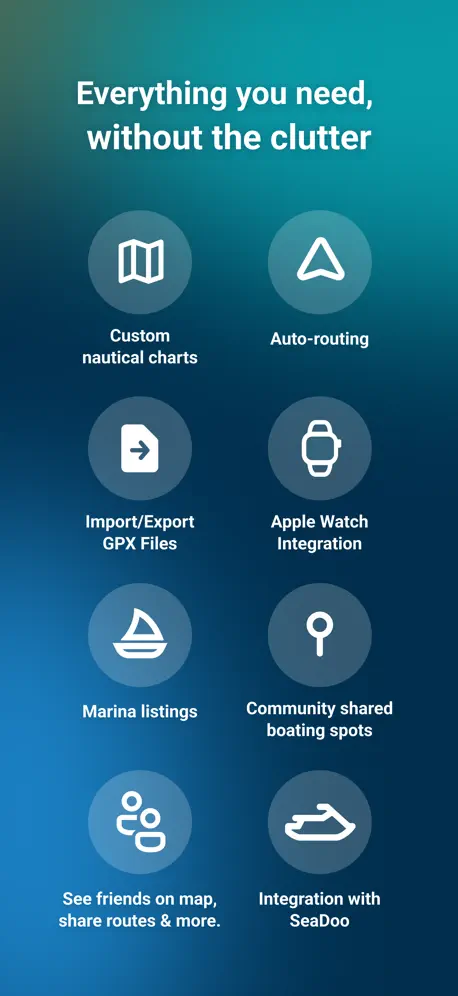
How much does Wavve Boating: GPS, Map, Chart cost?
Prices are current as of 4 Oct 2026.
4 subscriptions from $9.99
In the United States, Wavve Boating: GPS, Map, Chart has 4 subscriptions priced $9.99 – 69.99. Free trials run 14 days or 1 month.
| Subscription | Period | Price |
|---|---|---|
| Monthly Subscription (No Data) | Monthly | $9.99 |
| Monthly Subscription | Monthly | $11.99 |
| Best Value - Wavve Boating | AnnualTrial: 14 days, 1 month | $69.99 |
| Yearly Subscription (No Data) | AnnualTrial: 14 days | $69.99 |
See what Wavve Boating: GPS, Map, Chart costs in all 15 countries →
10+ alternatives to Wavve Boating: GPS, Map, Chart
| Wavve Boating: GPS, Map, Chart |   Dockwa Dockwa | 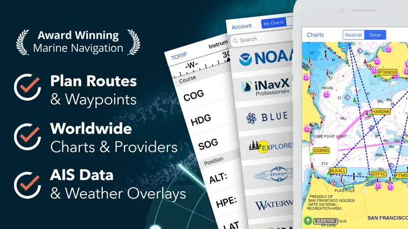  iNavX: Marine Navigation iNavX: Marine Navigation |   i-Boating: Marine Charts & Gps i-Boating: Marine Charts & Gps |   Aqua Map Boating Aqua Map Boating | 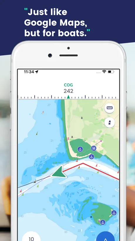  Savvy Navvy: Boat Navigation Savvy Navvy: Boat Navigation |   ActiveCaptain® ActiveCaptain® |   Navionics® Boating Navionics® Boating |   Argo Navigation: Boat GPS, Map Argo Navigation: Boat GPS, Map |   Lowrance: app for anglers Lowrance: app for anglers |   TZ iBoat – Marine Navigation TZ iBoat – Marine Navigation | |
|---|---|---|---|---|---|---|---|---|---|---|---|
| Rating / 5 | 4.7 | 4.9 | 4.7 | 4.5 | 4.7 | 4.6 | 4.0 | 3.0 | 4.9 | 4.6 | 4.6 |
| Reviews | 8.7K | 34K | 28K | 28K | 19K | 13K | 9.5K | 8K | 6.8K | 5.6K | 4K |
| Released | 2017 | 2015 | 2019 | 2015 | 2014 | 2019 | 2017 | 2014 | 2019 | 2019 | 2018 |
| Annual price | $69.99 | — | $59.99 | — | $14.99 | $129.00 | $99.99 | $49.99 | $9.99 | $23.49 | $19.99 |
| One-time price | — | — | — | $19.99 | $49.99 | — | $99.99 | — | — | — | $8.99 |
The going rate for each plan in United States, in its own currency, shaded from the cheapest price on the row to the dearest. Plans fewer than four in ten of the priced apps sell are left out.
Wavve Boating: GPS, Map, Chart reviews
4.7 out of 5, based on 8,698 reviews.
What people like
- Customer support responds very quickly
- Works well offline without cell service
- Easy to use and intuitive design
- Helps plan safe courses on new waterways
What they complain about
- No map data for many popular lakes
- Price is hidden until after you sign up
- Routes sometimes lead through land or danger
- Depth readings can be inaccurate
Just what I needed!
I used Wavve to navigate Okanagan Lake and Shuswap Lake in BC, Canada in a rented boat that had no depth gauge. Once you get the hang of it, it works *great* — it was just what I needed: - I downloaded the map for offline use because I wouldn’t have signal - I viewed the map looking for shallow spots to be ready for - I entered boat draft and expected avg speed - I manually entered routes, and then looked at the time estimates - And then I watched my progress along the routes live as I boated. Outstandingly well thought out and designed. Thank you!
Bait and switch
Says you have maps then wants a subscription. Hell I’ll go buy me a TP for that paying that every year.
Useful tool
Its a very useful app…
no information on big lakes near me.
i wanted to go out on a few lakes near me but it literally says no information. but showes me everything about other lakes 200 miles away. waste of money for this app
Does this work with apple car play as i have a screen installed on my boat
I have a car play device on the boat which alone music and so on but also does gps so is this app compatible with apple car play?
Great App for novice boaters!
I’m on Lake of the Woods 1-2 weeks per year. This app removes a lot of anxiety for me as a minimally experienced boater. Especially regarding navigation and hazards.
Provide some type option for free
Couldn’t tell you what the app offers. Obviously you give your email and name before they tell you anything. Once you create a simple profile, pay wall. X out, restart… same paywall. X out, log back in paywall. Like no offense I understand the idea a company needs profits but i don’t and know one else knows what the app helps with doing. Let me just pay 70 buck to find out like no! Fix your philosophy, make it free then ask for money like every other app.
Paul
I signed up for east and west lake Macy to Sandbanks Provincial Park in Ontario and they not available 😞
Trop chère
To much money
Looks like it would be amazing
If only they had the lakes that I boat on, it appears it would be a fantastic app and worth the money. I live in “Lake Country” and it’s named that for a reason. However none of our lakes, even our largest lakes aren’t available on the map!
I love this app!
I’ve been using Wavve for years and it only gets better. The charts are so easy to read and the autorouting is phenomenal. I’ve tried all the nav apps out there and this is the closest thing to actually having Google Maps on the water! I also love all the community points and seeing other Wavve app users on the water, it really has started to feel like a community. I also need to say that their customer support is the best I’ve ever interacted with. They are so friendly and get back to you right away. I’m sure I will be a lifelong customer.
Lake Vermilion in Mn.
No nautical data for one of Minnesota’s largest lakes! Of course I don’t find that out until I’ve paid for a subscription.
Chart names?
It would be nice to have the names of the inlets, bays… etc that you would see on a chart… not sure why they’re not on here
Routing need a LOT of work
The maps are nice but the routes take you through land, marinas, and dangerous areas. Not quite up to spec yet. Has potential though.
Coverage
Wish it covered all of Roatan Honduras. Not worth down loading until then.
Huge help navigating an unfamiliar lake
Very accurate course and water depth navigation!
Not free
Thought it would be like Waze but no it’s not free and I don’t need it enough to pay.
Needs CarPlay support
Great app, but given the availability of stereos and screens that run carplay, it would be very useful to have a larger screen view - especially if you are marketing it as "Google Maps for boaters" - fifth star if you add the feature. Otherwise it is a useful app.
Autorouting Issues
I subscribed to this in Hope that it would assist me in ICW routing through the canals. That does not seem to be the case so attempted the same thing with navionics and that works well. Contacted them and was told that they have challenges with what I want to do and just put in several waypoints to try to use it. That is not autorouting and to be honest I don’t find anything about this app to be better to where it is useful for boaters. It works for getting depths but not accurate really considering I tested its readings with my depth gauge and off. Can not find the value of this app for the money I pay so will be cancelling my subscription and don’t recommend this app for anyone seriously wanting to travel with their boat.
Doesn’t cover my area - North Georgia/South Carolina
Was excited to use this app and willing to pay the yearly subscription until I discovered the lakes in my area lacked coverage. Maybe sometime in the future, but until then, I have deleted the app.
Nice maps
Works great, saved me a ton of money buying multiple gps chart plotters/units for different boats!
Forced subscription before trying
Sucks all apps force you to agree to subscription rather then providing you with an actual free trial like this one I was gonna give it a try but not anymore
So many great features!
Love the app! Recommend over all other boating app!I hope they gonna add a feature to all time record a route!
Depth charts
Depths in my area are way off. And a place called Corey’s ditch that connects Back Bay and the North Landing river has no depth charted. More work needs done.
Missing speed zones
Would be great if the app showed the speed zone data
Kevin
I love using this app when on the water… what’s even better is their quick response to questions? I emailed Kayla at Wavve Boating at 7:30 a.m and by 8:30 a.m she returned my email with the answer needed for Boating that day. 👍👍
No lake data
Has no depth data on one of the most popular lakes in the country
Names
Wish the maps had names for the various water ways it displays. Be nice to know what creek or bay you’re currently in.
$60 a year
How about mentioning something about the price right from the beginning? Go through all the signing up, then see the free trial, followed by $60 a year. I did go back and saw the price at the very end of the description. Nope, I’ll just stick with the Navionics app I’ve been using for years, and it’s $10 less.
Gives me the confidence
Wavve gives me the confidence to explore. I have a 20ft bayliner vr5. This app and the feature to plan on the website and have it transferred to my phone is priceless. My wife and I explored almost 100 miles yesterday 10/18/2025 of the Bay Area Delta. We hit a couple boat up bars and restaurants and even did a little trolling. Only caught a buzz tho! Best app ever!!!
No free version
Pay to use only app. Makes you create an account then can’t use the app without providing payment details for a brief trial period.
Great-Not for Honey Harbour
We used this app to get us across Lake Ontario and it was absolutely fantastic. It could use some extra updates out in Georgian Bay, where we’re going to primarily keep our boat. But other than that we definitely recommend.
Limited lake data
Frustrating. Based on all the great reviews I tried for the second time. First time the app was new. I live in Texas and it seems none of the lakes I use have data. This includes Lake Texoma.
Best features, most intuitive
This could very possibly be the most functional app I’ve ever used. I’m speaking as a pleasure boater, not a fisherman or anything like that. But this app is packed for if everything I need to enjoy a day out in the boat. And the design is very intuitive. Kudos to this development team!! Make sure to watch the tutorial videos. They really helped me to make sure I knew everything that the app offers.
Useless for Key West
Had zero clue how to get to Jewfish Basin
Good App, Not so good Seadoo Interface
I am fairly sure the blame for this falls on BRP but I can’t really be sure. 90% of the functionality of this app is unavailable when using the screen on my Seadoo, but it seems pretty good when using my phone itself. Definitely needs some more Canadian charts added, ie the Muskoka’s and Trent Severn. I’m a bit choked to see I’m going to be without on screen navigation next week, my first time there. Giving 4 stars for what appears to be a good framework but lacking the map data, combined with developers that respond to messages which is a huge plus for me.
Not a first time user friendly app
We just bought a boat and got this app to help us with routes easier until we figure out the gps of the boat. It doesn’t read routes and the location that you are in. It says not enough data to figure out route. Maybe I was doing something wrong but definitely not a first time user friendly app.
Awesome Navigation
This app is a must! Very easy to use and plots a safe course for you. It is a must when boating in new areas
Locked behind a paywall
This is a $70 a year app. Total waste of money and completely misleading. Not free at all.
Great app would recommend it
Great app easy to use and very helpful in new waterways
Cell service
Just started the trial. If the cell service is bad in my area will this app work still? Have not been on the water yet to try .
Price?
Says in app purchases until you download it. Then it’s a free 3 day trial before you are billed. Never indicated how much it costs. Not playing that game.
Wavve Boating: GPS, Map, Chart price by country
A monthly subscription costs $6.94 in Australia and $11.99 in Barbados — 1.7× more for the same thing. Below is the going rate for each plan in every country that sells it — the middle price of what the app charges there, in the country's own currency with the dollar equivalent beneath it.
| Country | Monthly | Annual |
|---|---|---|
| Antigua And Barbuda | $9.99 | $69.99 |
| Australia | A$9.99$6.94 | A$69.99$48.60 |
| Barbados | $11.99 | $69.99 |
| Bermuda | $9.99 | $69.99 |
| British Virgin Islands | $9.99 | $69.99 |
| Canada | CA$9.99$7.04 | CA$69.99$49.29 |
| Cayman Islands | $9.99 | $69.99 |
| Grenada | $9.99 | $69.99 |
| Ireland | €9.99$11.24 | €59.99$67.48 |
| Jamaica | $9.99 | $69.99 |
| Montserrat | $9.99 | $69.99 |
| St. Lucia | $9.99 | $69.99 |
| St. Vincent & The Grenadines | $9.99 | $69.99 |
| United Kingdom | £7.99$10.57 | £45.99$60.83 |
| United States | $9.99 | $69.99 |
Wavve Boating: GPS, Map, Chart FAQ
- Is Wavve Boating: GPS, Map, Chart free?
- Yes. The app and its basic features are free, in all 15 countries it sells in. Premium features are paid: they start from $9.99 (US), across 4 subscriptions.
- How much does Wavve Boating: GPS, Map, Chart cost per month?
- Monthly Subscription is $9.99 – 11.99 (US). The annual plan works out cheaper per month: $69.99 a year.
- Does Wavve Boating: GPS, Map, Chart have a free trial?
- Yes — free trials of 14 days or 1 month (US), depending on the plan.
- Where is Wavve Boating: GPS, Map, Chart cheapest?
- A monthly subscription costs A$9.99 (≈$6.94) in Australia and $11.99 in Barbados, its cheapest and dearest countries.
- What are the best alternatives to Wavve Boating: GPS, Map, Chart?
- Dockwa (4.9 from 33,989 reviews), iNavX: Marine Navigation (4.7 from 28,413 reviews, premium from $9.99) and i-Boating: Marine Charts & Gps (4.5 from 27,897 reviews, premium from $19.99).
Wavve Boating: GPS, Map, Chart download
Last updated 5 days ago.
Wavve Boating: GPS, Map, Chart sells in 15 countries. It was released 9 years and 1 month ago, on 12 Aug 2017. It holds a 4.7 rating from 8,698 reviews.
Supports 1 language: English.
How much does Wavve Boating: GPS, Map, Chart make?
Third-party estimates for the last 30 days, worldwide — not the store's own figures, which Apple publishes for nobody.
Revenue by plan
- Annual 57%
- Monthly 43%
Revenue by country
- United States 79%
- Canada 15%
- Australia 5%
- United Kingdom 1%