i-Boating: USA Marine Charts
Nautical + Lake Contour Maps
How much does i-Boating: USA Marine Charts cost?
Prices are current as of 11 Sept 2026.
i-Boating: USA Marine Charts has no in-app products on record in the United States.
i-Boating: USA Marine Charts download price by country
| Country | Price |
|---|---|
| United States | $29.99 |
| Canada | CA$39.99 |
| Germany | €34.99 |
| United Arab Emirates | AED 119.99 |
| Afghanistan | $29.99 |
| Antigua And Barbuda | $29.99 |
| Anguilla | $29.99 |
| Albania | $34.99 |
| Armenia | $34.99 |
| Angola | $29.99 |
| Argentina | $29.99 |
| Austria | €34.99 |
| Australia | A$49.99 |
| Azerbaijan | $34.99 |
| Bosnia & Herzegovina | €34.99 |
| Barbados | $34.99 |
| Belgium | €34.99 |
| Burkina Faso | $29.99 |
| Bulgaria | €34.99 |
| Bahrain | $29.99 |
| Benin | $34.99 |
| Bermuda | $29.99 |
| Brunei Darussalam | $29.99 |
| Bolivia | $29.99 |
| Brazil | R$199.90 |
| Bahamas | $29.99 |
| Bhutan | $29.99 |
| Botswana | $29.99 |
| Belarus | $34.99 |
| Belize | $29.99 |
| Congo, Democratic Republic | $29.99 |
| Congo | $29.99 |
| Switzerland | CHF 25.00 |
| Cote Divoire | $34.99 |
| Chile | CLP 34,990 |
| Cameroon | $34.99 |
| China | CN¥198.00 |
| Colombia | COP 129,900 |
| Costa Rica | $29.99 |
| Cape Verde | $29.99 |
| Cyprus | €34.99 |
| Czech Republic | CZK 799.00 |
| Denmark | DKK 249.00 |
| Dominica | $29.99 |
| Dominican Republic | $29.99 |
| Algeria | $29.99 |
| Ecuador | $29.99 |
| Estonia | €34.99 |
| Egypt | EGP 1,499.99 |
| Spain | €34.99 |
| Finland | €34.99 |
| Fiji | $29.99 |
| Micronesia | $29.99 |
| France | €34.99 |
| Gabon | $29.99 |
| United Kingdom | £29.99 |
| Grenada | $29.99 |
| Georgia | $34.99 |
| Ghana | $34.99 |
| Gambia | $29.99 |
| Greece | €34.99 |
| Guatemala | $29.99 |
| Guinea-bissau | $29.99 |
| Guyana | $29.99 |
| Hong Kong | HK$228.00 |
| Honduras | $29.99 |
| Croatia | €34.99 |
| Hungary | HUF 12,990 |
| Indonesia | IDR 499,000 |
| Ireland | €34.99 |
| Israel | ₪99.90 |
| India | ₹2,999.00 |
| Iraq | $29.99 |
| Iceland | $34.99 |
| Italy | €34.99 |
| Jamaica | $29.99 |
| Jordan | $29.99 |
| Japan | ¥5,000 |
| Kenya | $34.99 |
| Kyrgyzstan | $29.99 |
| Cambodia | $29.99 |
| St. Kitts and Nevis | $29.99 |
| South Korea | ₩49,000 |
| Kuwait | $29.99 |
| Cayman Islands | $29.99 |
| Kazakhstan | KZT 17,990.00 |
| Lao Peoples Democratic Republic | $29.99 |
| Lebanon | $29.99 |
| St. Lucia | $29.99 |
| Sri Lanka | $29.99 |
| Liberia | $29.99 |
| Lithuania | €34.99 |
| Luxembourg | €34.99 |
| Latvia | €34.99 |
| Libya | $29.99 |
| Morocco | $29.99 |
| Moldova | $34.99 |
| Montenegro | €29.99 |
| Madagascar | $29.99 |
| Macedonia | $29.99 |
| Mali | $29.99 |
| Myanmar | $29.99 |
| Mongolia | $29.99 |
| Macao | $29.99 |
| Mauritania | $29.99 |
| Montserrat | $29.99 |
| Malta | €34.99 |
| Mauritius | $34.99 |
| Maldives | $29.99 |
| Malawi | $29.99 |
| Mexico | MX$599.00 |
| Malaysia | MYR 129.90 |
| Mozambique | $29.99 |
| Namibia | $29.99 |
| Niger | $29.99 |
| Nigeria | NGN 49,900.00 |
| Nicaragua | $29.99 |
| Netherlands | €34.99 |
| Norway | NOK 399.00 |
| Nepal | $34.99 |
| Nauru | $29.99 |
| New Zealand | NZ$49.99 |
| Oman | $29.99 |
| Panama | $29.99 |
| Peru | PEN 129.90 |
| Papua New Guinea | $29.99 |
| Philippines | ₱1,990.00 |
| Pakistan | PKR 7,900 |
| Poland | PLN 129.99 |
| Portugal | €34.99 |
| Palau | $29.99 |
| Paraguay | $29.99 |
| Qatar | QAR 99.99 |
| Romania | RON 149.99 |
| Serbia | €34.99 |
| Russia | RUB 2,490.00 |
| Rwanda | $29.99 |
| Saudi Arabia | SAR 129.99 |
| Solomon Islands | $29.99 |
| Seychelles | $29.99 |
| Sweden | SEK 399.00 |
| Singapore | SGD 39.98 |
| Slovenia | €34.99 |
| Slovakia | €34.99 |
| Sierra Leone | $29.99 |
| Senegal | $34.99 |
| Suriname | $29.99 |
| Sao Tome & Principe | $29.99 |
| El Salvador | $29.99 |
| Swaziland | $29.99 |
| Turks and Caicos | $29.99 |
| Chad | $29.99 |
| Thailand | THB 999.00 |
| Tajikistan | $29.99 |
| Turkmenistan | $29.99 |
| Tunisia | $29.99 |
| Tonga | $29.99 |
| Turkey | TRY 1,499.99 |
| Trinidad and Tobago | $29.99 |
| Taiwan | NT$990.00 |
| Tanzania | TZS 89,900.00 |
| Ukraine | $34.99 |
| Uganda | $34.99 |
| Uruguay | $29.99 |
| Uzbekistan | $29.99 |
| St. Vincent & The Grenadines | $29.99 |
| Venezuela | $29.99 |
| British Virgin Islands | $29.99 |
| Vietnam | ₫999,000 |
| Vanuatu | $29.99 |
| Kosovo | €34.99 |
| Yemen | $29.99 |
| South Africa | ZAR 599.99 |
| Zambia | $34.99 |
| Zimbabwe | $34.99 |
10+ alternatives to i-Boating: USA Marine Charts
| i-Boating: USA Marine Charts |   Dockwa Dockwa |   iNavX: Marine Navigation iNavX: Marine Navigation |   Aqua Map Boating Aqua Map Boating |   PRO CHARTS - Marine Navigation PRO CHARTS - Marine Navigation |   Savvy Navvy: Boat Navigation Savvy Navvy: Boat Navigation |   C-MAP: Boating C-MAP: Boating |   ActiveCaptain® ActiveCaptain® | 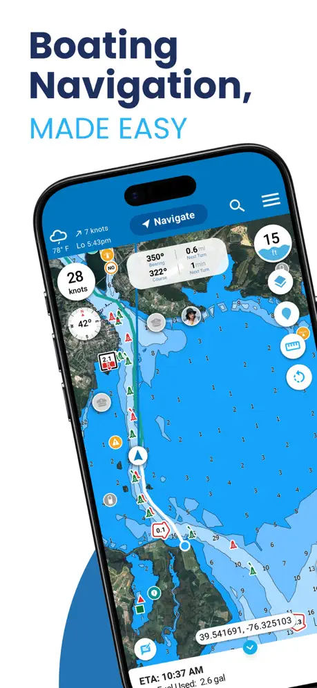  Argo Navigation: Boat GPS, Map Argo Navigation: Boat GPS, Map | 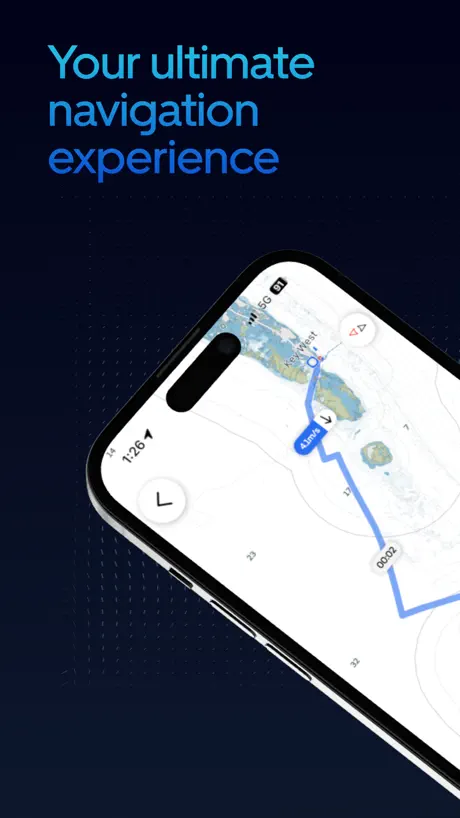  Orca: Boat GPS, Charts, Routes Orca: Boat GPS, Charts, Routes | 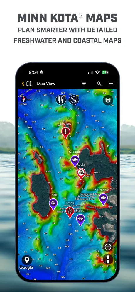  Minn Kota Fishing Minn Kota Fishing | |
|---|---|---|---|---|---|---|---|---|---|---|---|
| Rating / 5 | 4.3 | 4.9 | 4.7 | 4.7 | 4.5 | 4.6 | 4.5 | 4.0 | 4.9 | 4.6 | 2.6 |
| Reviews | 190 | 34K | 28K | 19K | 14K | 13K | 10K | 9.5K | 6.8K | 5.6K | 240 |
| Released | 2015 | 2015 | 2019 | 2014 | 2011 | 2019 | 2015 | 2017 | 2019 | 2021 | 2023 |
| Monthly price | — | — | $9.99 | — | $2.99 | — | $1.99 | — | $2.99 | — | — |
| Annual price | — | — | $59.99 | $14.99 | $29.99 | $129.00 | $18.99 | $99.99 | $9.99 | $89.99 | $24.99 |
The going rate for each plan in United States, in its own currency, shaded from the cheapest price on the row to the dearest. Plans fewer than four in ten of the priced apps sell are left out.
i-Boating: USA Marine Charts reviews
4.3 out of 5, based on 190 reviews.
What people like
- Works great for long trips.
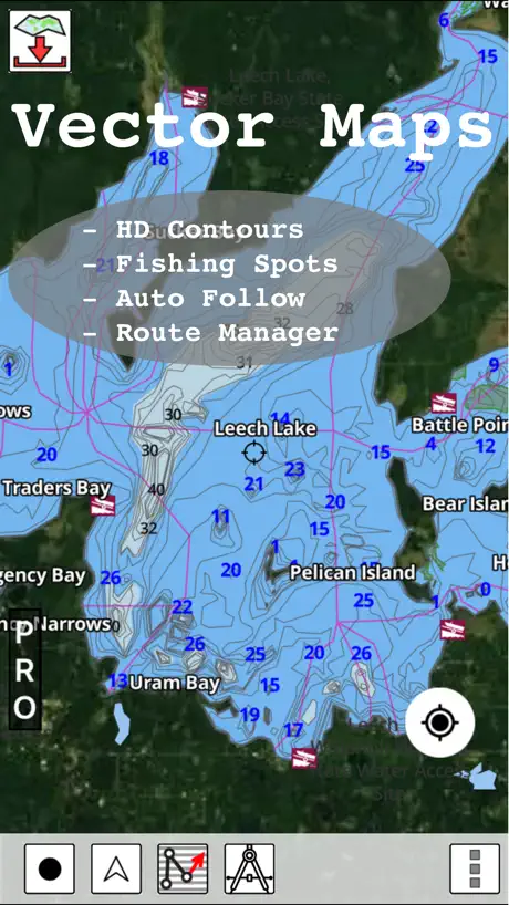
- Great detail for fishing spots.
- Much cheaper than big brands.
What they complain about
- Maps show wrong water depths.
- GPS shows wrong location often.
- App crashes and won't load maps.
Excellent small boat charting option!
Moved recently from Florida to Utah. Have encountered a number of nautical challenges transitioning from coastal chart plotter navigation to inland lakes navigation. Garmin & Lowrance both want a fortune for their chart plotter options in both inland and coastal products. This i-boating USA app. Provides fabulous detail on both coastal and inland options for a very, very reasonable price point. Awesome option alternative to big boy price gouging for marine navigation.
Review
Location where I am now not easy
Decent app
App works most of the time. Great when it does. They still need to add Lake of the Woods and other lakes in northern Minnesota and Canada.
Worked great as free but not since I paid
it
Great app
The charts are exceptional and the depth indications are great for fishing on Lake Michigan and navigating the St. Joseph river.
Incorrect water depths.
Bought this for a fishing trip to Shadehill reservoir. All water depths are incorrect and this is after a dry spring. It’s only off by 20 to 28 feet so basically worthless information
Nice and easy. Great buy
My only complaint would be to have the display stay on during operations if the phone is on charger. Other than that the app does the job.
Waste of money for N Californians
Zero stars if it was possible. Yeah update coming but when. Live in northern Ca & my location is determined to be in Maine. I only downloaded maps in N Ca but call up any famous N Ca lake & boom you’re taken to East Coast. Pretty much seems to be false app advertising. I would look elsewhere for lake maps. UPDATE: Two maps were updated, thank you. So I’ll give one more star for that. But, I ended up moving on to the Navonics app. $9.99/yr. Navonics works great on my iphone, extremely detailed & saved the day when my buddy’s sonar and GPS stopped working. This one had my location in the Midwest. Getting closer. I appreciate the update for the 2 lakes but needed something that worked better for inland fishing. I found it. I’ll keep this app tucked away in a folder, because it cost so much, but mainly in hopes it improves over time. I’ll play with it periodically to check on it. Until then, I’m sorry, but I had to find a better app.
Amazing app!
Just getting acquainted with this app, and I can’t compare it to other similar ones, but wow, it sure does work. 20$ for all of North America and no other costs. Works great.
Very difficult to creat a new route
Very difficult to creat a new route
Worked perfect for me
We are avid boaters in Texas and like to try out new lakes. Downloaded the app and headed to Lake Texoma. Huge lake and we didn’t want to get lost or bottom out on a low spot. I ran the app concurrently with my Lowrance and the app was actually better because I could see how the under water terrain changed and could navigate around the low spots through the channels. I was able to set waypoints on fishing hotspots, etc. Just as described.
This App is a Scam
This App is a Scam none of the maps displayed are complete
Awesome App!
Large font and easy to use. Fish are in trouble!
Not worth the money
Not very accurate
Easy to use marine navigation app
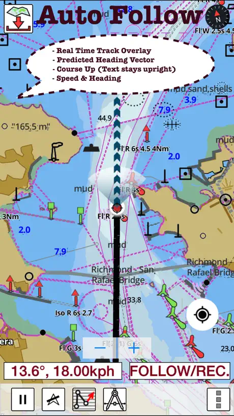
Really easy to use and set up charts for offline use. Download grid make it easy to see what all cells to download and what charts already exist on the phone. Charts look very hi def on the phone and are all vector. Most gps features are a toggle button away. Moving map gps clearly shows the breadcrumb and works very well even for long trips.
I-Boating
Could use some instructions.
Boat Gps
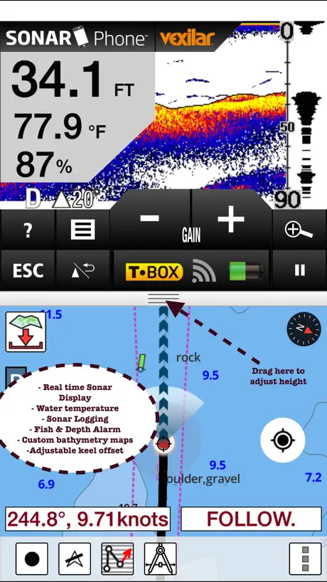
This is a very good boat navigation program that includes ENCs as well as detailed lake contour maps. Pretty much all the features that you find in a high end chartplotter are included. Very easy to overlay charts over satellite imagery, change depth shading to highlight shallow areas, apply depth offsets. It can even pull off AIS targets from our NMEA network.
...
Didnt load any navigational map
You really don't know what you need until you don't have it
I have used other navigational apps well commercial fishing in Alaska, GPS does go out, and if you do not have a paper chart well I hope you never experience the feeling. This is by far the best product I have used. Tech-support was extremely prompt and helpful. I would've paid more for this if I had known how good it is.
What a rip off
$19.99 and it locks up on home screen and will not allow the download of any map. Consistent errors on every screen. I want my money back.
Great App
The App worked flawlessly for a 400+ mile trip around Florida.
Waste of money
Way to hard to figure out. Not helpful at all - not worth the money and wish I could get a refund
Horrible for fishing
Don’t waste your money if used for fishing. Even after you buy this AND the fishing add on it will still prompt to upgrade even more for “pro”. Trash. Do your research there are far more useful apps for less money that actually work.
i-Boating: USA Marine Charts FAQ
- Is i-Boating: USA Marine Charts free?
- No. i-Boating: USA Marine Charts costs $29.99 (US) to download.
- Does i-Boating: USA Marine Charts have a free trial?
- No. None of its offers (US) come with a free trial.
- What are the best alternatives to i-Boating: USA Marine Charts?
- Dockwa (4.9 from 33,989 reviews), iNavX: Marine Navigation (4.7 from 28,413 reviews, premium from $9.99) and Aqua Map Boating (4.7 from 18,786 reviews, premium from $9.99).
i-Boating: USA Marine Charts download
Last updated 5 years ago.
i-Boating: USA Marine Charts sells in 175 countries. It was released 11 years and 4 months ago, on 6 Jun 2015. It holds a 4.3 rating from 190 reviews.
Supports 8 languages: English, Dutch, Finnish, French, German, Norwegian Bokmål, Russian, Swedish.
How much does i-Boating: USA Marine Charts make?
Third-party estimates for the last 30 days, worldwide — not the store's own figures, which Apple publishes for nobody.