
ForeFlight Mobile EFB
Intelligent Apps for Pilots
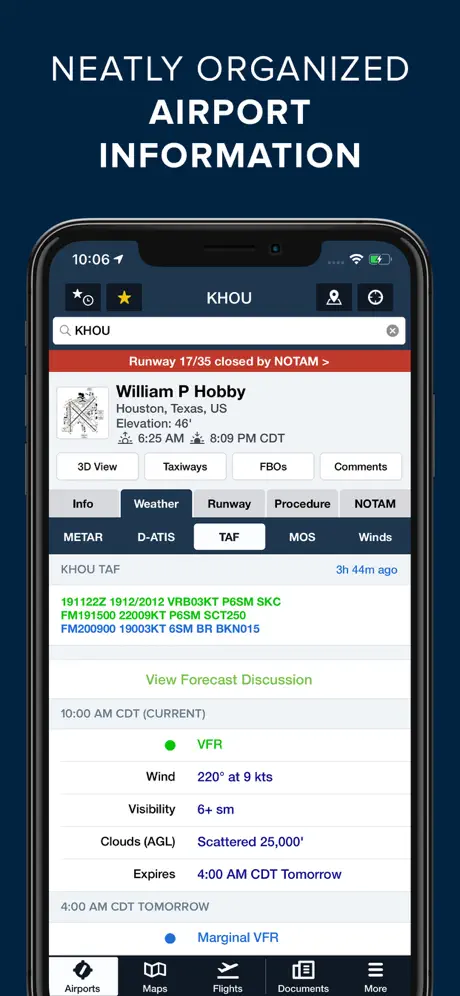
How much does ForeFlight Mobile EFB cost?
Prices are current as of 29 Sept 2026.
9 one-time purchases from $70.00
In the United States, ForeFlight Mobile EFB has 9 one-time purchases priced $70.00 – 390.00.
| Product | Price |
|---|---|
| Basic Plus US - 3 months | $70.00 |
| Starter APAC - 1 Year | $129.99 |
| Starter CA - 1 Year | $129.99 |
| Starter EUR - 1 Year | $129.99 |
| Starter ME & SA - 1 Year | $129.99 |
| Starter US - 1 Year | $129.99 |
| Essential CA - 1 Year | $259.99 |
| Essential US - 1 Year | $259.99 |
| Premium US - 1 Year | $390.00 |
10+ alternatives to ForeFlight Mobile EFB
| ForeFlight Mobile EFB | 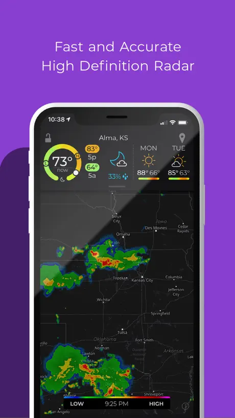  MyRadar Accurate Weather Radar MyRadar Accurate Weather Radar |   Windfinder: Wind & Weather map Windfinder: Wind & Weather map | 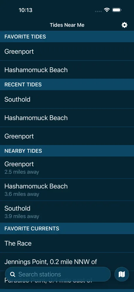  Tides Near Me Tides Near Me |   Ventusky: Weather Forecast Ventusky: Weather Forecast |   PredictWind — Marine Forecasts PredictWind — Marine Forecasts |   Surfline: Wave & Surf Reports Surfline: Wave & Surf Reports |   Tide Guide: Charts & Tables Tide Guide: Charts & Tables |   UAV Forecast UAV Forecast |   Garmin Pilot Garmin Pilot |   Surf-Forecast.com Surf-Forecast.com | |
|---|---|---|---|---|---|---|---|---|---|---|---|
| Rating / 5 | 4.4 | 4.8 | 4.7 | 4.8 | 4.8 | 4.8 | 4.6 | 4.7 | 4.5 | 4.6 | 4.9 |
| Reviews | 4.5K | 1.1M | 266K | 251K | 114K | 91K | 47K | 15K | 11K | 6.8K | 5.2K |
| Released | 2009 | 2009 | 2009 | 2012 | 2017 | 2012 | 2010 | 2018 | 2015 | 2009 | 2023 |
| Monthly price | — | $3.99 | $1.99 | $1.99 | $4.99 | $49.00 | $15.99 | $3.99 | $5.99 | — | $4.99 |
| Annual price | — | $29.99 | $4.99 | $14.99 | $19.99 | $249.00 | $119.99 | $29.99 | $39.99 | — | $34.99 |
The going rate for each plan in United States, in its own currency, shaded from the cheapest price on the row to the dearest. Plans fewer than four in ten of the priced apps sell are left out.
ForeFlight Mobile EFB reviews
4.4 out of 5, based on 4,528 reviews.
What people like
- Extremely helpful for flight planning
- Easy to use interface
- Some support agents are very fast
- Great for seeing charts at night
- Works reliably on iPhone and iPad
What they complain about
- App gets slow and lags often
- Support is unresponsive or just AI
- Price keeps going up every year
- Very limited features outside the USA
- Downloads get stuck and won't update
Fixed my problem
Extremely satisfied with prompt solution. I had a problem that I must’ve spent myself three hours on trying to resolve. I’m a 13 year user of ForeFlight in firmly believe in exhausting all of my own resources before I jump into the queue for corporate support. My initial complaint about a lock screen unable to automatically switch to landscape was met with three suggestions for how to use synthetic vision. I’m a Marine so you can imagine my thoughts when I read that and tried to ascertain how some AI fool thought I had a synthetic vision issue when I’m not even using it or subscribed to it. I responded flip it, but yet Todd apparently read my rejection and quickly jumped on the problem and his first solution complete with pitcher in an arrow, which button to push immediate resolved the problem again I spent all kinds time to resolve it on my own yet Todd quickly ascertain what my issue was and had a solution in my mailbox at six in the morning. Todd ROCKS!
New update is trash
I like to take notes on scratchpads and with the recent trash update, my notes are frequently and randomly deleted. I have been doing this for almost a decade now and have only run into this problem in the last few months. Also, get rid of the AI slop before you get someone killed.
No useful support
The app itself is very good. Support is almost non existent. The chat is AI that has no clue. There is no phone support. The only hope of communicating with a human is by email. It cold take days or weeks to get an answer going back and forth by email. Im trying to add to my subscription for a flight tomorrow but ran into an error for which there is no apparent way to fix it. I will end up borrowing charts for tomorrow. I am a very frustrated and unhappy customer.
ForeFlight’s downward spiral has begun
Like many of you, I was concerned when ForeFlight fired half of its staff after getting bought by a venture capital firm. I was ready for the asset strip to begin and this program to become slop. The chat-GPT plugin is the first example of this. Enjoy getting very inaccurate weather briefings. Hopefully no one dies because of this garbage.
AI is taking over
ForeFlight has been a great app for pilots. However, they are instituting AI in there product which often produces questionable output. From a developmental perspective, that’s fine. But it would be nice to have a setting that disables any AI output from being on the screen.
Long haul flights 15 plus hours
So I don’t pay the real fee on my iPhone but I’m going to do the trial. See I am very expirianced with this app. I would say I adore this app!!! I am a commercial pilot for Ethiopian and I do my favorite route nyc (KJFK) to adidas abbaba. And when I was with American Airlines I would use it for my jfk to Delhi flight. Cheers.
Once great, now stalling
They have removed the ability to purchase a subscription through the app even though their own documentation still says it is possible. “Support” is unresponsive. Unfortunately, it appears this company is entering an uncoordinated stall.
Better help needed
Customs contacts need to be listed more accurately. While this could be very helpful, my first experience almost resulted in a fine. The first number listed should NOT be the sector communications number, it should be the number for the office at the airport I am looking at or include which number it is. I used the sector number listed first to give notice of my arrival back to the US. The person took my information and indicated I was all set. Upon arrival the agent at the airport said to bring all aircraft and pilot documents inside, “I didn’t know you were coming”. Maybe this was an internal customs communication breakdown. But it resulted in unnecessary stress.
What happened
ForeFlight used to be great and it seems with every new recent update the app runs worse than before. The amount of times the app just bogs down doing anything is increasing, the weather and radar sometimes loads and sometimes doesn’t, and the amount of times I have to refresh a flight plan over and over again because of the “no winds” problem is absurd. At least the perf numbers and EOPs still work
Great app but recent update causing issues with finger measure tool
Great app for flying both commercially to watch it as a hobbyist flying privately like myself. But a recent update now makes it almost every time I pinch to zoom on the map instead goes to the measure tool. Is very frustrating and distracting. And I see no option to disable or adjust the settings. I also wish there was a way to set flight history to non pilot so it’s not officially tracked since I like to use it when traveling and not piloting.
Incredible Electronic Flight Bag!
You truly can’t go wrong with ForeFlight as an Electronic Flight Bag! The system and interface are very easy to use and navigate. Additionally, if questions arise, the ForeFlight Support Team is super easy to contact and very responsive. I would give 10 stars if I could!
Sleazy tactics
Price goes up every year, now they cut the SAFE discount in half. I am all done with ForeFlight, I knew once they were sold this was going to happen. Also w&b only includes fuel in the top tier. Sleazy
Perfect for IFR, Fair for VFR
For IFR it‘s an almost perfect tool. Single point on the wishlist would be a good GRAMET. For VFR it’s quite useful but doesn’t come close to other apps like SkyDemon in terms of readability and airspace awareness.
European Features
When will ForeFlight recognise its European customer base and start rolling out the features only available to the US market? Maps, features and resources are lacking over here however still at the same price point!
Use to be great
This app use to be great; however, it’s been on the decline. I’ve experienced a lot of performance issue within the last 8 months. I’ll be trying Garmin once my ForeFlight subscription expires
Love the app
Positively the best flying app I’ve ever had in my whole career thank you guys for everything you’ve done😃
Unable to update
ForeFlight is definitely going downhill fast. I’ve been trying to download updates FOR. TWO. DAYS! It always gives me an error and I have to try the update again. It’s not my iPad and my WiFi is working just fine. This is what happens when you fire the technical staff and send development offshore. I’m done with ForeFlight and will not renew.
Best available Flight App
Amazing flight planning and execution app. There are better ones for VFR purposes and to use all its potential you’d need the Jeppesen subscription as well but hey - can’t hardly be better. One drawback: sometimes limited route finding potential in Europe and no customer hotline to quickly solve route planning or Slot issues.
Jeppesen IFR/VFR Bundle
Sorry to see that Jeppesen is providing IFR/VFR Charts only in continental bundles. It would be great to buy these bundles by countries, so one can tailor it according one’s need.
why not support chinese
why
Excellent customer support
Excellent customer support and a very professional aviation app. The team was kind, responsive, and extremely helpful. Looking forward to using ForeFlight during my flying in the U.S.
They fired a bunch of staff and now basic functions don’t work.
Downloads don’t work consistently even with full service (verified stable connection). Downloads also don’t register as needing to be downloaded quickly anymore. Database gets old, I go to the downloads page to update and even though they are out of date the page doesn’t refresh to allow me to press the download button. When will the option open up? No clue, may take hours or may happen immediately. You have no control and can’t update in time for a flight. Downloads page is also stuck. Issue is not internet connection, and this is after an IPad restart. Same problem. Just frozen. Will not download. Sharing flights with crew members now only works maybe 50% of the time. Constantly failing. These issues did not happen before they laid off critical staff. This app is basic infrastructure for the safe operation of flight. Get it together!
From the ground looking up…
I’m giving this app only four stars because it doesn’t come with an aircraft to install it in! About the same time airlines we’re using iPads instead of “Brain Bags”…I retired. With mixed feelings, I gave op my 747-400 left seat for a rocking chair on the front veranda…mind you, it came with an ocean view, ( my reward for 26 thousand incident-free hours). I’m mentioning this only as some qualification to this review. You see…I’ve never had the privilege of using in on an actual flight! I didn’t want to give up flying but before I sorted out the many options In owning an aircraft.. I medicaled out. I had however purchased a years subscription to ForeFlight and in that year I put the app through it’s paces (as much as you can without leaving the ground) and honestly…I couldn’t find any serious anomalies". If I had had this software when I was flying…well…maybe I wouldn’t have as many grey hairs. And, not only that…but when I messed up and didn’t cancel the subscription at the end of the year….! The support team answered my plea with a refund. Thanks Todd and your gang. Gary
Lacking so many safety critical features
I could go on an absolute rant but I won’t. Company claims to fully support Australia but can’t even tell you LSALT’s along you’re route or display critical points. It can’t even give you correct routing from the route advisor. Nearly $600 AUD for the performance plan. An absolute waste of money when you can get nearly all the same features plus Australia focused ones from AvPlan and OzRunways for less then half the money. Don’t waste you’re time and money.
More CFI support
Overall the ForeFlight app has been incredible for the industry. It remains to be seen how the ownership changes effect the quality. I manage a corporate flight department and unlike many of my colleagues, I’m not making the full switch over to FF until I know the support and growth continues. The purpose of this review is specific to CFI support. FF wants us to recommend use of FF to our students and even goes so far as offering us “rewards” for doing so. What is truly lacking is full support for the instructors. We need to have the ability to print a PDF copy of the endorsements we have GIVEN. I can print a report of my experience/logbook with endorsements I have RECEIVED. I CANNOT print a copy of the endorsements I have given a student. It should not be that difficult to allow CFIs to go to instructor tools, endorsements and print a copy of all our endorsements. We are required to keep endorsements for 3 years (TSA-5 years). Currently we rely on the app not to crash or cloud to fail. We must have the ability to print a summary of our endorsements. I’ve made this request multiple times and ask CFIs I know to do the same. I always get the same response, “we are considering for future updates”. I do have high expectations especially when they want me to promote to my students and offer me rewards for doing so. Over the past 5 years I have recommended 34 pilots for checkrides from Sport pilot through CFII/MEI with a first time pass rate of 96%. I speak from experience, we should have the functionality to keep an additional record of our endorsements given.
Awesome app
I have had great experience and support from foreflight on the lasts 7 years!
Private Equity
Looks like it was bought by PE. That’s usually the peak. App will now prioritize revenue over features customers want. Slowly will hollow out user base until new boutique app pops up to replace it and grows… is bought out by private equity also... and circle of life occurs again.
They finally fixed it!
My company pays ForeFlight lots of money to use their product. We fly in western Canada and their service is invaluable to our ops. That said it took 2 years! To fix an issue with their radar picture. Their customer service needs some work especially for the price! Thanks for finally fixing this simple issue that only occurred with your radar image and no other provider like windy or Nav Canada.
Please update with Australian charts
With Australian charts this would be a great app
Not what it used to be
I never imagined that I would write this review. As a power user of ForeFlight for years, I am saddened to say that it’s not what it used to be. I used to open the app and it just worked - wonderfully, as advertised. Now, I open the app - it lags. I sometimes have to wait 10-20 seconds before it unfreezes and I can move between tabs. Previously, ForeFlight Support would immediately respond and have a solution to an issue. Now, the responses are not as quick and they are unable to help me with the latency issue. “Reinstall” is what I am encouraged to do. I loved ForeFlight. I can’t see spending this kind of money if it doesn’t work well.
Technical Support
Todd and crew at ForeFlight provide excellent support for the product. They are very responsive and knowledgeable on the product.
Money Hungry
Pretty sad the price continues to increase and synthetic vision can’t be an add on any longer. You have to pay an extra $130 to bump up to the Essential package and don’t use half of the stuff in the package.
Got it out of curiosity, will renew my subscription
I can’t really give a short description of everything it can do, just get the trial and play around. But some things I really like it for: - for unplanned stops at strange airports, two clicks is way faster than flipping through a book looking for the right aerodrome page - I like paper charts, but for night flying it is easier to see some details on screen than on paper (under the red light) - Quick estimation of en route time On a customer service note: I requested a feature update and they announced an update a reasonable time after. For those with Bluetooth headsets, hearing “Holding short runway 23” is nice extra touch.
Probably great if you live in the US
I made the mistake of purchasing a subscription because the publicity tells you that it covers world wide and even allows you to specify other regions for your database. What it doesn't tell you, is that for any airfield outside the US, there is very sparse information, and certainly no airfield plates. They really should make that fact clear.
Good app. Not worth the price any longer
Although the app is very well designed, the renewal rates go up every year. They always claim it’s to bring more features. Much like healthcare bill that was forced upon us. FF does the same thing. Having been a very loyal customer for at least 15 years. I will not be renewing. As a professional pilot, the cost of this app is no longer justified.
Great EFB App
This is one of the most comprehensive EFB apps out there. Works great, easy to use. Have used it for several years on iPhone and iPad, stable and reliable app.
Poor App Support
I lost a phone and was unable to log into ForeFlight . After numerous attempts with support (email only - terrible ) they just stopped responding ! I was never able to get back into my account ! Have lost my logbook for the last 6-7 years . Not a happy customer . Chuck B
X-Plane
Please... would you keep in mind that there are some user that would like to use your software only for Flight simulator and do a special price for them and not like 35$ a month but 35$ for life. You could get many user like this that you could not have acess... and mabe they will pilote for real some day and will pay the big price cause they will use it to make there buisness. Please.... give acess your software to those who will grow up with it. Thanks
Not bad
But since I can't see a way of using uk charts I will not pay past the 30 day free trial.
App is free but you need a subscription
I downloaded the app as it was suggested by a YouTuber and said to be free to use but now that I downloaded it they require a expensive subscription
Missed Approach Procedure
Adding a “Graphical” depiction of the Missed Approach, like on the published plates, would go a long way, especially if trying to read in the Bumps…. Thanks
Small weather fonts
Sure would be nice if we could pinch and spread the weather line on METARS & TAFS to read them better in a bouncing airplane at night. I have asked about this numerous times and seems nothing is done about it, The FF software writers should go fly at night in bad weather and report as to how they do!
Fly safer, get this app.
I’ve been monitoring ForeFlight since it came out in the US in 2007 along with other similar EFB apps. Now that it is available in Europe, I highly recommend it. What sets this apart from other apps is that you get Jeppesen VFR data overlayed on a really fast map. It also gives you warnings for obstacles, height, terrain, altimeter setting, runways etc. It definitely needs airspace notifications. I could go on with the amount of things it does. At this moment it’s not perfect but is near. I’ve already experienced their support team and they’re really good. Best thing you could do right now is download the app and try it for 30 days. Happy and safe flying!
Wrong!
Not for the world outside of the USA due to the limited or non-existence of the advertised features in here, blighty. Other thing equally annoying, not actually free as it needs subscription. I used to be able to open up this app but after the latest update last month, Oct 2010 it asked for a new user agreement and will not launch unless I pay up the subs rather than letting me check up the new update it contained. Wrong. Down to 2 stars for the use and feature but accessible only inside the subscription plan otherwise max of 4 as visual is cluttered.
To much
This update overpowered my Ipad. It is now unusable during flight.
I love ForeFlight!
It’s a great app and has been super helpful.
WARNING
ForeFlight just cost us OVER $2,000 (yes, TWO THOUSAND DOLLARS (& yes, United States dollars)) due to their incompetence & lack of wanting to prevent this from happening to you. Disgusting.
Stored route function needs improvement
Foreflight is an essential flight tool. But it is very weak in storing favorite routes or preplanned routes or alternate routes between airport pairs. There is no way to create folders, or to edit a route without creating a new route. It is a fine tool for planning a flight to take place right now, but poor for multi-leg trip planning.
Wrong side of the pond
This would be a great app if I livd or flew in the USA, but over here in Europe the functionality is greatly reduced with no charts, radar, sat images, or flight plan filing. All the other functionality comes free with a couple of different apps. Once you guys realise there is a world outside the USA give us a call. Until then, it's worth a subscription of £10 per annum, maximum.
waypoints saving in flight
Not easy to save a new wpt in flight, numbers are very small for touching, please, change it for large numbers and I wil purchase it.
ForeFlight Mobile EFB price by country
A one-time purchase costs $127.65 in Canada and $373.89 in Hungary — 3× more for the same thing. Below is the going rate for each plan in every country that sells it — the middle price of what the app charges there, in the country's own currency with the dollar equivalent beneath it.
| Country | One-time |
|---|---|
| Albania | $299.99 |
| Algeria | $259.99 |
| Angola | $259.99 |
| Anguilla | $259.99 |
| Antigua And Barbuda | $129.99 |
| Argentina | $259.99 |
| Armenia | $299.99 |
| Australia | A$199.99$139.85 |
| Austria | €299.99$341.67 |
| Azerbaijan | $299.99 |
| Bahamas | $299.99 |
| Bahrain | $299.99 |
| Barbados | $149.99 |
| Belgium | €299.99$341.67 |
| Belize | $129.99 |
| Benin | $299.99 |
| Bermuda | $259.99 |
| Bhutan | $259.99 |
| Bolivia | $129.99 |
| Bosnia & Herzegovina | €299.99$341.67 |
| Botswana | $259.99 |
| Brazil | R$1,799.90$347.47 |
| British Virgin Islands | $259.99 |
| Brunei Darussalam | $259.99 |
| Bulgaria | €299.99$341.67 |
| Burkina Faso | $259.99 |
| Cameroon | $299.99 |
| Canada | CA$179.99$127.65 |
| Cape Verde | $259.99 |
| Cayman Islands | $259.99 |
| Chad | $259.99 |
| Chile | CLP 299,990$311.76 |
| China | CN¥1,998.00$297.32 |
| Colombia | COP 1,199,900$359.87 |
| Congo | $299.99 |
| Costa Rica | $259.99 |
| Cote Divoire | $299.99 |
| Croatia | €149.99$170.83 |
| Czech Republic | CZK 6,990.00$326.64 |
| Denmark | DKK 2,299.00$350.46 |
| Dominica | $259.99 |
| Dominican Republic | $259.99 |
| Ecuador | $259.99 |
| Egypt | EGP 12,999.99$251.26 |
| El Salvador | $259.99 |
| Estonia | €299.99$341.67 |
| Fiji | $129.99 |
| Finland | €299.99$341.67 |
| France | €299.99$341.67 |
| Gabon | $259.99 |
| Gambia | $259.99 |
| Georgia | $299.99 |
| Germany | €299.99$341.67 |
| Ghana | $299.99 |
| Greece | €149.99$170.83 |
| Grenada | $259.99 |
| Guatemala | $259.99 |
| Guinea-bissau | $259.99 |
| Guyana | $129.99 |
| Honduras | $259.99 |
| Hong Kong | HK$1,888.00$240.82 |
| Hungary | HUF 119,990$373.89 |
| Iceland | $299.99 |
| India | ₹24,900.00$259.56 |
| Indonesia | IDR 4,999,000$278.95 |
| Ireland | €299.99$341.67 |
| Israel | ₪799.90$262.26 |
| Italy | €299.99$341.67 |
| Jamaica | $259.99 |
| Japan | ¥40,000$253.98 |
| Jordan | $259.99 |
| Kazakhstan | KZT 79,990.00$180.71 |
| Kenya | $299.99 |
| Kosovo | €299.99$341.67 |
| Kuwait | $129.99 |
| Kyrgyzstan | $299.99 |
| Lao Peoples Democratic Republic | $299.99 |
| Latvia | €299.99$341.67 |
| Lebanon | $259.99 |
| Liberia | $259.99 |
| Lithuania | €299.99$341.67 |
| Luxembourg | €299.99$341.67 |
| Macao | $259.99 |
| Macedonia | $259.99 |
| Madagascar | $259.99 |
| Malawi | $259.99 |
| Malaysia | MYR 1,199.90$294.82 |
| Maldives | $259.99 |
| Mali | $259.99 |
| Malta | €299.99$341.67 |
| Mauritania | $259.99 |
| Mauritius | $299.99 |
| Mexico | MX$5,999.00$338.16 |
| Micronesia | $259.99 |
| Moldova | $299.99 |
| Mongolia | $259.99 |
| Montenegro | €249.99$284.73 |
| Montserrat | $259.99 |
| Morocco | $299.99 |
| Mozambique | $259.99 |
| Namibia | $259.99 |
| Nepal | $299.99 |
| Netherlands | €299.99$341.67 |
| New Zealand | NZ$229.99$129.94 |
| Nicaragua | $259.99 |
| Niger | $259.99 |
| Nigeria | NGN 399,900.00$301.29 |
| Norway | NOK 3,490.00$366.98 |
| Oman | $259.99 |
| Pakistan | PKR 69,900$252.43 |
| Palau | $259.99 |
| Panama | $259.99 |
| Papua New Guinea | $259.99 |
| Paraguay | $259.99 |
| Peru | PEN 1,199.90$353.95 |
| Philippines | ₱14,990.00$240.03 |
| Poland | PLN 1,199.99$312.50 |
| Portugal | €299.99$341.67 |
| Qatar | QAR 999.99$274.72 |
| Romania | RON 1,499.99$323.97 |
| Rwanda | $259.99 |
| Sao Tome & Principe | $259.99 |
| Saudi Arabia | SAR 999.99$266.66 |
| Senegal | $299.99 |
| Serbia | €299.99$341.67 |
| Seychelles | $259.99 |
| Sierra Leone | $259.99 |
| Singapore | SGD 399.98$312.48 |
| Slovakia | €149.99$170.83 |
| Slovenia | €299.99$341.67 |
| Solomon Islands | $259.99 |
| South Africa | ZAR 4,999.99$306.37 |
| South Korea | ₩449,000$331.11 |
| Spain | €299.99$341.67 |
| Sri Lanka | $259.99 |
| St. Kitts and Nevis | $259.99 |
| St. Lucia | $259.99 |
| St. Vincent & The Grenadines | $259.99 |
| Suriname | $299.99 |
| Swaziland | $259.99 |
| Sweden | SEK 3,495.00$352.32 |
| Switzerland | CHF 220.00$265.38 |
| Taiwan | NT$8,990.00$282.97 |
| Tajikistan | $299.99 |
| Tanzania | TZS 699,900.00$263.40 |
| Thailand | THB 9,990.00$298.92 |
| Tonga | $259.99 |
| Trinidad and Tobago | $129.99 |
| Tunisia | $259.99 |
| Turkey | TRY 14,999.99$306.43 |
| Turkmenistan | $259.99 |
| Turks and Caicos | $259.99 |
| Uganda | $299.99 |
| Ukraine | $299.99 |
| United Arab Emirates | AED 999.99$272.48 |
| United Kingdom | £249.99$330.67 |
| United States | $129.99 |
| Uruguay | $259.99 |
| Uzbekistan | $299.99 |
| Vanuatu | $259.99 |
| Vietnam | ₫7,999,000$308.41 |
| Yemen | $259.99 |
| Zambia | $299.99 |
ForeFlight Mobile EFB FAQ
- Is ForeFlight Mobile EFB free?
- Yes. The app and its basic features are free, in all 163 countries it sells in. Premium features are paid: they start from $70.00 (US), across 9 one-time purchases.
- Does ForeFlight Mobile EFB have a free trial?
- No. None of its offers (US) come with a free trial.
- Where is ForeFlight Mobile EFB cheapest?
- A one-time purchase costs CA$179.99 (≈$127.65) in Canada and HUF 119,990 (≈$373.89) in Hungary, its cheapest and dearest countries.
- What are the best alternatives to ForeFlight Mobile EFB?
- MyRadar Accurate Weather Radar (4.8 from 1,110,358 reviews, premium from $1.99), Windfinder: Wind & Weather map (4.7 from 266,273 reviews, premium from $1.99) and Tides Near Me (4.8 from 250,845 reviews, premium from $1.99).
ForeFlight Mobile EFB download
Last updated 28 days ago.
ForeFlight Mobile EFB sells in 163 countries. It was released 16 years and 9 months ago, on 16 Dec 2009. It holds a 4.4 rating from 4,528 reviews.
Supports 3 languages: English, French, German.
How much does ForeFlight Mobile EFB make?
Third-party estimates for the last 30 days, worldwide — not the store's own figures, which Apple publishes for nobody.
Revenue by plan
- One-time 100%
Revenue by country
- United States 80%
- Germany 4%
- Canada 4%
- Switzerland 1%