
RiverApp - River levels
Real-time river conditions
How much does RiverApp - River levels cost?
Prices are current as of 28 Sept 2026.
2 subscriptions from $0.99
In the United States, RiverApp - River levels has 2 subscriptions priced $0.99 – 6.99.
| Subscription | Period | Price |
|---|---|---|
| Premium - 1 month subscription | Monthly | $0.99 |
| Premium - 1 year subscription | Annual | $6.99 |
1 one-time purchase from $29.99
In the United States, RiverApp - River levels has 1 one-time purchase priced $29.99.
| Product | Price |
|---|---|
| RiverApp Premium | $29.99 |
See what RiverApp - River levels costs in all 174 countries →
10+ alternatives to RiverApp - River levels
| RiverApp - River levels |   Windfinder: Wind & Weather map Windfinder: Wind & Weather map |   Tide Charts Tide Charts | 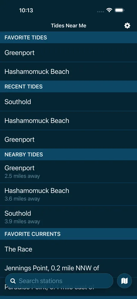  Tides Near Me Tides Near Me | 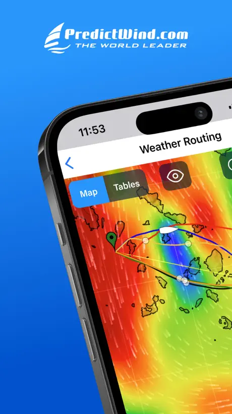  PredictWind — Marine Forecasts PredictWind — Marine Forecasts |   My Tide Times - Tables & Chart My Tide Times - Tables & Chart | 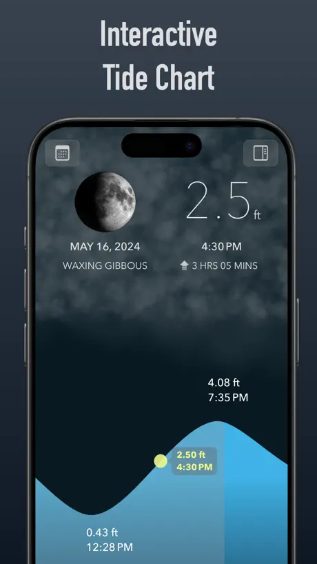  Tide Alert (NOAA) - Tide Chart Tide Alert (NOAA) - Tide Chart |   Marine Weather Forecast Pro Marine Weather Forecast Pro |   Rivercast: River Levels USA Rivercast: River Levels USA |   OpenSnow OpenSnow |   FishWeather: Marine Forecasts FishWeather: Marine Forecasts | |
|---|---|---|---|---|---|---|---|---|---|---|---|
| Rating / 5 | 4.8 | 4.7 | 4.7 | 4.8 | 4.8 | 4.8 | 4.8 | 4.7 | 4.7 | 4.7 | 4.7 |
| Reviews | 11K | 266K | 263K | 251K | 91K | 71K | 45K | 17K | 11K | 9.4K | 5.5K |
| Released | 2013 | 2009 | 2015 | 2012 | 2012 | 2014 | 2018 | 2017 | 2012 | 2013 | 2012 |
| Monthly price | $0.99 | $1.99 | — | $1.99 | $49.00 | — | — | $3.99 | — | — | $14.99 |
| Annual price | $6.99 | $4.99 | — | $14.99 | $249.00 | — | $19.99 | $11.99 | $9.99 | $49.99 | $44.99 |
| One-time price | $29.99 | — | $1.99 | — | — | — | $99.99 | $0.99 | $44.99 | — | — |
The going rate for each plan in United States, in its own currency, shaded from the cheapest price on the row to the dearest. Plans fewer than four in ten of the priced apps sell are left out.
RiverApp - River levels reviews
4.8 out of 5, based on 10,628 reviews.
What people like
- Convenient tracking for paddling trips and safety planning
- Clean and user-friendly interface
- Useful features like saved favorites and historical data
- Helpful seasonal trends and forecast data
What they complain about
- Inaccurate or delayed river level data
- Unexpected premium subscription charges and recurring ads
- Missing coverage for specific regions and rivers
- Technical bugs including crashes and map connectivity issues
- Poor responsiveness of customer support
Awesome app
Well built, useful and accurate, what more could you ask for?
What is wrong with the Saugeen river chart near port Elgin Ontario
I’ve been trying to check for Atleast a week for the water level and it hasn’t been available
Recently purchased
Seems like the best replacement for the now defunct RiverData. Still getting familiar with it. I'm optimistic, It can give me all the info I need in one or two taps.
Tried it, didn’t like it…NOT ACCURATE
Well, I wouldn’t trust this for a day run or a major float. Totally off on cfs.
Lack of Data
Why is there no data for the ovens river below Myrtleford?
Best app for monitoring rivers
App has clean design and is easy to use. I can save favorite rivers, look at historical data, etc. I have used many apps to plan self-support river trips in my canoe. This is by far the best.
Update
The new update has a bug where the levels don’t show
Solid flow data app
Overall a good flow data app. The forecast (when available) and seasonal trends features are what set this app apart from the rest. I just wish it had a way to organize favorite gauges by watershed. Instead of having one big list with all my favorites on it there could be drop down tabs with custom naming options so I can collapse gauges I don’t want to see right now.
Good for kayaking
Prefer other apps which does the same when I go fishing, but ok when kayaking.
Location
Closest river height is in Goshen. Would like height closer to Elkhart.
👍🏽👍🏽👍🏽
Great Resource. Thank you
Get the info for free from usgs
They only allow you to see 2 days of river flow data and then charge you to see more. You can get the info for free from usgs, which is where they steal the data from anyways and then try to profit off of it.
Icon
I love the app, but miss the original icon. I am getting used to looking for the new one, but would love to see the old one return as it catches my eye more easily.! Love this app for its eas in seeing where levels are at the moment. USGS is better for trends, but takes time, so this is a nice supplement.
Bonne application mais....
Application de bonne qualité mais pourquoi est elle compatible maintenant qu’à partir d’iOS 13. Apple met à jour ces iPhone sous iOS 12 et apres ça passe à ios 15. Aucun iPhone compatible avec iOS 13 ne l’est qu’avec cette version, mettre iOS 13 compatible ça participe à l’obsolescence programmée et donc à la production de déchets, c’est dommage
Gives false information
When it does work it’s a great app but most of the time it gives false information
Green River in Hart County Kentucky
Let me see daily, the impact of Green River Dam on Green River in Hart County
Scam
This app shows a 24 hour window on river conditions for free then charges to show beyond that. It’s public data you can easily Google - USGS river data is free and far better than this junk. The UI is garbage compared to the USGS website. Save your money and space on your phone.
Exelent
Bonne évolution 👍
River Great Ouse - Correction Required
River Great Ouse is identified as ‘Ouse- (Derbyshire)’ which is incorrect
Good but could be better
DNR needs to use our $ to put more equip for flow rates at more locations along the ocmulgee, oconee, and flint rivers.
Perfect!
This is such a handy app to utilize whenever you’re planning to paddle down a river. It’s concise and very easy to read. Our entire family uses it to help ensure the safest paddle possible.
You forgot the Great Ouse
Why isn’t the River GREAT OUSE included , one of the UK’s finest Rivers From the Wash to Bedford with tributarys of the River Cam , the Lark , the Middle Level ?
Map isn’t working
The app is fantastic. I love it. It is very helpful. My only issue is when I try to use the map feature it keeps telling me there is no internet connection. It never goes away. Must be a bug.
Missing Rivers
Northern Ireland missing from UK and Ireland rivers
No communication
App is good but when you try to communicate whomever runs it via their email, you won’t get a response. Gadge is off by 1800 cfs versus California Department of water resources.
Helpful
We live near a river and have to watch for flooding. This app is updated regularly and able to keep my concerns at bay
Poor
No up to date data
Excellent source of river levels
A really useful consolidation of river levels
Was quite useful
This app was quite useful, but now it crashes all the time and useful navigation so that you can go back up the menu hierarchy after selecting a river have disappeared in the latest update rendering the app all but useless.
Mise à jour
Bonjour, je vous contacte ici pour vous indiquez que je me trouve actuellement en aval du barrage de chaudanne et sur l’application vous indiquez un débit de 3m/s. Il y a actuellement un débit d’environ de 13 m/s, un responsable kayakiste viens de me le dire. Pourriez-vous vérifier vos données svp ? Cordialement romain.
Water level
Great way to track for trips!
False alarms !
Just sent me an alarm notification that the River Aire at Carleton Bridge is at 3.92m and it’s only at 1.24m. Just about to delete the app now :-(
Tres bonne application mais
Tres bnne applis très complète mais manque le Guil riviere importante pour le kayak dans les hautes Alpes 05 ??? Dommage et manque la station de Castellanne ( Verdon) beaucoup plus de lacher non indiqué qui n’a rien a voir avec les débits de la station de Vinon sur Verdon
Asse bien
Bien, mais les prévisions ont disparues !!
Best app for river runners
Been running rivers around the world for 20+ years. This app makes it easy to watch the water and plan accordingly.
Updates on levels lag a lot
Did used to work perfectly. Now lags a lot, which is a shame, given that the primary purpose is to give current river levels. For example, currently two days out of date on Welsh rivers. Really annoying given that I paid for the premium version.
Very useful for fishermen
Comprehensive coverage of the UK and updated regularly. It would be nice if the measurements could be converted into feet and inches.
Going down hill
I’ve used this app for the past several years keeping a close eye on the gauges in my area. Lately they don’t seem to work much at all. I know it’s not the gauges themselves because I can login on other websites and see perfectly fine. Not sure what’s going on.
River information
On of my favorite apps
Disgraceful marketing!!
Have used this app over the past season as a fly fisherman in North Wales getting accurate river levels. It’s been brilliant. Just checked the update info and decided to update only to find my regular ‘FREE’ app is now charging me for ‘premium’ info. I’d not have updated if I’d known but will now delete it. I’d have kept it if the new charge was made clear - it wasn’t! That’s bloody cheeky!!! I appreciate it’s not expensive but it’s the principle... If you’ve got the app, DO NOT UPDATE!! 👎
Just Short of Perfection
It's absolutely fantastic that someone has taken the time (and skill) to create an app of this quality for a sport as niche as kayaking; thank you! It almost feels ungrateful to suggest how the app could be improved, but if it were possible to view a map showing icons that correspond to a river's current level, that would make this my one stop shop for planning paddling trips - even if the app could list rivers in order of distance from the user or a certain point, just to help people quickly see what's running near them, and even discover new runs in their local area, I'd be over the moon.
Geographically incorrect
No problems with using Open Street Map as the base but the provided geographic areas are wrong. There are States and Territories in Australia!! The capital of Australia, Canberra, is in the Australian Capital Territory, not in New South Wales which is the only option. The Northern Territory, which is larger than most countries is also missing? Having to just navigate on the map to find the correct areas is slow. Please also add the option to read heights in millimetres (mm) to account for low river gauges.
Great app
I use this every day to check river levels. Works flawlessly and gives me the six levels I need to watch all in one setting. Great app !!!!
Great Ouse UK not included.
One of the biggest rivers in the UK but not available in this app :-(
Fantastic resource
Brilliant app, proved invaluable on a recent trip to Austria. Very accurate and generally easy to use but can require a little digging to find the river section you want. The only thing that makes it difficult to use is that the app uses the native (eg; Austrian) names for the rivers, not the English names, so searching for the "Lower Oetz" find nothing, as the app calls it the "Untere Ötz". If you're using a UK guidebook, it can take some guesswork to match the guidebook to the app. It would also be great if there was a way of looking at an overview map of river sections in the local area, to see what's running nearby. All in all though, a really great app- a must have for all paddlers!
Good app BUT ...
I love this app. We live in a flood zone so I use it a lot and it’s almost always up to date. I dropped two stars because, even though I’ve paid for the premium version I have just started seeing adverts even though my premium is enabled. The reason I paid was to remove them, so why are they back? I don’t expect this to happen and I don’t expect to have email to complain either after I e paid almost £7 for an app. Please sort this out ...
RiverApp - River levels price by country
A monthly subscription costs $0.12 in Turkey and $1.36 in the Czech Republic — 11× more for the same thing. Below is the going rate for each plan in every country that sells it — the middle price of what the app charges there, in the country's own currency with the dollar equivalent beneath it.
| Country | Monthly | Annual | One-time |
|---|---|---|---|
| Afghanistan | $0.99 | $5.99 | $29.99 |
| Albania | $1.19 | $6.99 | $34.99 |
| Algeria | $0.99 | $5.99 | $29.99 |
| Angola | $0.99 | $5.99 | $29.99 |
| Anguilla | $0.99 | $5.99 | $29.99 |
| Antigua And Barbuda | $0.99 | $5.99 | $29.99 |
| Argentina | $0.99 | $5.99 | $29.99 |
| Armenia | $0.99 | $6.99 | $34.99 |
| Australia | A$1.49$1.04 | A$9.99$6.99 | A$49.99$34.96 |
| Austria | €0.99$1.13 | €6.99$7.96 | €34.99$39.85 |
| Azerbaijan | $0.99 | $5.99 | $34.99 |
| Bahamas | $0.99 | $6.99 | $29.99 |
| Bahrain | $0.99 | $6.99 | $29.99 |
| Barbados | $0.99 | $6.99 | $34.99 |
| Belarus | $0.99 | $6.99 | $34.99 |
| Belgium | €0.99$1.13 | €6.99$7.96 | €34.99$39.85 |
| Belize | $0.99 | $5.99 | $29.99 |
| Benin | $0.99 | $5.99 | $34.99 |
| Bermuda | $0.99 | $5.99 | $29.99 |
| Bhutan | $0.99 | $5.99 | $29.99 |
| Bolivia | $0.99 | $5.99 | $29.99 |
| Bosnia & Herzegovina | €0.99$1.13 | €6.99$7.96 | €34.99$39.85 |
| Botswana | $0.99 | $5.99 | $29.99 |
| Brazil | R$3.90$0.75 | R$29.90$5.76 | R$199.90$38.52 |
| British Virgin Islands | $0.99 | $5.99 | $29.99 |
| Brunei Darussalam | $0.99 | $5.99 | $29.99 |
| Bulgaria | €0.99$1.13 | €6.49$7.39 | €34.99$39.85 |
| Burkina Faso | $0.99 | $5.99 | $29.99 |
| Cambodia | $0.99 | $6.99 | $29.99 |
| Cameroon | $0.99 | $6.99 | $34.99 |
| Canada | CA$1.29$0.91 | CA$7.99$5.67 | CA$39.99$28.36 |
| Cape Verde | $0.99 | $5.99 | $29.99 |
| Cayman Islands | $0.99 | $5.99 | $29.99 |
| Chad | $0.99 | $5.99 | $29.99 |
| Chile | CLP 690$0.74 | CLP 5,990$6.42 | CLP 34,990$37.50 |
| China | CN¥7.00$1.04 | CN¥38.00$5.65 | CN¥198.00$29.46 |
| Colombia | COP 3,900$1.17 | COP 34,900$10.47 | COP 129,900$38.96 |
| Congo | $0.99 | $5.99 | $34.99 |
| Congo, Democratic Republic | $0.99 | $5.99 | $29.99 |
| Costa Rica | $0.99 | $5.99 | $29.99 |
| Cote Divoire | $0.99 | $5.99 | $34.99 |
| Croatia | €1.06$1.23 | €6.99$8.11 | €34.99$40.59 |
| Cyprus | €0.99$1.13 | €6.99$7.96 | €34.99$39.85 |
| Czech Republic | CZK 29.00$1.36 | CZK 149.00$6.96 | CZK 799.00$37.34 |
| Denmark | DKK 8.00$1.25 | DKK 49.00$7.63 | DKK 249.00$38.79 |
| Dominica | $0.99 | $5.99 | $29.99 |
| Dominican Republic | $0.99 | $5.99 | $29.99 |
| Ecuador | $0.99 | $5.99 | $29.99 |
| Egypt | EGP 14.99$0.29 | EGP 199.99$3.87 | EGP 1,499.99$28.99 |
| El Salvador | $0.99 | $5.99 | $29.99 |
| Estonia | €0.99$1.13 | €6.99$7.96 | €34.99$39.85 |
| Fiji | $0.99 | $5.99 | $29.99 |
| Finland | €0.99$1.13 | €6.99$7.96 | €34.99$39.85 |
| France | €0.99$1.13 | €6.99$7.96 | €34.99$39.85 |
| Gabon | $0.99 | $5.99 | $29.99 |
| Gambia | $0.99 | $5.99 | $29.99 |
| Georgia | $0.99 | $6.99 | $34.99 |
| Germany | €0.99$1.13 | €6.99$7.96 | €34.99$39.85 |
| Ghana | $0.99 | $6.99 | $34.99 |
| Greece | €0.99$1.13 | €6.99$7.96 | €34.99$39.85 |
| Grenada | $0.99 | $5.99 | $29.99 |
| Guatemala | $0.99 | $5.99 | $29.99 |
| Guinea-bissau | $0.99 | $5.99 | $29.99 |
| Guyana | $0.99 | $5.99 | $29.99 |
| Honduras | $0.99 | $5.99 | $29.99 |
| Hong Kong | HK$8.00$1.02 | HK$48.00$6.12 | HK$228.00$29.08 |
| Hungary | HUF 349$1.09 | HUF 2,490$7.76 | HUF 12,990$40.48 |
| Iceland | $1.23 | $6.99 | $34.99 |
| India | ₹79.00$0.82 | ₹599.00$6.24 | ₹2,999.00$31.26 |
| Indonesia | IDR 13,000$0.73 | IDR 99,000$5.52 | IDR 599,000$33.42 |
| Iraq | $0.99 | $5.99 | $29.99 |
| Ireland | €0.99$1.13 | €6.99$7.96 | €34.99$39.85 |
| Israel | ₪3.90$1.28 | ₪19.90$6.52 | ₪99.90$32.75 |
| Italy | €0.99$1.13 | €6.99$7.96 | €34.99$39.85 |
| Jamaica | $0.99 | $5.99 | $29.99 |
| Japan | ¥100$0.63 | ¥900$5.71 | ¥5,000$31.75 |
| Jordan | $0.99 | $5.99 | $29.99 |
| Kazakhstan | KZT 349.00$0.79 | KZT 2,990.00$6.75 | KZT 17,990.00$40.64 |
| Kenya | $0.99 | $6.99 | $34.99 |
| Kosovo | €0.99$1.13 | €6.99$7.96 | €34.99$39.85 |
| Kuwait | $0.99 | $5.99 | $29.99 |
| Kyrgyzstan | $0.99 | $6.99 | $29.99 |
| Lao Peoples Democratic Republic | $0.99 | $5.99 | $29.99 |
| Latvia | €0.99$1.13 | €6.99$7.96 | €34.99$39.85 |
| Lebanon | $0.99 | $5.99 | $29.99 |
| Liberia | $0.99 | $5.99 | $29.99 |
| Libya | $0.99 | $5.99 | $29.99 |
| Lithuania | €0.99$1.13 | €6.99$7.96 | €34.99$39.85 |
| Luxembourg | €0.99$1.13 | €6.99$7.96 | €34.99$39.85 |
| Macao | $0.99 | $5.99 | $29.99 |
| Macedonia | $0.99 | $5.99 | $29.99 |
| Madagascar | $0.99 | $5.99 | $29.99 |
| Malawi | $0.99 | $5.99 | $29.99 |
| Malaysia | MYR 3.90$0.96 | MYR 29.90$7.35 | MYR 129.90$31.92 |
| Maldives | $0.99 | $5.99 | $29.99 |
| Mali | $0.99 | $5.99 | $29.99 |
| Malta | €0.99$1.13 | €6.99$7.96 | €34.99$39.85 |
| Mauritania | $0.99 | $5.99 | $29.99 |
| Mauritius | $0.99 | $5.99 | $34.99 |
| Mexico | MX$17.00$0.96 | MX$129.00$7.27 | MX$599.00$33.77 |
| Micronesia | $0.99 | $5.99 | $29.99 |
| Moldova | $0.99 | $6.99 | $34.99 |
| Mongolia | $0.99 | $5.99 | $29.99 |
| Montenegro | €0.99$1.13 | €5.99$6.82 | €29.99$34.16 |
| Montserrat | $0.99 | $5.99 | $29.99 |
| Morocco | $0.99 | $5.99 | $34.99 |
| Mozambique | $0.99 | $5.99 | $29.99 |
| Myanmar | $0.99 | $5.99 | $29.99 |
| Namibia | $0.99 | $5.99 | $29.99 |
| Nauru | $0.99 | $5.99 | $29.99 |
| Nepal | $0.99 | $5.99 | $34.99 |
| Netherlands | €0.99$1.13 | €6.99$7.96 | €34.99$39.85 |
| New Zealand | NZ$1.69$0.95 | NZ$9.99$5.64 | NZ$49.99$28.24 |
| Nicaragua | $0.99 | $5.99 | $29.99 |
| Niger | $0.99 | $5.99 | $29.99 |
| Nigeria | NGN 350.00$0.26 | NGN 4,900.00$3.69 | NGN 49,900.00$37.60 |
| Norway | NOK 10.00$1.05 | NOK 79.00$8.31 | NOK 399.00$41.96 |
| Oman | $0.99 | $5.99 | $29.99 |
| Pakistan | PKR 140$0.51 | PKR 1,700$6.14 | PKR 7,900$28.53 |
| Palau | $0.99 | $5.99 | $29.99 |
| Panama | $0.99 | $5.99 | $29.99 |
| Papua New Guinea | $0.99 | $5.99 | $29.99 |
| Paraguay | $0.99 | $5.99 | $29.99 |
| Peru | PEN 2.90$0.87 | PEN 22.90$6.84 | PEN 129.90$38.78 |
| Philippines | ₱49.00$0.78 | ₱299.00$4.79 | ₱1,990.00$31.87 |
| Poland | PLN 3.99$1.08 | PLN 29.99$8.08 | PLN 129.99$35.04 |
| Portugal | €0.99$1.15 | €6.99$8.11 | €34.99$40.59 |
| Qatar | QAR 2.99$0.82 | QAR 19.99$5.49 | QAR 99.99$27.47 |
| Romania | RON 4.99$1.08 | RON 29.99$6.48 | RON 149.99$32.40 |
| Rwanda | $0.99 | $5.99 | $29.99 |
| Sao Tome & Principe | $0.99 | $5.99 | $29.99 |
| Saudi Arabia | SAR 3.69$0.98 | SAR 24.99$6.66 | SAR 129.99$34.66 |
| Senegal | $0.99 | $5.99 | $34.99 |
| Serbia | €0.99$1.13 | €6.99$7.96 | €34.99$39.85 |
| Seychelles | $0.99 | $5.99 | $29.99 |
| Sierra Leone | $0.99 | $5.99 | $29.99 |
| Singapore | SGD 1.48$1.16 | SGD 8.98$7.02 | SGD 39.98$31.23 |
| Slovakia | €0.99$1.13 | €6.99$7.96 | €34.99$39.85 |
| Slovenia | €0.99$1.13 | €6.99$7.96 | €34.99$39.85 |
| Solomon Islands | $0.99 | $5.99 | $29.99 |
| South Africa | ZAR 14.99$0.92 | ZAR 119.99$7.35 | ZAR 599.99$36.76 |
| South Korea | ₩1,200$0.88 | ₩8,800$6.49 | ₩49,000$36.13 |
| Spain | €0.99$1.13 | €6.99$7.96 | €34.99$39.85 |
| Sri Lanka | $0.99 | $5.99 | $29.99 |
| St. Kitts and Nevis | $0.99 | $5.99 | $29.99 |
| St. Lucia | $0.99 | $5.99 | $29.99 |
| St. Vincent & The Grenadines | $0.99 | $5.99 | $29.99 |
| Suriname | $0.99 | $5.99 | $29.99 |
| Swaziland | $0.99 | $5.99 | $29.99 |
| Sweden | SEK 11.00$1.15 | SEK 79.00$8.23 | SEK 399.00$41.56 |
| Switzerland | CHF 1.00$1.21 | CHF 7.00$8.44 | CHF 25.00$30.16 |
| Taiwan | NT$30.00$0.94 | NT$190.00$5.98 | NT$990.00$31.16 |
| Tajikistan | $0.99 | $6.99 | $29.99 |
| Tanzania | TZS 2,200.00$0.83 | TZS 17,900.00$6.74 | TZS 89,900.00$33.83 |
| Thailand | THB 29.00$0.87 | THB 199.00$5.95 | THB 999.00$29.89 |
| Tonga | $0.99 | $5.99 | $29.99 |
| Trinidad and Tobago | $0.99 | $5.99 | $29.99 |
| Tunisia | $0.99 | $5.99 | $29.99 |
| Turkey | TRY 5.99$0.12 | TRY 199.99$4.09 | TRY 1,499.99$30.64 |
| Turkmenistan | $0.99 | $5.99 | $29.99 |
| Turks and Caicos | $0.99 | $5.99 | $29.99 |
| Uganda | $0.99 | $6.99 | $34.99 |
| Ukraine | $0.99 | $6.99 | $34.99 |
| United Arab Emirates | AED 3.69$1.01 | AED 22.99$6.26 | AED 119.99$32.69 |
| United Kingdom | £0.99$1.31 | £6.99$9.25 | £29.99$39.67 |
| United States | $0.99 | $6.99 | $29.99 |
| Uruguay | $0.99 | $5.99 | $29.99 |
| Uzbekistan | $0.99 | $6.99 | $29.99 |
| Vanuatu | $0.99 | $5.99 | $29.99 |
| Venezuela | $0.99 | $5.99 | $29.99 |
| Vietnam | ₫22,000$0.85 | ₫149,000$5.74 | ₫999,000$38.52 |
| Yemen | $0.99 | $5.99 | $29.99 |
| Zambia | $0.99 | $5.99 | $34.99 |
| Zimbabwe | $0.99 | $6.99 | $34.99 |
RiverApp - River levels FAQ
- Is RiverApp - River levels free?
- Yes. The app and its basic features are free, in all 174 countries it sells in. Premium features are paid: they start from $0.99 (US), across 2 subscriptions and 1 one-time purchase.
- How much does RiverApp - River levels cost per month?
- Premium - 1 month subscription is $0.99 (US). The annual plan works out cheaper per month: $6.99 a year.
- Does RiverApp - River levels have a free trial?
- No. None of its offers (US) come with a free trial.
- Where is RiverApp - River levels cheapest?
- A monthly subscription costs TRY 5.99 (≈$0.12) in Turkey and CZK 29.00 (≈$1.36) in the Czech Republic, its cheapest and dearest countries.
- What are the best alternatives to RiverApp - River levels?
- Windfinder: Wind & Weather map (4.7 from 266,273 reviews, premium from $1.99), Tide Charts (4.7 from 262,563 reviews, premium from $1.99) and Tides Near Me (4.8 from 250,845 reviews, premium from $1.99).
RiverApp - River levels download
Last updated 11 days ago.
RiverApp - River levels sells in 174 countries. It was released 13 years and 3 months ago, on 4 Jul 2013. It holds a 4.8 rating from 10,628 reviews.
Supports 6 languages: English, Czech, French, German, Italian, Norwegian Bokmål.
How much does RiverApp - River levels make?
Third-party estimates for the last 30 days, worldwide — not the store's own figures, which Apple publishes for nobody.
Revenue by plan
- Monthly 70%
- Annual 20%
- One-time 10%
Revenue by country
- United States 56%
- France 11%
- Germany 8%
- United Kingdom 5%