
onX Backcountry: 3D Trail Maps
Offline Hiking & Biking GPS
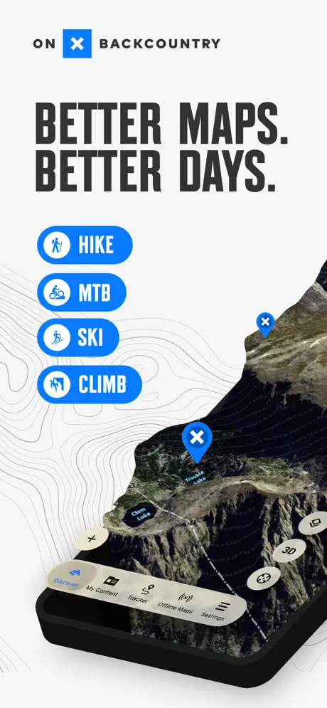
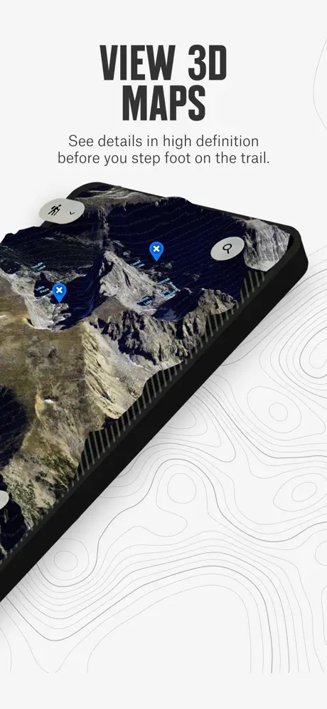
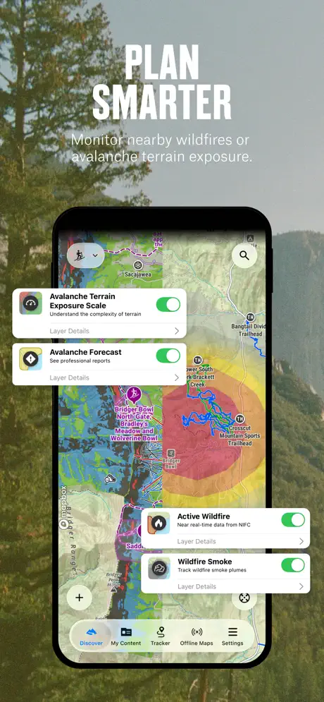
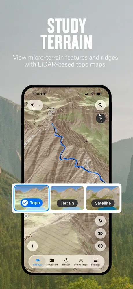
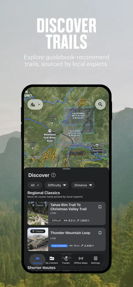
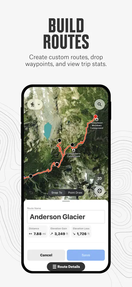
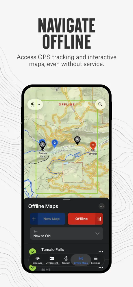
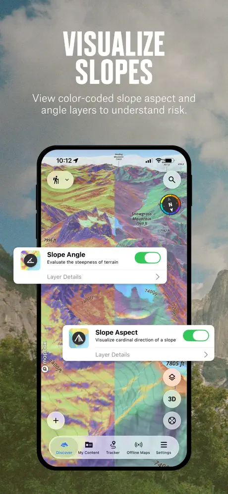
How much does onX Backcountry: 3D Trail Maps cost?
Prices are current as of 4 Oct 2026.
7 subscriptions from $9.99
In the United States, onX Backcountry: 3D Trail Maps has 7 subscriptions priced $9.99 – 99.99. It comes with a 7 days free trial.
| Subscription | Period | Price |
|---|---|---|
| Backcountry Elite Month (AS) | MonthlyTrial: 7 days | $9.99 |
| Backcountry Elite Monthly | MonthlyTrial: 7 days | $14.99 |
| Backcountry Premium Year (AS) | AnnualTrial: 7 days | $24.99 |
| Backcountry Premium Yearly | AnnualTrial: 7 days | $29.99 |
| onX SOS | Annual | $49.99 |
| Backcountry Elite Year | Annual | $99.99 |
| Backcountry Elite Year (AS) | AnnualTrial: 7 days | $79.99 – 99.99 |
See what onX Backcountry: 3D Trail Maps costs in all 3 countries →
10+ alternatives to onX Backcountry: 3D Trail Maps
| onX Backcountry: 3D Trail Maps |   Avenza Maps: Offline Mapping Avenza Maps: Offline Mapping |   The Dyrt: RV & Free Camping The Dyrt: RV & Free Camping |   Gaia GPS: Mobile Trail Maps Gaia GPS: Mobile Trail Maps |   Trailforks: Offline Bike Maps Trailforks: Offline Bike Maps | 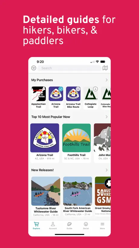  FarOut: Hike, Bike, Paddle FarOut: Hike, Bike, Paddle | 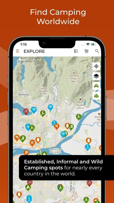  iOverlander iOverlander |   GOHUNT: Research & Maps GOHUNT: Research & Maps |   CalTopo: Backcountry Mapping CalTopo: Backcountry Mapping |   Garmin Explore™ Garmin Explore™ | 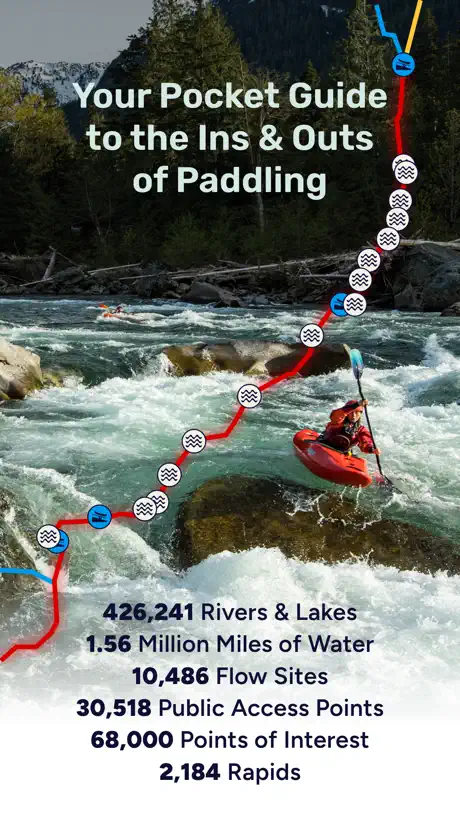  Paddle Ways - Lets Go Paddling Paddle Ways - Lets Go Paddling | |
|---|---|---|---|---|---|---|---|---|---|---|---|
| Rating / 5 | 4.7 | 4.7 | 4.8 | 4.7 | 4.7 | 4.8 | 4.4 | 4.8 | 4.8 | 4.0 | 4.4 |
| Reviews | 6.6K | 251K | 126K | 43K | 33K | 30K | 19K | 8.6K | 8.4K | 4.3K | 1.5K |
| Released | 2020 | 2010 | 2017 | 2017 | 2015 | 2013 | 2024 | 2021 | 2019 | 2018 | 2023 |
| Monthly price | $14.99 | — | $6.99 | — | — | $15.00 | $9.99 | — | — | — | $9.99 |
| Annual price | $49.99 | $34.99 | $35.99 | $71.90 | $53.90 | — | $59.99 | $169.99 | — | — | $49.99 |
The going rate for each plan in United States, in its own currency, shaded from the cheapest price on the row to the dearest. Plans fewer than four in ten of the priced apps sell are left out.
onX Backcountry: 3D Trail Maps reviews
4.7 out of 5, based on 6,602 reviews.
What people like
- Offline maps work well for backcountry safety.
- Easy to create custom routes with elevation info.
- Interface is simple and very user friendly.
What they complain about
- Map data has many errors and missing peaks.
- Metric units do not work properly on maps.
- Subscription charges continue even after you try to cancel.
- App is slow to load and feels sluggish.
Unclear on the free trial
I purchased the free trial to try it out for a hike. I didn’t end up needing it and since it was a free trial, I assumed like most apps it would show it my subscriptions in the app store which it does not. I have been getting charged $16 a month for the last 2 months for essentially nothing and have not gotten one notification or warning before my trial was due to end. Not to mention, the app itself is poorly made and takes ages to load.
Fake loading
Deleted this trash after i saw the fake loading bars after every question alluding to this being a subscription app. Waste of time
Make them disappear
Only downfall on this app and it’s not a huge one, would be to take all those buttons and be able to hide them off the screen.When I’m in the middle of a forest on my mule, they seem to be always in the way and I seem to hit them when I’m trying to find my way out. (zooming in zooming out )It would be very nice if they could take all the buttons and take them off the face of the map when needed. A hide feature thanks guys.
Search sucks
Search feature is extremely limited, and not as good as a backcountry app should be. You’d expect to be able to search for certain camps, rivers, and things like that, but nope. Just a half assed mountain project app that charges an arm and a leg to use
Why are there popups when I already pay?
This is a fantastic app for discovering new trails and for finding climbing areas. Although it lacks many of the features of more powerful mapping apps, that’s not its main purpose. I do have one major gripe though: why are there in app popups (dickovers)!? I pay for the premium subscription, which is admittedly not the most expensive tier, but every third time I open the app there’s a new dickover waiting for me that I have to dismiss before using the app. Just put a little notification number in the corner, sheesh.
Great Product
I love the product and the support from Outside is amazing. Great product and great company.
Can’t cancel
I have cancel before and I did it again I’ve been charged for the past Atleast few months of trying to cancel and keeps saying it is but still charges. Very scumming and very disappointing. I enjoyed the app I plan on paying on months I neeed but I will no longer ever be doing that again.
New feature
Would it be possible on the tracker feature to have acreage as an option? This would be a great add-on for the fire community/fire personnel.
Um… where are the campsites
I’m looking for good places on BLM land to camp. This app shows my places to hike, places to mountain bike, places to climb, and ski places. But the promo material talks a lot about camping. Is there a secret alternative interface for camping?
Not so good in backcountry !
Make sure you have a backup if you are going off-grid. All this app gave me was a very generic map, and said “Offline” in red. Didn’t identify the BC campsite I was in or show me the main trail back to where I parked. Sad to say that Google Maps had more detail.
First time user
Downloading some maps for a hike in the Wallowas, Oregon, leaving in 3 weeks. Easy to navigate the app.
Subscription fees are outrageous
Not as expected. Wanted this for leisure: Weekend hikes, exploring potential parks, no option for a straight fixed fee. All options are monthly subscriptions. It’s 2026, no one wants a monthly subscription anymore. Stay away from
Gramz
I’m liking it , I just upgraded my trial
Why no metric
This app would be way better if it had metric
Bait and switch
I downloaded and set up a one year elite for $80. When I logged into the app it showed me an offer for $40. When I clicked on it, it said I was already subscribed. So why didn’t I get the offer when signing up?
great hiking companion
onX is a great app for tracking hikes and outdoor adventures. I have used some of the competitors apps as well and I like onX the best. My only feature request would be for the tracker to either let me choose a color for the track or randomly choose one. Right now it records every track as cyan, requiring me to go and edit them later to change the color. Having them all the same color is not ideal, and competing apps alternate the colors.
Data grab
Them moment you open the app they are asking to register. No trail period. Straight to the data grab
I wish onX would combine apps
This app is awesome, but I just wish onX would combine the off-road app and hunting app with this app so it can all be in one place. I want to know where the hiking trails are, but also where I can do dispersed camping and go 4-wheeling. It is really annoying to have switch between apps. I would love one app that has all the layers in it!
Limited Usability in Canada
No matter what I try, I can’t seem to make the maps actually switch to metric. Please, please, please make an update that solves this.
Bring back the weather button
This app was so much easier to use when there was a dedicated weather button on the Home Screen
The map I’ve been looking for
This shows old trail traces that show on on other map
Not as good as Far out app
The reason I downloaded it was I kept seeing the ads they push in youtube. I tried it. Not impressive. Far out is way better. But apparently they push in youtube too much, and much of my subscription money would go to the youtubers than actually making the app better. Would not recommend.
Metric Units
Everything on the app is great! Is it possible to get the base map to display mountain peak elevations in meters? It still shows it in feet despite setting units in metric
Has potential
Seems like a great app since its design and usability is very simple. However, there aren’t any Canadian trails available on this app, so don’t install it if you are expecting that you’ll get local trails in Canada. This app shouldn’t even be on the Canadian AppStore but for some reason it is? Still, great potential but lacks practicality in Canada and in some parts of the USA too.
No metric topos
There are routes and maps in Canada but all in feet not meters :(
Helpful for planning routes
I really like this app, and I’m saying this as an experienced backpacker/outdoorsman. It’s the best you can get for the price point. You can easily make custom routes which is something that costs over $100 to do in AllTrails. The interface is straightforward and the maps (at least here in NY) are up to date with the latest topo maps available from USGIS and the DEC.
Do not buy the memberships it is not worth it!
The PAID filters are nice. But why are you not able to filter through different types of climbing. Having to sift through every single pinger to see if it’s rope or sport or bouldering is not worth it. And I would highly recommend not wasting your money if that’s what you’re looking for.
Canadian Content
I agree with some other reviewers that there is a paucity of CanCon. However, for backcountry skiing in Canada it is actually quite helpful. We found some new terrain in an area I’d skied several times before. I hope they keep developing content.
Not Fatmap yet- but close
Still looking for somthing that can give what Fatmap had. This app is the best I’ve found so far but still needs work. The biggest issue i have is that the satellite maps are not near as clear and there is some kind of glaze over all the terrain details to make the map more smooth and load easier i assume but it makes rout finding/planning next to impossible since you can’t really tell what you’re looking at for sure. Fat map has unbelievable detail which was definitely needed. Also on the web version on my macbook i cant figure out how to spin and tilt the map in 3d mode. Please just buy Fatmap from Strava and load it on here!!!
My Go-To Outdoor App
Ive been using ON X for a few years now. Ive tried pretty much all the other apps. On X is absolutely the best. I always get the Premium Subscription. The other apps may have the same features, but ON X is definitely the most user friendly, and that’s whats important to me. I LOVE the “create your own trail” feature, it’s super user friendly and it will tell you the elevation and how many miles. You can also download offline maps, so you’ll have it in SOS mode. I hope ON X never changes.
Bring back line tool
Why did this handy tool disappear?
Metric is a must!
The map layers show great detail which is sweet but topo maps will not display metric units which is super frustrating! If you want to be successful outside of the US please change this for your international users!
Very useful!!!
I use it everytime I go out
Dangerously inaccurate for anything other than a Sunday stroll
Just the most obvious things in onX after a few minutes of browsing before my 7-day trial expires, these are only in Chugach State Park because that’s the area I know the best to double-check their maps: - maps are much lower resolution than Gaia or Caltopo, and suprisingly even lower detail than Alltrails - Only has crevass information on satellite/3D view, Caltopo has crevasses from lidar on topo maps - North and South Yuyanq' Ch'ex are called “Suicide Peaks” and the South peak is the only one marked. Despite there being a route listed for the North peak. - East Fork of Eklutna River doesn’t exist, at all. It’s not that it’s not labeled, it’s not even there. - Mount Yukla is incorrectly marked as being a mountain pass a few MILES away from the actual summit - Half-dozen prominent peaks east of Williwaw aren’t marked - Avalanche Mountain not marked - The trails detailed in the military lands near Temptation Peak don’t mention anything about all the red tape required to hike on those military lands - See above but for Ram Valley access - Concerto Peak not marked - Chugach State Park 7000ers: the Kiliaks and Korohusk aren’t marked - Missing: White Lice Mountain, Ovis Peak, Baneful, Boisterous, The Watchman - Eklutna high traverse is marked, but almost every peak on it is not - Pioneer peak summit marker is way off - Baldy to Mile high traverse is marked but most of the mountains it connects are not, including Baldy and Mile High - I’m an avid Open Street Map (OSM) contributer. If OnX had simply taken this free data, then repackaged it and sold it…this app would be better for it. The errors in marking some of the most notable mountains in the most populated parts of Alaska are laughably bad - I guess all the VC funding an influencer marketing in the world can’t account for bad taste
Not quite fatmaps
Pretty decent map but it can’t hold a candle to the amount of crowdsourced trail info that fatmaps had. It will show you popular trails in your area but the more obscure ones are yet to be marked. Maybe that’s for the best.
Just
Pay for it.
Terrible System
You cannot build routes in app. It almost seems like the app does whatever it wants and makes random points on the map when building a route. It will not let you remove random points and it will not let you build a route from where you are. Pointless feature in the app that only annoys you when you try to use it. Not happy with this app.
Nice potential Fatmap replacement
The 3D view is nice, the layers are also really nice. They don’t have alot of suggested trails in Canada yet. Making a path and changing the waypoints is harder than other app on my phone. But I would use this app, if only the topo lines where in meters
Great mapping
Super user friendly and nice interface. Great features and I love all the different sports!
Don’t Give Money to VC Clowns
The app constantly nagged me for a review even after I stupidly paid for a subscription just to get access to public information that you can get for free at sites like OpenTrailMap.us, so here’s my review: don’t pay for this. These clowns bought the REI Hiking Project, MTB Project, Powder Project, Trail Run Project, and Mountain Project, then OnX acquired them and ruined them all with their subscription plans that they gate everything behind. Everyone who contributed anything to these just gave free value to capitalist pigs. Don’t support this and use something open source instead.
Not useful in Canada yet
Currently trails aren’t supported and the maps don’t support metric. Basic over site but it makes the app unusable.
onX Backcountry: 3D Trail Maps price by country
A monthly subscription costs $7.04 in Canada and $16.42 in Mexico — 2× more for the same thing. Below is the going rate for each plan in every country that sells it — the middle price of what the app charges there, in the country's own currency with the dollar equivalent beneath it.
| Country | Monthly | Annual |
|---|---|---|
| Canada | CA$9.99$7.04 | CA$69.99$49.29 |
| Mexico | MX$299.00$16.42 | MX$999.00$54.86 |
| United States | $14.99 | $49.99 |
onX Backcountry: 3D Trail Maps FAQ
- Is onX Backcountry: 3D Trail Maps free?
- Yes. The app and its basic features are free, in all 3 countries it sells in. Premium features are paid: they start from $9.99 (US), across 7 subscriptions.
- How much does onX Backcountry: 3D Trail Maps cost per month?
- Backcountry Elite Month (AS) is $9.99 – 14.99 (US). The annual plan works out cheaper per month: $24.99 – 99.99 a year.
- Does onX Backcountry: 3D Trail Maps have a free trial?
- Yes — a 7 days free trial (US).
- Where is onX Backcountry: 3D Trail Maps cheapest?
- A monthly subscription costs CA$9.99 (≈$7.04) in Canada and MX$299.00 (≈$16.42) in Mexico, its cheapest and dearest countries.
- What are the best alternatives to onX Backcountry: 3D Trail Maps?
- Avenza Maps: Offline Mapping (4.7 from 250,891 reviews, premium from $0.99), The Dyrt: RV & Free Camping (4.8 from 126,096 reviews, premium from $6.99) and Gaia GPS: Mobile Trail Maps (4.7 from 43,076 reviews, premium from $19.99).
onX Backcountry: 3D Trail Maps download
Last updated 15 days ago.
onX Backcountry: 3D Trail Maps sells in 3 countries. It was released 5 years and 9 months ago, on 9 Dec 2020. It holds a 4.7 rating from 6,602 reviews.
Supports 1 language: English.
How much does onX Backcountry: 3D Trail Maps make?
Third-party estimates for the last 30 days, worldwide — not the store's own figures, which Apple publishes for nobody.
Revenue by plan
- Annual 76%
- Monthly 24%
Revenue by country
- United States 98%
- Canada 2%
- Mexico 0%