
Firespot: Wildfire app
Wildfire photos, alerts, more
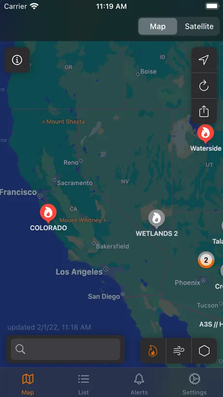
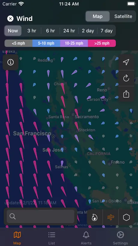
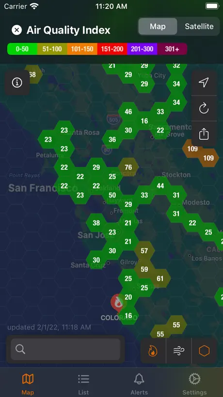
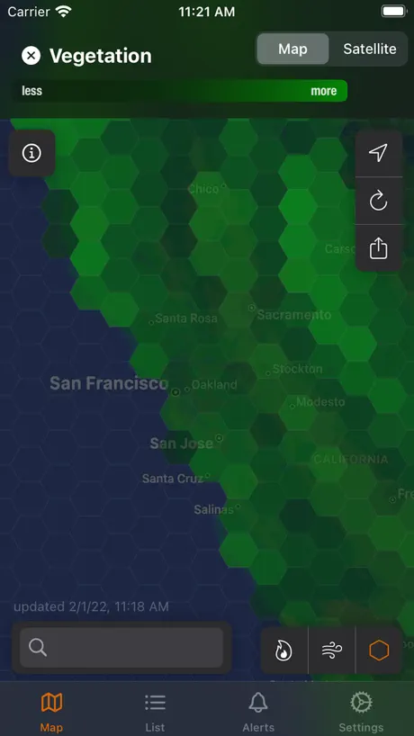
How much does Firespot: Wildfire app cost?
Prices are current as of 30 Sept 2026.
1 subscription from $29.99
In the United States, Firespot: Wildfire app has 1 subscription priced $29.99.
| Subscription | Period | Price |
|---|---|---|
| Firespot Yearly | Annual | $29.99 |
See what Firespot: Wildfire app costs in all 175 countries →
10+ alternatives to Firespot: Wildfire app
| Firespot: Wildfire app |   My Lightning Tracker & Alerts My Lightning Tracker & Alerts |   QuakeFeed Earthquake Alerts QuakeFeed Earthquake Alerts |   Storm Tracker° Storm Tracker° |   SKAI - NOAA Weather Radar SKAI - NOAA Weather Radar |   Alberta Emergency Alert Alberta Emergency Alert |   Paku - Air Quality & AQI Map Paku - Air Quality & AQI Map |   OpenSnow OpenSnow |   EPA AIRNow EPA AIRNow |   Wildfire Info Wildfire Info |   Wildfire Aware® Wildfire Aware® | |
|---|---|---|---|---|---|---|---|---|---|---|---|
| Rating / 5 | 4.6 | 4.7 | 4.8 | 4.6 | 4.6 | 4.7 | 4.7 | 4.7 | 3.1 | 3.4 | 4.5 |
| Reviews | 8.4K | 192K | 113K | 103K | 31K | 15K | 12K | 9.4K | 570 | 31 | 24 |
| Released | 2020 | 2016 | 2010 | 2014 | 2023 | 2014 | 2020 | 2013 | 2011 | 2016 | 2022 |
| Weekly price | — | — | — | $3.99 | $4.99 | — | — | — | — | — | — |
| Monthly price | — | — | — | — | $9.99 | — | $1.99 | — | — | — | — |
| Annual price | $29.99 | — | $6.99 | $19.99 | $29.99 | — | $13.99 | $49.99 | — | — | — |
| One-time price | — | — | $1.99 | — | — | — | $8.99 | — | — | — | — |
The going rate for each plan in United States, in its own currency, shaded from the cheapest price on the row to the dearest. Plans fewer than four in ten of the priced apps sell are left out.
Firespot: Wildfire app reviews
4.6 out of 5, based on 8,417 reviews.
What people like
- Quickest alerts compared to other apps
- Provides crucial life-saving information during fires
- Useful weather data like wind speed
What they complain about
- App crashes immediately on startup
- Alerts arrive too late for safety
- Developer ignores customer support emails
Fire find
Great app
Junk
Nothing works. Notifications do not work. Email setting will not work. Fire map is not working. So angry I paid for a year subscription.
Good updates to mas
I have enjoyed this app. I have followed numerous fires and have found the information reliable. Fast interface. Comprehensive coverage.
Its OK. Funky UX, expensive
Was disappointed in the UX and the timeliness of the reporting. Data seems slow to populate. UX is kind of funky. Its also kind of expensive.
Almost perfect
I’m in wildfire-prone Malibu. This app has so many features that I love. I can customize my alert areas. I can get wind speeds and direction and all sorts of useful weather info. My only issue is that I receive alerts at least twice a day, every day, for small fires in my area that were put out a week ago. It’s the app that cried wolf! I’m beginning to ignore the alerts and don’t want to miss something that I need to know about!
It’s All We Have
Better than Facebook for factual updates, infinitely better than Cal Fire for timeliness, it’s a literal lifesaver
About 2 hours late to notify for fire in area
Fire in 20 mile radius that was pretty bad got notified after 2 hours. Likely i use non profit app and they notified me 5 minutes after fire started
Amazing app! except for one thing.
So this app is AMAZING at tracking fires except whenever I use it for a few minutes it starts glitching out and the screen freezes. I don’t know if it’s my device or the app itself but it is very glitchy and my device has not had that problem. Other than that it is an amazing app! I recommend this app for people who want to know if there is a fire near the area, people who have a lot of wildfires, and people who like to plan early and get prepared for a wildfire.
Worked great at first, now useless
Like so many others, we’re dealing with fires cropping up constantly right now. We live on a horse farm and need as much possible advance warning as possible if we have to load horses. This app started out great a few weeks ago when I subscribed. I used it everyday. Now, for some reason, it no longer shows any fires anywhere. And, it keeps dumping my subscription. I bought an annual subscription about 4 weeks ago. I have tried every adjustment, I’ve restarted my phone, I’ve dumped and reloaded the app. It restored my subscription once. Now, nothing. I tried contacting the developer and got no response. Nothing left to do but ask Apple to refund. I’m sad because when it worked it was great. Now it’s completely useless.
Information not updated
Looking at fires on the West Coast, the information hasn’t changed in weeks. This was my go-to app but now it’s sadly unusable.
Nice app
Works great
No info for large, nearby fire.
There’s a wildfire that’s burned 1,300 acres less than 10 miles from my house; started more than 10 hours ago. The incident doesn’t show up in this app at all (neither on the map nor in the list).
Decent app
The app is pretty good but the only thing I don’t understand is the camera option, when you turn on the camera filter and select a camera it doesn’t show anything and I don’t know what it’s suppose to show , it doesn’t work
Fire ap
It does not load or show fires quickly and accurately
Review Firespot
So helpful to be informed!
Scammed
Took my money and did not work on my iPhone…
Idaho
I was in Stanley Idaho for a couple of days and the smoke was like breathing in a barbecue . I imagine it was a lot worse for the fire fighters and people right next to the fire . I would not advise traveling there if you can’t handle the smoke and headaches.
Texan , Father ,Grandfather
Information in a hellish time when decisions to flee and which direction must be made. Mistakes cost lives.
Cannot get it to open
I have downloaded, deleted and reloaded this app multiple times. When I first tried it out, it worked for a couple of days. I decided to subscribe to it for $29.99 a year. It still will not open. I’m not sure what the problem is. I tried canceling my subscription and the charge went through anyway. Not happy about this.
Now fixed…
Addendum #2: Glad I kept nagging. The problems described below are now fixed (+3*s). I look forward to this app providing warnings for the upcoming fire season. Original review: This app is sending me alerts that satellites have detected fires in a large area of E. Canada that I have delineated… yet absolutely nothing shows up on the map for any sensor methods. Then today: “a fire near you.” Nada. The lists are even worse — all categories totally empty. Clearly this app has been abandoned. Complete waste of a $30 subscription. (Dev: please don’t suggest uninstalling, reinstalling, blah, blah. Done that twice. No difference.) Addendum #1: Yes, the lists populate now. But the map in Eastern Canada, still nada. The alerts for the large portion of western Quebec that I outlined now zoom in with a detailed little pop-up but NOTHING shows up on the map.
Fire
I love this app it keeps me informed what states have fires
Horrible app.
Purchased this app because it had great reviews and sounded to good to be true. Well turns out it is. The alerts do not work in my selected area. Wild wires don’t pop up until we’ll after the local news has already alerted people. The satellite does not let you see how big the fire is getting. Total waste of money.
Great tool
Very easy to keep up with where the problem s are
More capable than Watch Duty
I’ve run all wildfire apps simultaneously for two years - this one has the quickest alerts and more functionality than the others. It’s 100% worth paying for.
Data not updating
The fire data is suspect. The 23LX-Smith fire has been at 112K acres for at least a month, even though is identified as uncontrollable. That makes me suspect the rest of the data.
Amazing app
This is an amazing app for my kids to play I’m teaching them young to be on the lookout for fire. I like them to play it while they are about to go to bed sometimes it gives them nightmares about fires but that’s ok. This is an amazing for my dog too even though his color blind he knows what colors are fires.
Cant do any other problems
Their is no problem to this I know where my fire locations are so be aware that I love this app it is my all time favorite ok I love it
Get nothing ...
Doesnt work on Voice Over , im blind first crash on start up need constant gps then after turned on nothing showing i keep tapping wont get any thing out of it ,, bummer was really excited about this one..
Thanks
I live in Foresthill California and just wanted to thank you so much for this app
Crashes when loading.
When you open/load the app, It immediately crashes. I thought it was just a glitch so I deleted and reinstalled, but as I went back onto the app it crashed.
Amazing app
I got this app to check the Plumta fire and this gave me wore information about that fire than I could even think I could get. Thank you so much for creating this app.
Crashes on launch
Won’t even open. As I was downloading the app, I noticed some bugs related to this were supposedly fixed a few days ago but clearly it’s still an issue.
Firespot: Wildfire app price by country
An annual subscription costs $6.33 in Turkey and $40.26 in Colombia — 6× more for the same thing. Below is the going rate for each plan in every country that sells it — the middle price of what the app charges there, in the country's own currency with the dollar equivalent beneath it.
| Country | Annual |
|---|---|
| Afghanistan | $29.99 |
| Albania | $35.99 |
| Algeria | $29.99 |
| Angola | $29.99 |
| Anguilla | $29.99 |
| Antigua And Barbuda | $29.99 |
| Argentina | $29.99 |
| Armenia | $29.99 |
| Australia | A$42.99$30.06 |
| Austria | €29.99$34.12 |
| Azerbaijan | $29.99 |
| Bahamas | $29.99 |
| Bahrain | $29.99 |
| Barbados | $29.99 |
| Belarus | $29.99 |
| Belgium | €29.99$34.12 |
| Belize | $29.99 |
| Benin | $29.99 |
| Bermuda | $29.99 |
| Bhutan | $29.99 |
| Bolivia | $29.99 |
| Bosnia & Herzegovina | €29.99$34.83 |
| Botswana | $29.99 |
| Brazil | R$162.90$31.27 |
| British Virgin Islands | $29.99 |
| Brunei Darussalam | $29.99 |
| Bulgaria | €28.99$32.98 |
| Burkina Faso | $29.99 |
| Cambodia | $29.99 |
| Cameroon | $29.99 |
| Canada | CA$36.99$26.05 |
| Cape Verde | $29.99 |
| Cayman Islands | $29.99 |
| Chad | $29.99 |
| Chile | CLP 24,900$25.90 |
| China | CN¥198.00$29.46 |
| Colombia | COP 132,900$40.26 |
| Congo | $29.99 |
| Congo, Democratic Republic | $29.99 |
| Costa Rica | $29.99 |
| Cote Divoire | $29.99 |
| Croatia | €31.19$36.23 |
| Cyprus | €29.99$34.12 |
| Czech Republic | CZK 779.00$36.32 |
| Denmark | DKK 229.00$34.86 |
| Dominica | $29.99 |
| Dominican Republic | $29.99 |
| Ecuador | $29.99 |
| Egypt | EGP 469.99$9.03 |
| El Salvador | $29.99 |
| Estonia | €29.99$34.12 |
| Fiji | $29.99 |
| Finland | €29.99$34.12 |
| France | €29.99$34.12 |
| Gabon | $29.99 |
| Gambia | $29.99 |
| Georgia | $29.99 |
| Germany | €29.99$34.12 |
| Ghana | $29.99 |
| Greece | €29.99$34.12 |
| Grenada | $29.99 |
| Guatemala | $29.99 |
| Guinea-bissau | $29.99 |
| Guyana | $29.99 |
| Honduras | $29.99 |
| Hong Kong | HK$233.00$29.72 |
| Hungary | HUF 11,490$35.60 |
| Iceland | $37.19 |
| India | ₹2,699.00$28.09 |
| Indonesia | IDR 479,000$26.63 |
| Iraq | $29.99 |
| Ireland | €29.99$34.12 |
| Israel | ₪97.90$31.89 |
| Italy | €29.99$34.12 |
| Jamaica | $29.99 |
| Japan | ¥3,300$20.98 |
| Jordan | $29.99 |
| Kazakhstan | KZT 12,790.00$29.03 |
| Kenya | $29.99 |
| Kosovo | €29.99$34.12 |
| Kuwait | $29.99 |
| Kyrgyzstan | $29.99 |
| Lao Peoples Democratic Republic | $29.99 |
| Latvia | €29.99$34.12 |
| Lebanon | $29.99 |
| Liberia | $29.99 |
| Libya | $29.99 |
| Lithuania | €29.99$34.12 |
| Luxembourg | €29.99$34.12 |
| Macao | $29.99 |
| Macedonia | $29.99 |
| Madagascar | $29.99 |
| Malawi | $29.99 |
| Malaysia | MYR 129.90$32.15 |
| Maldives | $29.99 |
| Mali | $29.99 |
| Malta | €29.99$34.12 |
| Mauritania | $29.99 |
| Mauritius | $29.99 |
| Mexico | MX$699.00$39.05 |
| Micronesia | $29.99 |
| Moldova | $29.99 |
| Mongolia | $29.99 |
| Montenegro | €29.99$34.12 |
| Montserrat | $29.99 |
| Morocco | $29.99 |
| Mozambique | $29.99 |
| Myanmar | $29.99 |
| Namibia | $29.99 |
| Nauru | $29.99 |
| Nepal | $29.99 |
| Netherlands | €29.99$34.12 |
| New Zealand | NZ$47.99$27.11 |
| Nicaragua | $29.99 |
| Niger | $29.99 |
| Nigeria | NGN 13,200.00$9.93 |
| Norway | NOK 309.00$32.42 |
| Oman | $29.99 |
| Pakistan | PKR 4,600$16.61 |
| Palau | $29.99 |
| Panama | $29.99 |
| Papua New Guinea | $29.99 |
| Paraguay | $29.99 |
| Peru | PEN 114.90$33.60 |
| Philippines | ₱1,450.00$23.20 |
| Poland | PLN 139.99$36.46 |
| Portugal | €29.99$34.12 |
| Qatar | QAR 109.99$30.22 |
| Romania | RON 144.99$31.25 |
| Russia | RUB 2,690.00$31.88 |
| Rwanda | $29.99 |
| Sao Tome & Principe | $29.99 |
| Saudi Arabia | SAR 129.99$34.66 |
| Senegal | $29.99 |
| Serbia | €29.99$34.12 |
| Seychelles | $29.99 |
| Sierra Leone | $29.99 |
| Singapore | SGD 42.98$33.58 |
| Slovakia | €29.99$34.12 |
| Slovenia | €29.99$34.12 |
| Solomon Islands | $29.99 |
| South Africa | ZAR 489.99$29.86 |
| South Korea | ₩37,000$27.23 |
| Spain | €29.99$34.12 |
| Sri Lanka | $29.99 |
| St. Kitts and Nevis | $29.99 |
| St. Lucia | $29.99 |
| St. Vincent & The Grenadines | $29.99 |
| Suriname | $29.99 |
| Swaziland | $29.99 |
| Sweden | SEK 315.00$31.63 |
| Switzerland | CHF 30.00$36.06 |
| Taiwan | NT$900.00$28.29 |
| Tajikistan | $29.99 |
| Tanzania | TZS 69,900.00$26.41 |
| Thailand | THB 939.00$27.95 |
| Tonga | $29.99 |
| Trinidad and Tobago | $29.99 |
| Tunisia | $29.99 |
| Turkey | TRY 309.99$6.33 |
| Turkmenistan | $29.99 |
| Turks and Caicos | $29.99 |
| Uganda | $29.99 |
| Ukraine | $29.99 |
| United Arab Emirates | AED 114.99$31.33 |
| United Kingdom | £25.99$34.47 |
| United States | $29.99 |
| Uruguay | $29.99 |
| Uzbekistan | $29.99 |
| Vanuatu | $29.99 |
| Venezuela | $29.99 |
| Vietnam | ₫689,000$26.58 |
| Yemen | $29.99 |
| Zambia | $29.99 |
| Zimbabwe | $29.99 |
Firespot: Wildfire app FAQ
- Is Firespot: Wildfire app free?
- Yes. The app and its basic features are free, in all 175 countries it sells in. Premium features are paid: they start from $29.99 (US), across 1 subscription.
- Does Firespot: Wildfire app have a free trial?
- No. None of its offers (US) come with a free trial.
- Where is Firespot: Wildfire app cheapest?
- An annual subscription costs TRY 309.99 (≈$6.33) in Turkey and COP 132,900 (≈$40.26) in Colombia, its cheapest and dearest countries.
- What are the best alternatives to Firespot: Wildfire app?
- My Lightning Tracker & Alerts (4.7 from 192,173 reviews), QuakeFeed Earthquake Alerts (4.8 from 112,861 reviews, premium from $1.99) and Storm Tracker° (4.6 from 103,061 reviews, premium from $2.99).
Firespot: Wildfire app download
Last updated 13 days ago.
Firespot: Wildfire app sells in 175 countries. It was released 6 years ago, on 13 Sept 2020. It holds a 4.6 rating from 8,417 reviews.
Supports 1 language: English.
How much does Firespot: Wildfire app make?
Third-party estimates for the last 30 days, worldwide — not the store's own figures, which Apple publishes for nobody.
Revenue by plan
- Annual 100%
Revenue by country
- United States 78%
- Canada 13%
- United Kingdom 1%
- Germany 1%