
WeTrek – Trail, Hike & Cycling
GPS with IGN offline topo maps
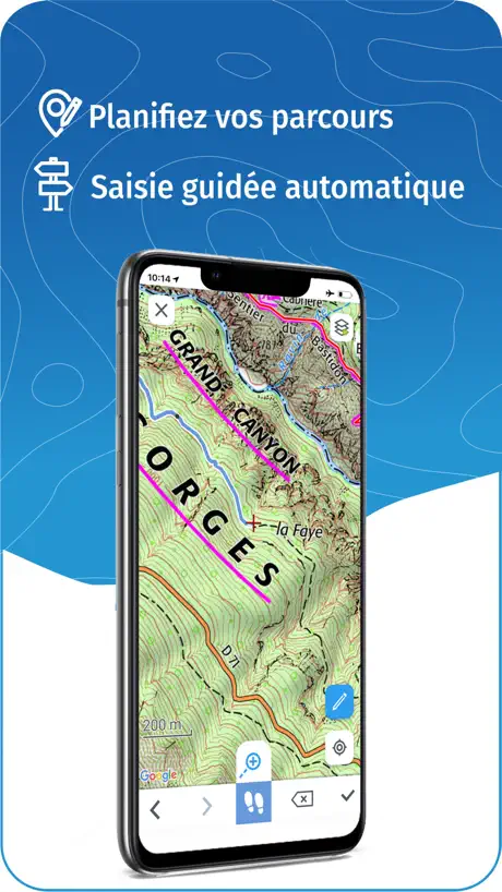
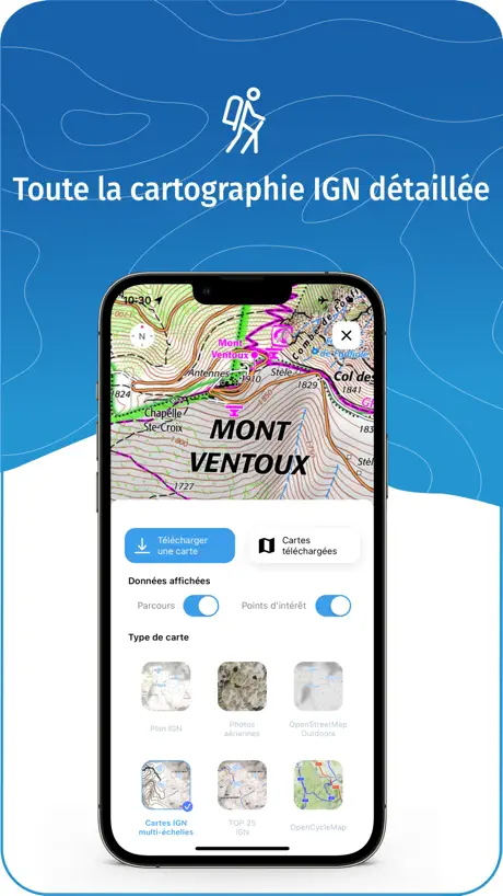
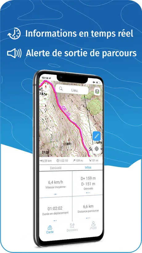
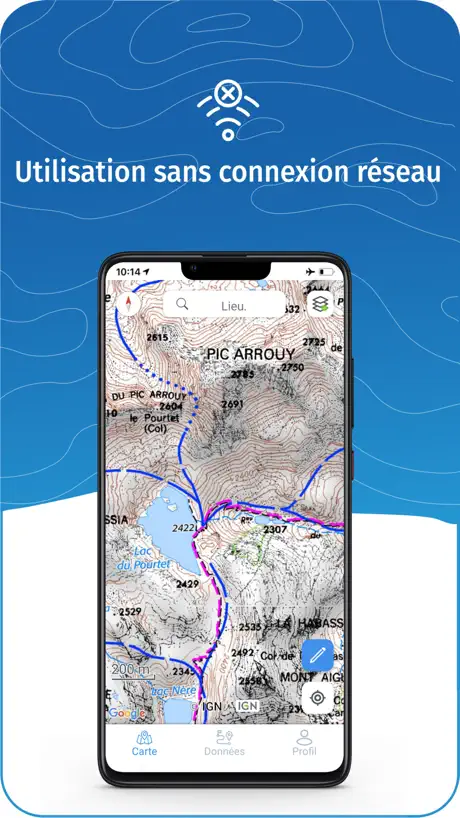
How much does WeTrek – Trail, Hike & Cycling cost?
Prices are current as of 6 Oct 2026.
1 subscription from $19.99
In the United States, WeTrek – Trail, Hike & Cycling has 1 subscription priced $19.99.
| Subscription | Period | Price |
|---|---|---|
| IGNrando' Plus | Annual | $19.99 |
See what WeTrek – Trail, Hike & Cycling costs in all 175 countries →
10+ alternatives to WeTrek – Trail, Hike & Cycling
| WeTrek – Trail, Hike & Cycling |   Geovelo : bike GPS Geovelo : bike GPS |   Visorando Walking Routes Visorando Walking Routes | 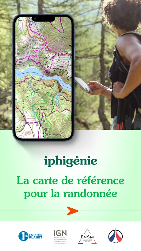  Iphigénie | Offline Maps Iphigénie | Offline Maps | 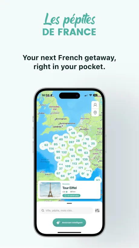  Les Pépites de France Les Pépites de France | 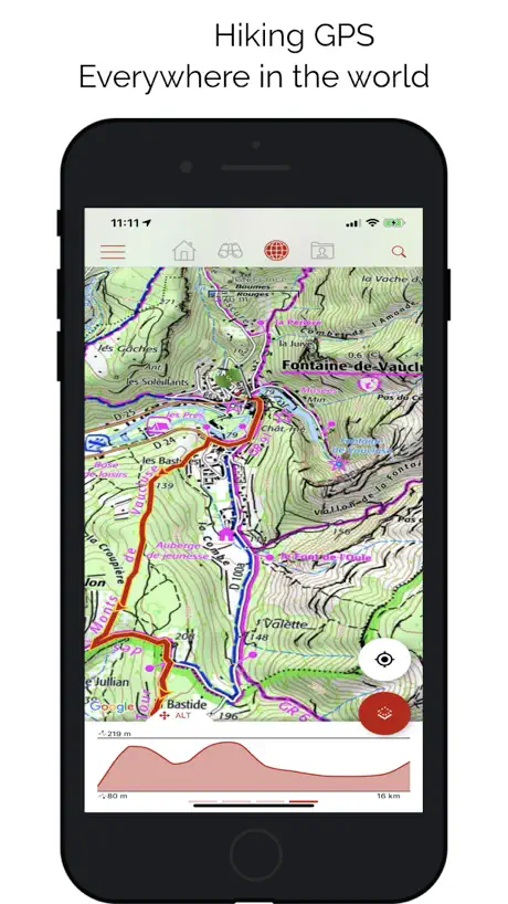  SityTrail SityTrail |   Relief Maps : backcountry gps Relief Maps : backcountry gps |   Hika - Hiking trails and maps Hika - Hiking trails and maps |   Cirkwi Cirkwi |   MaRando – FFRandonnée MaRando – FFRandonnée |   HexaTrek : Thru Hike France HexaTrek : Thru Hike France | |
|---|---|---|---|---|---|---|---|---|---|---|---|
| Rating / 5 | 4.5 | 4.7 | 4.7 | 4.5 | 4.7 | 4.4 | 4.6 | 4.7 | 4.5 | 4.6 | 4.5 |
| Reviews | 26K | 65K | 25K | 12K | 5.3K | 2.3K | 2.2K | 974 | 769 | 543 | 58 |
| Released | 2019 | 2017 | 2015 | 2010 | 2022 | 2011 | 2019 | 2020 | 2013 | 2022 | 2022 |
| Monthly price | — | — | $6.00 | — | $4.00 | — | $0.99 | $7.49 | — | — | — |
| Annual price | $19.99 | — | $19.99 | $24.99 | $22.00 | $24.99 | $13.99 | $27.49 | — | $11.49 | — |
| One-time price | — | — | — | $4.99 | $39.00 | — | $13.99 | — | $3.99 | — | — |
The going rate for each plan in United States, in its own currency, shaded from the cheapest price on the row to the dearest. Plans fewer than four in ten of the priced apps sell are left out.
WeTrek – Trail, Hike & Cycling reviews
4.5 out of 5, based on 26,418 reviews.
What people like
- Offline maps work great without signal
- Navigation guidance is very precise
- Good value compared to other apps
- Detailed terrain data helps with planning
What they complain about
- App crashes frequently and is unstable
- Registration process is confusing and broken
- Cannot plan routes outside of France
- Map downloads fail or disappear often
L’indispensable fond de carte pour randonner
La carte IGN papier m’a accompagné pendant 40 ans de randonnée car sa précision permet de s’orienter efficacement et en plus d’estimer la technicité du terrain. La version digitale permet de connaître précisément sa position. Il devient difficile de se perdre et facile de modifier l’itinéraire en cours de route. Et le gros avantage est de conserver une grande surface de la carte même en cas de perte de réseau satellite
Useless
Without IGN map capability, unfortunately this is no longer a useful app.
Complète mais bug création itinéraire
L’appli est super. C’est mon outil de travail. Mais gros bug en ce moment. Impossible de créer un itinéraire sur le fond de carte Swiss TOPO (saisie guidée piétion/voiture). Ça part en cacahuètes dès la création du premier point. Appli à jour pourtant et la saisie guidée fonctionne sur IGN TOP 25.
Pas fiable et aucun service client
Ça fait 5 ans que je l’utilise et ça m’agace de plus en plus. Quand ça marche c’est nickel mais tous les 6 mois-1 an il est impossible de créer des parcours manuellement sauf en ligne droite (ça me fait une belle jambes) je dois donc supprimer l’appli et la réinstaller et au passage perdre tous mes parcours. Chaque fois je laisse un message signalant le problème au service client et demandant si il y a une manœuvre à faire. Ils ne m’ont jamais répondu. Alors si un jour ça arrive et que vous êtes en rando sans 3-4-5G bas il ne vous reste plus qu’à aller tout droit 🤦🏻♂️
Énervé
Rarement eu autant de difficultés avec une application. Illisible, les caractères sont taille fixe, insensibles aux réglages d’Apple. Utilisation du gris pour compléter le manque de lisibilité. Impossible de réinitialiser mon mot de passe ( ne reçois rien dans mes emails). Impossible de créer un nouveau compte (votre email existe déjà…) Le changement d’orientation écran provoque des erreurs de recadrage. Export des données : ne me demande par vers quoi… j’en oublie.
IGN au top
La carte ign de ref avec toutes les donees precises ideales pour vos sorties Randos!!!!
Garbage
Just wasted one hour trying to get this to work - this should be awesome as plenty of folks want actual OS maps offline but alas no…the French just can’t do tech it seems …what a shame.
Enfin une mise à jour qui fiabilise l’appli
Enfin une mise à jour qui fiabilise l’appli
Médiocre
L’appli plante à tout moment. Lorsque vous voulez classer des traces par dossiers, elle se fige et il faut la relancer… Sélectionner plusieurs traces prend un temps fou. Enfin l’ergonomie est franchement à repenser. Je suis abonné à IgnRando depuis des années et je constate que le changement de proprio n’a rien proposé de mieux. Rien ! Du coup je ne vais pas prolonger mon abonnement et basculer sur VisoRando…
Bien mais quelques améliorations
Très bonne application, pas trop chère par rapport aux concurrents, quel plaisir d’avoir les fonds de carte IGN. Par contre les points négatifs: l’application crash quand je zoom (notamment pour sélectionner des points trop proches), quand je zoom dans alors que le fond Top 25 est sélectionné, les photos aériennes apparaissent/remplacent mon fond de carte, ce qui est gênant. De plus, le plus gros points noir qui me ferait changé d’app: impossible de faire des traces en dehors de la France, j’habite à proximité de la frontière Suisse et Italienne… donc souvent je ne peux pas me servir de cette application et d’utiliser mon application Garmin. Quand on débloque le Nord de la carte, la boussole change également de direction, ce qui fait qu’elle est inutilisable (la flèche de notre point bleu qui indique notre position)… Si ces problèmes étaient réglés ça serait top. Pour finir, ça serait bien de pouvoir tracer un azimut, ou alors je n’ai pas trouvé l’option.
Très bonne appli
Depuis la mise à jour, et le nouveau nom de l’appli, il n’y a plus de bug. J’ai testé différentes applis et celle-ci est vraiment top.
IGN problematic
I don’t want to be forced into writing a review.
Très bonne application mais pas compatible iwatch
Super application pour planifier ses parcours , le guidage par téléphone est très précis mais ça oblige d avoir le telephone dans la main en courant , je mettrais 5 le jours ou elle sera compatible avec iwatch et que le guidage pourra se faire via la montre ..
plante à chaque fois
l’appli n’est pas stable>quand on essaie se s’abonner, elle plante…
Bonne appli mais
Plante quand on zoom …
Superbe !
L’application est superbe et extrêmement bien détaillée 👍🏻 Y a t’il un mode d’emploi quelque part dans l’application ? Si ce n’est pas le cas, pourriez-vous faire un document pour expliquer comment l’utiliser dans ses multiples possibilités ? Bravo 👏🏻 pour cette superbe réalisation 🙏🏻
Mac version does not open
It does nto work on the mac . on the iphone it is excellent
Cartes imprécises
Dans le Cantal, beaucoup de chemins indiqués mais n’existant plus, et beaucoup de nouveaux chemins non indiqués…
Peut mieux faire
Simple et facile à utiliser, mais des nombreux plantages lors de l’enregistrement d’une trace. Fonctionnalité inutilisable
Application à améliorer
J’utilise l’application depuis 18 mois, en particulier cet été durant 67 jours, 1800km de randonnée itinérante (à pieds) à travers Vosges, Jura et Alpes. J’ai fait remonté à l’équipe mes remarques mais je n’ai pas l’impression que ce soit beaucoup pris en compte. Deux points majeurs : - Quand on trace un parcours sur IPhone, le calcul du dénivelé est très erroné, surévalué d’environ 20% (et compensé par du dénivelé négatif surévalué). - J’ai dû très régulièrement réactiver mon abonnement (alors qu’il était toujours valide)… mais il fallait pour cela que je me trouve dans un secteur avec du réseau, ce qui n’a pas toujours été le cas donc je me suis retrouvé plusieurs fois sans accès aux cartes téléchargées, bref, sans carte en pleine montagne. En points gênants: - l’appli donne accès aux cartes d’autres pays, mais on ne peut y tracer des itinéraires qu’en point par point, sans reconnaissance des chemins, ce qui est très pénible (de plus ça serait bien d’avoir tous les pays limitrophes, en particulier l’Italie) - Le téléchargement des cartes ne peut se faire que par petites zones. Pour une rando d’un jour ça va, mais c’est pénible pour un long trek. Points mineurs: C’est contre intuitif la manière de supprimer une carte téléchargée
Carte IGN
Fantastique application, localisation précise et immédiate
Can’t create account
Fill in the boxes and press “Validez” (log in page doesn’t offer English version). One or more of the boxes is rejected. Refill it but now another box is rejected. Refill that box and a box is rejected, usually the first. Giving up.
Suppression de tracés?
Je n’arrive pas à supprimer des tracés importés dans l’application pour smartphone. Quand on a plusieurs tracés dans la même région, impossible de les différencier, ils ont la même couleur et s’ils se superposent , difficile de s’orienter.
Rechercher !??
On ne peut plus rechercher un lieu !! Dommage c’est une fonction indispensable
Supprimer
Supprimer une carte n est pas intuitif
Dites moi comment faire pour avoir la forêt noire
L’application me plait
Keeps crashing!
Maps look good, soon as you click to select routes etc it just crashes and closed the app. Tried reinstalling etc., just the same. V poor, I’m used to the OS app in the UK, which is brilliant. Real shame.
Déçue
J’utilisais souvent ignrando, sans soucis. Depuis que le passage à WeTrek, plus rien ne fonctionne : accès aux communautés, aux cartes communautaires..
Super pro !
Merci pour les webinaires. C’est très instructif
Crashes
Wge
Taille écriture
Écrit beaucoup trop petit!!! Des que l’on agrandit, ça se rétrécit!!
IGN
One of my favourite mapping apps. Great value an invaluable for cycling across france.
Impossible to create an account
Account created in the website (ver difficult as it is impossible to understand which account and area to address).then tried to use same user and password in the app. A non self explanatory error comes out. Pity as it seems to be a great app and I bought 4 paper maps. Will uninstall soon
Very complicated!
Compared with say Swisstopo, this is very unclear. Not sure if and when a map is downloaded or not, can’t work out how to give my maps name. Not user friendly!
Génial
Il serait bien de proposer aussi un abonnement au mois sans engagement.
Difficult to use
Lack of detail in “close ups”. I try to discover moderate walking tours 20 km around (there are many) tap to see the results repeatedly. Nothing. Unless it improves, it is a waste of money.
Not clear
Maps are not downloaded quickly enough and when downloaded (so you think) they do not appear. POI’s don’t load, you have to make them up yourself. Who needs that. You want those that already exist. It is not an app that is user friendly.
Absolutely ultimate maps
Absolutely amazing app. UI is just perfect and easy to use. Only problem- registration is a headache... tried twice, no luck. Not sure about zoom and map detalisation, but if noticed right zooming was better first time I opened app. Can’t zoom enough using online anymore , no details...
Disappointed
Downloaded it. Created an account as requested... but it won’t show me any existing hikes: I get to the page, click on the options of interest and... it bugs there and doesn’t go to the results. Sure it’s a good app as it was recommended by friends but so far... Hum.
uniquement pour le france
Uniquement pour la France ! Ne fonctionne pas en Belgique !
WeTrek – Trail, Hike & Cycling price by country
An annual subscription costs $15.95 in the Philippines and $30.40 in Colombia — 1.9× more for the same thing. Below is the going rate for each plan in every country that sells it — the middle price of what the app charges there, in the country's own currency with the dollar equivalent beneath it.
| Country | Annual |
|---|---|
| Afghanistan | $19.99 |
| Albania | $22.99 |
| Algeria | $19.99 |
| Angola | $19.99 |
| Anguilla | $19.99 |
| Antigua And Barbuda | $19.99 |
| Argentina | $19.99 |
| Armenia | $22.99 |
| Australia | A$29.99$20.83 |
| Austria | €22.99$25.77 |
| Azerbaijan | $19.99 |
| Bahamas | $19.99 |
| Bahrain | $19.99 |
| Barbados | $22.99 |
| Belarus | $22.99 |
| Belgium | €22.99$25.77 |
| Belize | $19.99 |
| Benin | $22.99 |
| Bermuda | $19.99 |
| Bhutan | $19.99 |
| Bolivia | $19.99 |
| Bosnia & Herzegovina | €22.99$25.77 |
| Botswana | $19.99 |
| Brazil | R$99.90$19.90 |
| British Virgin Islands | $19.99 |
| Brunei Darussalam | $19.99 |
| Bulgaria | €19.99$22.41 |
| Burkina Faso | $19.99 |
| Cambodia | $19.99 |
| Cameroon | $22.99 |
| Canada | CA$24.99$17.48 |
| Cape Verde | $19.99 |
| Cayman Islands | $19.99 |
| Chad | $19.99 |
| Chile | CLP 22,990$23.25 |
| China | CN¥148.00$22.06 |
| Colombia | COP 99,900$30.40 |
| Congo | $19.99 |
| Congo, Democratic Republic | $19.99 |
| Costa Rica | $19.99 |
| Cote Divoire | $22.99 |
| Croatia | €22.99$25.77 |
| Cyprus | €22.99$25.77 |
| Czech Republic | CZK 499.00$22.88 |
| Denmark | DKK 179.00$26.84 |
| Dominica | $19.99 |
| Dominican Republic | $19.99 |
| Ecuador | $19.99 |
| Egypt | EGP 999.99$19.07 |
| El Salvador | $19.99 |
| Estonia | €22.99$25.77 |
| Fiji | $19.99 |
| Finland | €22.99$25.77 |
| France | €22.99$25.77 |
| Gabon | $19.99 |
| Gambia | $19.99 |
| Georgia | $22.99 |
| Germany | €22.99$25.77 |
| Ghana | $22.99 |
| Greece | €22.99$25.77 |
| Grenada | $19.99 |
| Guatemala | $19.99 |
| Guinea-bissau | $19.99 |
| Guyana | $19.99 |
| Honduras | $19.99 |
| Hong Kong | HK$148.00$18.85 |
| Hungary | HUF 8,990$27.43 |
| Iceland | $22.99 |
| India | ₹1,999.00$20.74 |
| Indonesia | IDR 349,000$19.51 |
| Iraq | $19.99 |
| Ireland | €22.99$25.77 |
| Israel | ₪69.90$22.92 |
| Italy | €22.99$25.77 |
| Jamaica | $19.99 |
| Japan | ¥3,000$18.99 |
| Jordan | $19.99 |
| Kazakhstan | KZT 9,990.00$21.89 |
| Kenya | $22.99 |
| Kosovo | €22.99$25.77 |
| Kuwait | $19.99 |
| Kyrgyzstan | $19.99 |
| Lao Peoples Democratic Republic | $19.99 |
| Latvia | €22.99$25.77 |
| Lebanon | $19.99 |
| Liberia | $19.99 |
| Libya | $19.99 |
| Lithuania | €22.99$25.77 |
| Luxembourg | €22.99$25.77 |
| Macao | $19.99 |
| Macedonia | $19.99 |
| Madagascar | $19.99 |
| Malawi | $19.99 |
| Malaysia | MYR 99.90$24.43 |
| Maldives | $19.99 |
| Mali | $19.99 |
| Malta | €22.99$25.77 |
| Mauritania | $19.99 |
| Mauritius | $19.99 |
| Mexico | MX$399.00$22.03 |
| Micronesia | $19.99 |
| Moldova | $22.99 |
| Mongolia | $19.99 |
| Montenegro | €22.99$25.77 |
| Montserrat | $19.99 |
| Morocco | $19.99 |
| Mozambique | $19.99 |
| Myanmar | $19.99 |
| Namibia | $19.99 |
| Nauru | $19.99 |
| Nepal | $22.99 |
| Netherlands | €22.99$25.77 |
| New Zealand | NZ$39.99$22.34 |
| Nicaragua | $19.99 |
| Niger | $19.99 |
| Nigeria | NGN 29,900.00$22.46 |
| Norway | NOK 249.00$25.96 |
| Oman | $19.99 |
| Pakistan | PKR 4,900$17.68 |
| Palau | $19.99 |
| Panama | $19.99 |
| Papua New Guinea | $19.99 |
| Paraguay | $19.99 |
| Peru | PEN 79.90$23.23 |
| Philippines | ₱999.00$15.95 |
| Poland | PLN 99.99$25.57 |
| Portugal | €22.99$25.77 |
| Qatar | QAR 69.99$19.23 |
| Romania | RON 99.99$21.01 |
| Russia | RUB 1,790.00$21.02 |
| Rwanda | $19.99 |
| Sao Tome & Principe | $19.99 |
| Saudi Arabia | SAR 89.99$24.00 |
| Senegal | $22.99 |
| Serbia | €22.99$25.77 |
| Seychelles | $19.99 |
| Sierra Leone | $19.99 |
| Singapore | SGD 29.98$23.42 |
| Slovakia | €22.99$25.77 |
| Slovenia | €22.99$25.77 |
| Solomon Islands | $19.99 |
| South Africa | ZAR 399.99$24.02 |
| South Korea | ₩29,000$21.60 |
| Spain | €22.99$25.77 |
| Sri Lanka | $19.99 |
| St. Kitts and Nevis | $19.99 |
| St. Lucia | $19.99 |
| St. Vincent & The Grenadines | $19.99 |
| Suriname | $19.99 |
| Swaziland | $19.99 |
| Sweden | SEK 249.00$24.80 |
| Switzerland | CHF 20.00$24.07 |
| Taiwan | NT$690.00$21.70 |
| Tajikistan | $19.99 |
| Tanzania | TZS 59,900.00$22.67 |
| Thailand | THB 699.00$20.75 |
| Tonga | $19.99 |
| Trinidad and Tobago | $19.99 |
| Tunisia | $19.99 |
| Turkey | TRY 899.99$18.31 |
| Turkmenistan | $19.99 |
| Turks and Caicos | $19.99 |
| Uganda | $22.99 |
| Ukraine | $22.99 |
| United Arab Emirates | AED 79.99$21.80 |
| United Kingdom | £19.99$27.09 |
| United States | $19.99 |
| Uruguay | $19.99 |
| Uzbekistan | $19.99 |
| Vanuatu | $19.99 |
| Venezuela | $19.99 |
| Vietnam | ₫499,000$19.22 |
| Yemen | $19.99 |
| Zambia | $22.99 |
| Zimbabwe | $22.99 |
WeTrek – Trail, Hike & Cycling FAQ
- Is WeTrek – Trail, Hike & Cycling free?
- Yes. The app and its basic features are free, in all 175 countries it sells in. Premium features are paid: they start from $19.99 (US), across 1 subscription.
- Does WeTrek – Trail, Hike & Cycling have a free trial?
- No. None of its offers (US) come with a free trial.
- Where is WeTrek – Trail, Hike & Cycling cheapest?
- An annual subscription costs ₱999.00 (≈$15.95) in the Philippines and COP 99,900 (≈$30.40) in Colombia, its cheapest and dearest countries.
- What are the best alternatives to WeTrek – Trail, Hike & Cycling?
- Geovelo : bike GPS (4.7 from 65,247 reviews), Visorando Walking Routes (4.7 from 24,938 reviews, premium from $6.00) and Iphigénie | Offline Maps (4.5 from 11,564 reviews, premium from $4.99).
WeTrek – Trail, Hike & Cycling download
Last updated 4 months ago.
WeTrek – Trail, Hike & Cycling sells in 175 countries. It was released 7 years and 2 months ago, on 24 Jul 2019. It holds a 4.5 rating from 26,418 reviews.
Supports 2 languages: English, French.
How much does WeTrek – Trail, Hike & Cycling make?
Third-party estimates for the last 30 days, worldwide — not the store's own figures, which Apple publishes for nobody.
Revenue by plan
- Annual 100%
Revenue by country
- France 90%
- Switzerland 4%
- United Kingdom 2%
- Belgium 1%