
RipCharts
How much does RipCharts cost?
Prices are current as of 6 Oct 2026.
10 one-time purchases from $169.99
In the United States, RipCharts has 10 one-time purchases priced $169.99 – 229.99.
| Product | Price |
|---|---|
| AU - NSW/Sydney | $169.99 |
| AU - Queensland/Cairns | $169.99 |
| AU - Queensland/NSW/Brisbane | $169.99 |
| MX - Baja | $169.99 |
| NZ - New Zealand North | $169.99 |
| NZ - New Zealand South | $169.99 |
| US - East Coast | $169.99 |
| US - Gulf of Mexico | $169.99 |
| US - West Coast | $169.99 |
| US / Baja Package | $229.99 |
10+ alternatives to RipCharts
| RipCharts |   FishVerify: ID & Regulations FishVerify: ID & Regulations |   iDfish iDfish |   Salt Strong: Fishing Spots App Salt Strong: Fishing Spots App | 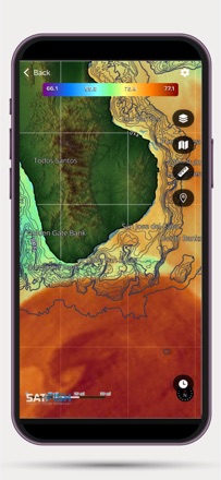  SatFish Fishing App SatFish Fishing App | 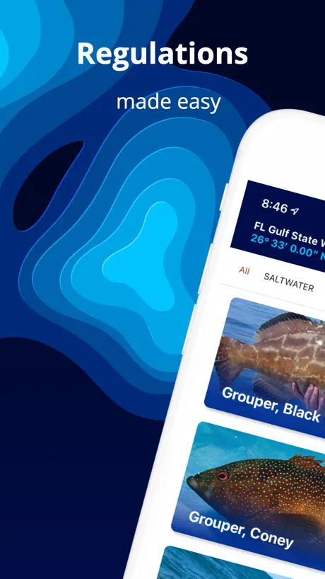  Fish Rules: Local Fishing Laws Fish Rules: Local Fishing Laws |   Minn Kota i-Pilot Link Minn Kota i-Pilot Link |   The Big Rock Tournament The Big Rock Tournament |   Power-Pole Power-Pole |   Salty Offshore Salty Offshore |   CR MAP by Canyon Runner CR MAP by Canyon Runner | |
|---|---|---|---|---|---|---|---|---|---|---|---|
| Rating / 5 | 4.8 | 4.5 | 4.6 | 4.7 | 4.6 | 3.8 | 2.4 | 4.0 | 4.5 | 5.0 | 4.9 |
| Reviews | 798 | 2.3K | 1.5K | 945 | 323 | 198 | 68 | 35 | 11 | 11 | 8 |
| Released | 2015 | 2017 | 2016 | 2023 | 2020 | 2013 | 2017 | 2016 | 2023 | 2025 | 2024 |
| Annual price | — | $29.99 | $5.99 | — | — | $29.99 | — | — | — | — | — |
| One-time price | $169.99 | $2.99 | $3.99 | — | — | — | — | — | — | — | — |
The going rate for each plan in United States, in its own currency, shaded from the cheapest price on the row to the dearest. Plans fewer than four in ten of the priced apps sell are left out.
RipCharts reviews
4.8 out of 5, based on 798 reviews.
What people like
- Helps save fuel on trips
- Works well offline without cell
- Great for planning offshore fishing
What they complain about
- Maps are pixelated and inaccurate
- Pinch to zoom often crashes
- Support never responds to users
Great App
Great SST App. Plus many more features.
Please fix
Please update app to fix issues on newer devices. The ‘pinch to zoom’ feature is all messed up. Great features, terrible interface.
Need fixing
I try and put in numbers manually on my iPhone for my fishing locations, and you can’t see the numbers on the bottom to adjust the lat and Long. Help!
No fee trial
Currently $220 Australian with no free trial I don’t think so
Need help
Need the altemptry chart to update daily sometimes it won’t for days
My Go Yo App for Water Temp Breaks
I got this app 3 years ago and it way improved my accuracy to find blue water for tuna. This year I also started using it to find 57 degree water for salmon. Love the multiple shots I get over the day for a comprehensive trend of the water & currents. I use the layers & tools to find structure & distance. It’s the one app I pay for every year. I Love this app!
App is no good
App freezes and us pixelated
Western Australia Charts.
I have see this app in use and know people that use it who say it’s helpful. I downloaded the app to find it has no Charts for the Western Australian Coast. If these would be implemented I will definitely start using the app.
Catch Fish
Get RipCharts and get on the fish!!
Sort out the glitches
5 stars for valuable info Less than 1 star….moving round maps causes glitches and app to freeze. Using iPhone.. pinch to zoom in usually results in error viewing maps, exit app, restart app and try again on currents and sea temp pages with same result if you pinch and zoom too much. Currents page often won’t show current info on spot selected.
Very important tool for fishing!
I have been using Rip Charts for several years and it has paid off with fish and not waisted fuel.
Horrible customer service
They never respond back
Everything you need
I’ve been using Rip Charts for a decent amount of years and have always liked the quality and price. Gives plenty of info for serious offshore and bay fishing in MD. I use it for early season crabbing in the Chesapeake.
Never a clear shot of NC
I’ve been trying to use this app since this summer and have yet to have one clear image of NC. I understand you can’t control the weather but this app is useless in my opinion.
The best available for serious anglers.
Tried them all and this is the best in so many ways. Won’t be disappointed AT ALL. This is what you have been looking for
Not worth the money
No worth the money, I’ve down loaded the app on my phone and the maps are pixelated and inaccurate temperature readings.
If you desire success
Ripcharts is a very user friendly platform. After viewing the application’s educational videos and tutorials online I have been able to find the optimal areas for making a decision on the best locations for maximizing the trip success . Nothing is a guarantee in the realm of fishing but Ripcharts will 100% give you an advantage. Thanks for making a great tool for any and all fishermen 🤙🤙🤙sobx
Doesn’t work in Whitsundays Australia
It’s pixelated in the Whitsundays Queensland Australia.
Great for north west fishing
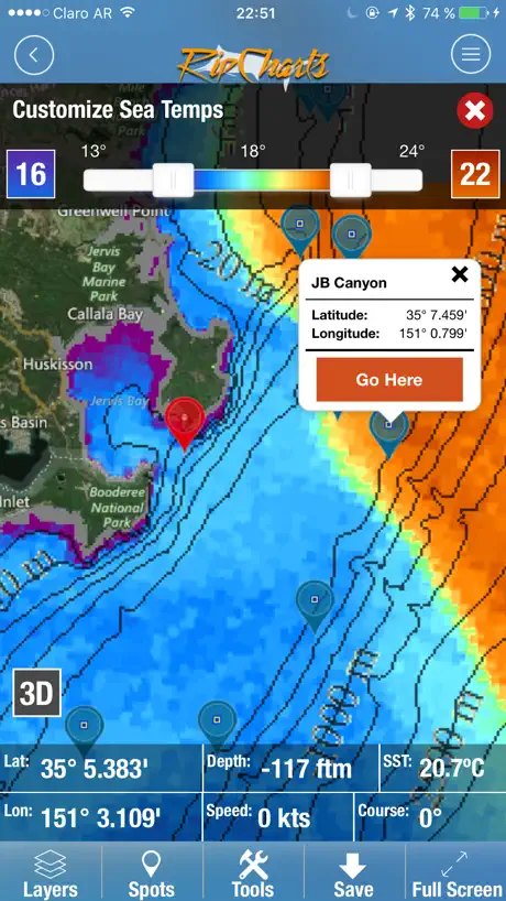
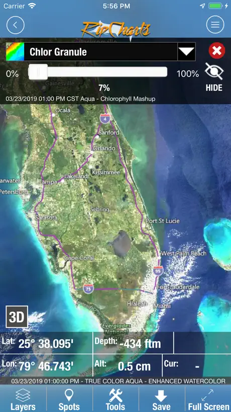
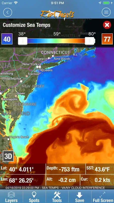
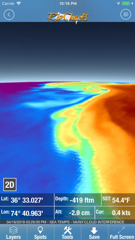
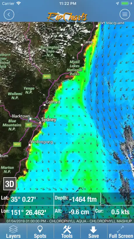
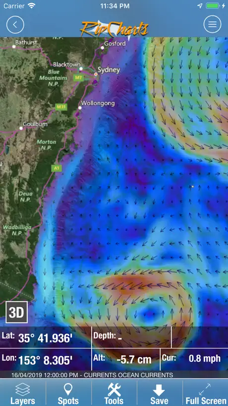
This is a must have for planning your next offshore trip. This app has lots of little options to help assist your next fishing trip. I can overlay the sea surface temps with chloro or other charts. You can measure point to point for distance, and set a point for GPS locations.
I wish I seen the reviews before purchasing!
I watched 3 tutorials and I was sold: that’s what I need! I’m giving you 1 star only for the idea - that’s the only pro - the idea. Cons: Not granular enough for ANYTHING!!! There’s no good resolution on anything even the easy stuff. For fishermen fishing within a 30 Mile radius is useless. Then.... YOU PAY YOU GET SCREWED!!!! CANT GET MY MONEY BACK!!!!
Temps are everything
When I want to head to the canyons, this is what I use for sure. Know where that water is and know where the fish may be
Not here in HI
Love the app but sorry to say doesn't have Hawaii harbors! Still waiting for refund
RipCharts is a no brainer
Fishing offshore can have some guesswork involved if you don’t have daily intel from the charter fleet. RipCharts is an excellent way to gather information on what’s happening offshore. The premium account is a no brainer as it’s certainly less than a tank of fuel for any offshore adventure. The mobile app is great to use even offshore without cell network and the web browser version really can dial in where fishing is shown to be expected with chart overlays. Definitely watch the tutorial videos as it helps you understand how to get the most out of your subscription! Tight Lines! Caneelin’ Sportfishing
DOESNT WORK SINCE UPDATE!?
Why release something that's not working
RipCharts price by country
A one-time purchase costs $159.79 in the Philippines and $257.46 in Colombia — 1.6× more for the same thing. Below is the going rate for each plan in every country that sells it — the middle price of what the app charges there, in the country's own currency with the dollar equivalent beneath it.
| Country | One-time |
|---|---|
| Afghanistan | $169.99 |
| Albania | $199.99 |
| Algeria | $169.99 |
| Angola | $169.99 |
| Anguilla | $169.99 |
| Antigua And Barbuda | $169.99 |
| Argentina | $169.99 |
| Armenia | $199.99 |
| Australia | A$249.99$173.60 |
| Austria | €199.99$232.55 |
| Azerbaijan | $199.99 |
| Bahamas | $199.99 |
| Bahrain | $199.99 |
| Barbados | $199.99 |
| Belarus | $199.99 |
| Belgium | €199.99$232.55 |
| Belize | $169.99 |
| Benin | $199.99 |
| Bermuda | $169.99 |
| Bhutan | $169.99 |
| Bolivia | $169.99 |
| Bosnia & Herzegovina | €199.99$232.55 |
| Botswana | $169.99 |
| Brazil | R$999.90$196.06 |
| British Virgin Islands | $169.99 |
| Brunei Darussalam | $169.99 |
| Bulgaria | €199.99$232.55 |
| Burkina Faso | $169.99 |
| Cambodia | $199.99 |
| Cameroon | $199.99 |
| Canada | CA$229.99$166.66 |
| Cape Verde | $169.99 |
| Cayman Islands | $169.99 |
| Chad | $169.99 |
| Chile | CLP 199,990$216.49 |
| China | CN¥1,198.00$178.01 |
| Colombia | COP 799,900$257.46 |
| Congo | $169.99 |
| Congo, Democratic Republic | $169.99 |
| Costa Rica | $169.99 |
| Cote Divoire | $199.99 |
| Croatia | €199.99$232.55 |
| Cyprus | €199.99$232.55 |
| Czech Republic | CZK 4,990.00$239.44 |
| Denmark | DKK 1,499.00$233.13 |
| Dominica | $169.99 |
| Dominican Republic | $169.99 |
| Ecuador | $169.99 |
| Egypt | EGP 9,999.99$195.31 |
| El Salvador | $169.99 |
| Estonia | €199.99$232.55 |
| Fiji | $169.99 |
| Finland | €199.99$232.55 |
| France | €199.99$232.55 |
| Gabon | $169.99 |
| Gambia | $169.99 |
| Georgia | $199.99 |
| Germany | €199.99$232.55 |
| Ghana | $199.99 |
| Greece | €199.99$232.55 |
| Grenada | $169.99 |
| Guatemala | $169.99 |
| Guinea-bissau | $169.99 |
| Guyana | $169.99 |
| Honduras | $169.99 |
| Hong Kong | HK$1,288.00$164.29 |
| Hungary | HUF 79,990$255.86 |
| Iceland | $199.99 |
| India | ₹17,900.00$188.18 |
| Indonesia | IDR 2,999,000$171.32 |
| Iraq | $169.99 |
| Ireland | €199.99$232.55 |
| Israel | ₪599.90$198.64 |
| Italy | €199.99$232.55 |
| Jamaica | $169.99 |
| Japan | ¥25,000$162.77 |
| Jordan | $169.99 |
| Kazakhstan | KZT 99,990.00$220.01 |
| Kenya | $199.99 |
| Kosovo | €199.99$232.55 |
| Kuwait | $169.99 |
| Kyrgyzstan | $199.99 |
| Lao Peoples Democratic Republic | $199.99 |
| Latvia | €199.99$232.55 |
| Lebanon | $169.99 |
| Liberia | $169.99 |
| Libya | $169.99 |
| Lithuania | €199.99$232.55 |
| Luxembourg | €199.99$232.55 |
| Macao | $169.99 |
| Macedonia | $169.99 |
| Madagascar | $169.99 |
| Malawi | $169.99 |
| Malaysia | MYR 799.90$196.54 |
| Maldives | $169.99 |
| Mali | $169.99 |
| Malta | €199.99$232.55 |
| Mauritania | $169.99 |
| Mauritius | $199.99 |
| Mexico | MX$3,999.00$236.63 |
| Micronesia | $169.99 |
| Moldova | $199.99 |
| Mongolia | $169.99 |
| Montenegro | €149.99$174.41 |
| Montserrat | $169.99 |
| Morocco | $169.99 |
| Mozambique | $169.99 |
| Myanmar | $169.99 |
| Namibia | $169.99 |
| Nauru | $169.99 |
| Nepal | $199.99 |
| Netherlands | €199.99$232.55 |
| New Zealand | NZ$299.99$175.43 |
| Nicaragua | $169.99 |
| Niger | $169.99 |
| Nigeria | NGN 299,900.00$226.17 |
| Norway | NOK 1,990.00$216.30 |
| Oman | $169.99 |
| Pakistan | PKR 49,900$179.96 |
| Palau | $169.99 |
| Panama | $169.99 |
| Papua New Guinea | $169.99 |
| Paraguay | $169.99 |
| Peru | PEN 799.90$238.78 |
| Philippines | ₱9,990.00$159.79 |
| Poland | PLN 799.99$215.63 |
| Portugal | €199.99$232.55 |
| Qatar | QAR 599.99$164.83 |
| Romania | RON 999.99$221.24 |
| Russia | RUB 14,990.00$175.65 |
| Rwanda | $169.99 |
| Sao Tome & Principe | $169.99 |
| Saudi Arabia | SAR 699.99$186.66 |
| Senegal | $199.99 |
| Serbia | €199.99$232.55 |
| Seychelles | $169.99 |
| Sierra Leone | $169.99 |
| Singapore | SGD 249.98$198.40 |
| Slovakia | €199.99$232.55 |
| Slovenia | €199.99$232.55 |
| Solomon Islands | $169.99 |
| South Africa | ZAR 3,499.99$218.20 |
| South Korea | ₩299,000$223.30 |
| Spain | €199.99$232.55 |
| Sri Lanka | $169.99 |
| St. Kitts and Nevis | $169.99 |
| St. Lucia | $169.99 |
| St. Vincent & The Grenadines | $169.99 |
| Suriname | $199.99 |
| Swaziland | $169.99 |
| Sweden | SEK 2,295.00$239.31 |
| Switzerland | CHF 150.00$185.19 |
| Taiwan | NT$5,990.00$190.34 |
| Tajikistan | $199.99 |
| Tanzania | TZS 499,900.00$189.02 |
| Thailand | THB 5,990.00$182.07 |
| Tonga | $169.99 |
| Trinidad and Tobago | $169.99 |
| Tunisia | $169.99 |
| Turkey | TRY 9,999.99$206.14 |
| Turkmenistan | $169.99 |
| Turks and Caicos | $169.99 |
| Uganda | $199.99 |
| Ukraine | $199.99 |
| United Arab Emirates | AED 699.99$190.73 |
| United Kingdom | £179.99$243.89 |
| United States | $169.99 |
| Uruguay | $169.99 |
| Uzbekistan | $199.99 |
| Vanuatu | $169.99 |
| Venezuela | $169.99 |
| Vietnam | ₫4,999,000$193.32 |
| Yemen | $169.99 |
| Zambia | $199.99 |
| Zimbabwe | $199.99 |
RipCharts FAQ
- Is RipCharts free?
- Yes. The app and its basic features are free, in all 175 countries it sells in. Premium features are paid: they start from $169.99 (US), across 10 one-time purchases.
- Does RipCharts have a free trial?
- No. None of its offers (US) come with a free trial.
- Where is RipCharts cheapest?
- A one-time purchase costs ₱9,990.00 (≈$159.79) in the Philippines and COP 799,900 (≈$257.46) in Colombia, its cheapest and dearest countries.
- What are the best alternatives to RipCharts?
- FishVerify: ID & Regulations (4.5 from 2,274 reviews, premium from $2.99), iDfish (4.6 from 1,470 reviews, premium from $1.99) and Salt Strong: Fishing Spots App (4.7 from 945 reviews).
RipCharts download
Last updated 2 years ago.
RipCharts sells in 175 countries. It was released 11 years and 4 months ago, on 3 Jun 2015. It holds a 4.8 rating from 798 reviews.
Supports 1 language: English.
How much does RipCharts make?
Third-party estimates for the last 30 days, worldwide — not the store's own figures, which Apple publishes for nobody.
Revenue by plan
- One-time 100%
Revenue by country
- United States 66%
- Australia 31%
- New Zealand 3%
- Mexico 0%