My Altitude
GPS Elevation & Barometer
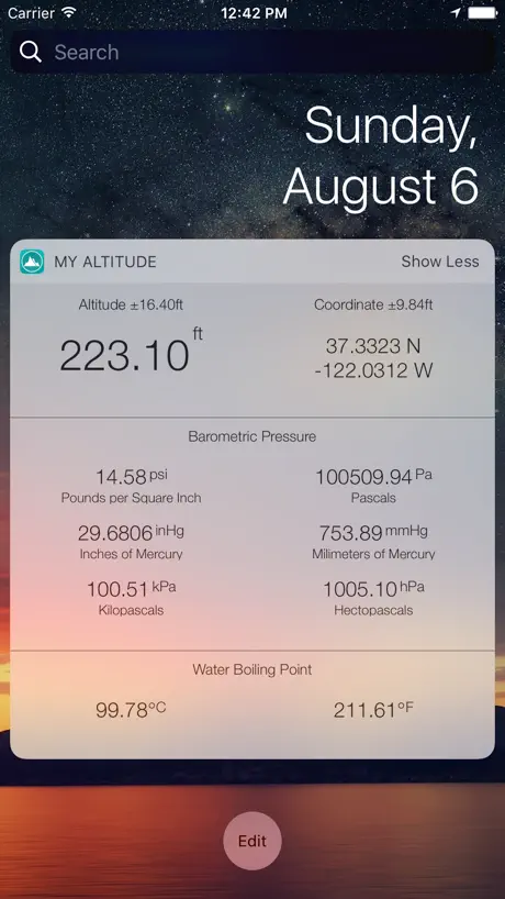
How much does My Altitude cost?
Prices are current as of 7 Oct 2026.
1 subscription from $2.99
In the United States, My Altitude has 1 subscription priced $2.99. It comes with a 1 month free trial.
| Subscription | Period | Price |
|---|---|---|
| No Advertisement Annually | AnnualTrial: 1 month | $2.99 |
1 one-time purchase from $1.99
In the United States, My Altitude has 1 one-time purchase priced $1.99.
| Product | Price |
|---|---|
| No Advertisement | $1.99 |
10+ alternatives to My Altitude
| My Altitude |   Harvest Hosts - RV Camping Harvest Hosts - RV Camping |   GPS Tracks GPS Tracks |   Altimeter: Elevation, Compass Altimeter: Elevation, Compass |   Altimeter - Altitude & Compass Altimeter - Altitude & Compass |   GPS Speedometer, Speed Tracker GPS Speedometer, Speed Tracker |   Savvy Navvy: Boat Navigation Savvy Navvy: Boat Navigation |   Altimeter GPS & Barometer Altimeter GPS & Barometer |   My GPS Coordinates ° My GPS Coordinates ° |   Parkwolf: National Park Guide Parkwolf: National Park Guide |   onX Backcountry: 3D Trail Maps onX Backcountry: 3D Trail Maps | |
|---|---|---|---|---|---|---|---|---|---|---|---|
| Rating / 5 | 4.7 | 4.9 | 4.7 | 4.6 | 4.6 | 4.7 | 4.6 | 4.6 | 4.6 | 4.7 | 4.7 |
| Reviews | 42K | 72K | 37K | 36K | 33K | 31K | 13K | 11K | 10K | 8.7K | 6.6K |
| Released | 2011 | 2017 | 2011 | 2017 | 2017 | 2019 | 2019 | 2012 | 2018 | 2022 | 2020 |
| Monthly price | — | — | — | $4.99 | — | — | — | — | $0.99 | $6.99 | $14.99 |
| Annual price | $2.99 | $169.99 | $29.99 | $29.99 | $49.99 | — | $129.00 | $9.99 | $8.99 | $48.00 | $49.99 |
| One-time price | $1.99 | — | $2.99 | $4.99 | $2.99 | $5.99 | — | $3.99 | — | — | — |
The going rate for each plan in United States, in its own currency, shaded from the cheapest price on the row to the dearest. Plans fewer than four in ten of the priced apps sell are left out.
My Altitude reviews
4.7 out of 5, based on 42,213 reviews.
What people like
- Works perfectly without needing a phone internet connection.
- Gives accurate elevation readings for hiking and climbing.
- Helped users understand symptoms of high altitude sickness.
- Fun to use while driving through different terrains.
What they complain about
- Crashes immediately when you try to open it.
- Shows wildly wrong altitude numbers like thirty thousand feet.
- Ads include pornographic images at the bottom of screen.
- Deletes all your saved places without warning or backup.
Rocky Mountains National Park
My altitude app helped us see the altitude we were at, that explained the symptoms of the heart racing and others as well.
Inappropriate ad’s, disgustingly unethical
Super lame free version scrolled porn ad’s at the bottom. Never observed this in any app.
Oh my goodness
Omg I have to pee
Useless app
It’s accurate to within 90 feet.
Shows same barometric pressure every day; no trend function
Outside temp was almost 10°F off per manual thermometer and other weather apps. If it read the indoors temperature then over 15°F inaccurate. Nice to have pressure, boiling point etc but no function to monitor their trend.
Fun and Useful
I find myself opening this app way more than I would have ever thought. Of course when visiting new hiking spots and mountain elevations, but also when close to home, in an urban environment, seeing where the high and the low ground in the neighborhood is. Or on long drives passing through new towns and terrains, it's fun and often surprising to see what elevation you're at.
😑
Requires ios 26!! For a simple app like this one You gotta be kidding me
Wish it could be a widget on home screen
Great app other than not being able to see it quickly without having to open the app
Too Much Tracking
The app wanted to constantly track all of my movements and sell data to advertisers. The data given on altitude also seemed to be quite unreliable and jumped around a lot. I only stay in one place 99% of the time and didn’t need its intrusive requirements anyway. It kept wanting to say my house was 20 feet higher than it is in reality. When I tried to insist it only track my location when I was using the app, it stopped giving me any useful information. The app had pretty mint green effects. I do NOT recommend this app to iPhone users.
Et l’iWatch ?
Il manque la version iWatch qui était présente avant. Dommage. C’était pratique.
Great app!
Took a trip west through NM,AZ, and CO. It was nice to see the altitude at anytime. Coming from IN where we’re only 365 above sea level, the highest out west were amazing!
Advertising
Pornographic pictures along the bottom of the screen for advertising.
Great, but no widget for iOS 26
Great app, good information, minimally intrusive ads. I dropped one star because I always used it through the widgets, and there are no widget options on iOS 26 on my iPhone 17 pro
Barometer broken
This app looks great and seemingly pulls accurate data from GPS. However the barometer function seems to be broken on iPhone 16 Pro. It always reads 24.xx inHg even on sunny days. I imagine it’s not reading from the in-phone sensor properly.
Announced
I would like an app that announces change in elevation every 100 feet
Nice
Very accurate and more data than I expected
Doesn’t work on iPad 9 IOS18
Just keeps searching for GPS signal.
Where did the Apple Watch app go?
Guess it didn't make it to the 3.0 release? I used it as much as the iOS app.
Nice
Nice but it no loner supports the Apple Watch
Can’t read white lettering
Great app, but there’s no way to change the white lettering. Changing the background does not help.
Very useful
Very precise and useful information
Porn!
The ads that popped up were porn sites. I ask the app not to track from other apps. I guess the porn was the consequence. I deleted the app.
Great app but 1 bug.
Doesn’t show Barometric pressure in inches of Mercury. You can set it in the settings but doesn’t show on the display.
App was great
App was great and accurate. But with latest update from App Store, the crashes as soon as I open it
Helpful
Helpful
Perfect for going through colorado
We went on our honeymoon and are from Kansas. We wanted to see our elevation climb through the mountains and up pikes peak! It was very accurate and amazing to see it go up and down!!
DO NOT DOWNLOAD
i was on a roadtrip through the rocky mountains in colorado. i didnt want to have to make a shape on google maps and see the elevation in that shape because that takes too long. i relied on this app, and i was at 2200 feet, and the app said i was at 7000 feet. terrible app, do not download this.
Great app but units need more options
Hi, we love this app and use it pretty frequently. The only thing that could make it better is customising the ability to select units vs just a metric/ imperial option. I know it’s a British thing in blending units but it would be great to have altitude in feet, temps in *c and wind in kph. Thanks.
Crashes after latest update
Great app until I installed new update. It crashes every time I try to open it
How?
Can anyone explain me how my altitude changes every day? Today it show 2060, after sometime it may be 2054 or 2063 and so on. Why this happens?
No GPS.
Don’t need telephone connection. The app seems to work on satellites
No longer works on Apple Watch
Used to work on Apple Watch but no longer does. 🙁
Excellent
Almost perfect
Very inaccurate readings!
We are at least 10,000 and it reads 3,000
Nice app just not accurate enough
Elevation says +or - 11 ft. Would like to be within 6”, 3” would be better. Just checking drainage routes.
This app works terrific for me!
I am really loving this app! I need my elevation all the time for droning and other activities. Thankful for this!
lost all my saved places
the app is good but in one of their recent updates they wiped out all my places i saved in the course of the last 5 years :(( that’s a major issue for me. Their customer support doesn’t even answer. Looking for more reliable apps.
How to add to widgets?
Looks like we can add but can’t seem to via edit Home Screen
Irregularities
How odd ... !
My Altitude
This app is useful in its free configuration however I think most of its elevations are off.
Excellent and dependable.
This app is Excellent and dependable.
Used for backing
App constantly crashed. Never could tell my altitude or anything. Not impressed.
Almost perfect
All seems to work well, however my watch is showing imperial measurements and my phone metric. Any fixes.
Not accurate
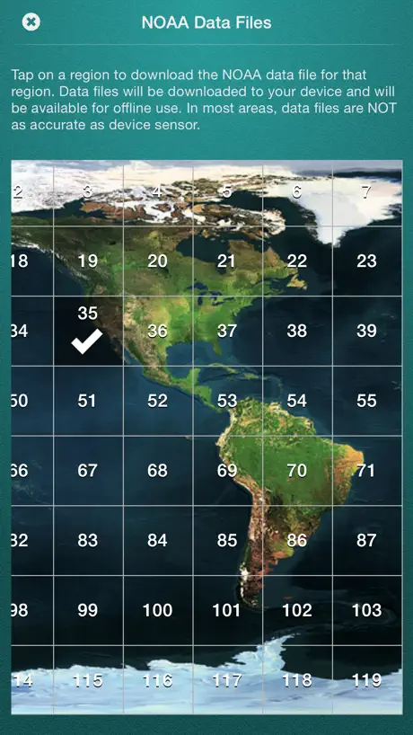
While the onboard sensor part of this app works within a few feet, the stored data is way out. My current location, confirmed online, with several apps and a measuring device - is showing double what it should be on this app’s stored data. Don’t trust it.
App is good
I do like the app, use it quite a bit wile walking along side a Garmin GPS. Since the last update the app will slow me to restore previous purchase but will not remember that I have, everyone the app opens it will show adds across the bottom.
Worked great
Exactly what I needed for a recent climb up Cotopaxi. Easy to use.
Latest update crashes on opening
Too bad. Latest update crashes on opening. Running iOS 18.4.1
Almost Perfect
Just needs a complication so it can be launched directly from the watch face, then it’ll be a 5-Star app.
Does it work
Not sure this really works as it can’t make its mind up what my altitude is I’m sure when I’m sat still and it can’t determine whether I’m at 1,349 or 1,389 every few seconds I have perfect full 4g and WiFi connected
Display makes no sense
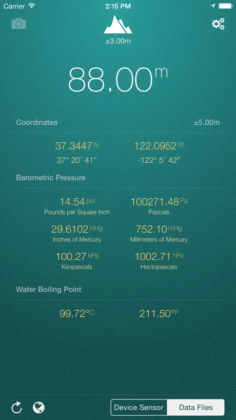
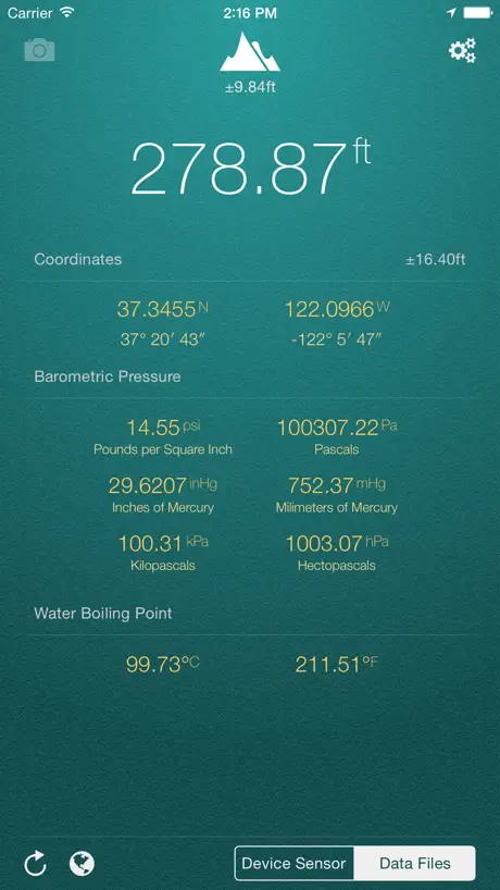
Why on earth are altitude and pressure displayed with 2 decimal places accuracy??? As a general rule, they should be displayed only as far as they're actually precise. Eg if the uncertainty is +/- 1m then don't blindly show 66.00m, just 66m is all you can say. It gets even worse in feet with 9015.37 ft +/- 14.53 ft... Quit it with the 2dp, it's just clutter. 9015ft +/- 14ft is just as accurate and useful, and less cluttered/misleading. Pressures are even worse!! I'm pretty sure any more than 3 significant figures is impossible with the sensors available. And why show Pa, hPa and kPa? It's just clutter, stick to kPa and simplify the display (and again, seriously, you're telling me the pressure to the nearest 0.01 Pascals? I don't think so...) Latitude and longitude are the only ones that should be so precise... In fact I'm not sure you've even gone precise enough! But weirdly you've put the error in ft/m for the location in degrees... What a mess!
My Altitude price by country
An annual subscription costs $2.64 in Turkey and $4.55 in Hungary — 1.7× more for the same thing. Below is the going rate for each plan in every country that sells it — the middle price of what the app charges there, in the country's own currency with the dollar equivalent beneath it.
| Country | Annual | One-time |
|---|---|---|
| Afghanistan | $2.99 | $1.99 |
| Albania | $3.99 | $1.99 |
| Algeria | $2.99 | $1.99 |
| Angola | $2.99 | $1.99 |
| Anguilla | $2.99 | $1.99 |
| Antigua And Barbuda | $2.99 | $1.99 |
| Argentina | $2.99 | $1.99 |
| Armenia | $3.99 | $1.99 |
| Australia | A$4.99$3.47 | A$2.99$2.08 |
| Austria | €2.99$3.48 | €1.99$2.31 |
| Azerbaijan | $3.99 | $1.99 |
| Bahamas | $2.99 | $1.99 |
| Bahrain | $2.99 | $1.99 |
| Barbados | $3.99 | $1.99 |
| Belarus | $3.99 | $1.99 |
| Belgium | €2.99$3.35 | €1.99$2.23 |
| Belize | $2.99 | $1.99 |
| Benin | $3.99 | $1.99 |
| Bermuda | $2.99 | $1.99 |
| Bhutan | $2.99 | $1.99 |
| Bolivia | $2.99 | $1.99 |
| Bosnia & Herzegovina | €2.99$3.35 | €1.99$2.23 |
| Botswana | $2.99 | $1.99 |
| Brazil | R$14.90$2.97 | R$12.90$2.57 |
| British Virgin Islands | $2.99 | $1.99 |
| Brunei Darussalam | $2.99 | $1.99 |
| Bulgaria | €3.49$3.91 | €1.99$2.23 |
| Burkina Faso | $2.99 | $1.99 |
| Cambodia | $2.99 | $1.99 |
| Cameroon | $3.99 | $1.99 |
| Canada | CA$3.99$2.79 | CA$2.99$2.09 |
| Cape Verde | $2.99 | $1.99 |
| Cayman Islands | $2.99 | $1.99 |
| Chad | $2.99 | $1.99 |
| Chile | CLP 2,990$3.02 | CLP 1,990$2.01 |
| China | CN¥22.00$3.28 | CN¥15.00$2.24 |
| Colombia | COP 14,900$4.53 | COP 9,900$3.01 |
| Congo | $2.99 | $1.99 |
| Congo, Democratic Republic | $2.99 | $1.99 |
| Costa Rica | $2.99 | $1.99 |
| Cote Divoire | $3.99 | $1.99 |
| Croatia | €2.99$3.35 | €1.99$2.23 |
| Cyprus | €2.99$3.35 | €1.99$2.23 |
| Czech Republic | CZK 79.00$3.62 | CZK 49.00$2.25 |
| Denmark | DKK 29.00$4.35 | DKK 19.00$2.85 |
| Dominica | $2.99 | $1.99 |
| Dominican Republic | $2.99 | $1.99 |
| Ecuador | $2.99 | $1.99 |
| Egypt | EGP 149.99$2.86 | EGP 99.99$1.91 |
| El Salvador | $2.99 | $1.99 |
| Estonia | €2.99$3.48 | €1.99$2.31 |
| Fiji | $2.99 | $1.99 |
| Finland | €2.99$3.35 | €1.99$2.23 |
| France | €2.99$3.35 | €1.99$2.23 |
| Gabon | $2.99 | $1.99 |
| Gambia | $2.99 | $1.99 |
| Georgia | $3.99 | $1.99 |
| Germany | €2.99$3.35 | €1.99$2.23 |
| Ghana | $3.99 | $1.99 |
| Greece | €2.99$3.35 | €1.99$2.23 |
| Grenada | $2.99 | $1.99 |
| Guatemala | $2.99 | $1.99 |
| Guinea-bissau | $2.99 | $1.99 |
| Guyana | $2.99 | $1.99 |
| Honduras | $2.99 | $1.99 |
| Hong Kong | HK$22.00$2.80 | HK$18.00$2.29 |
| Hungary | HUF 1,490$4.55 | HUF 999$3.05 |
| Iceland | $3.99 | $1.99 |
| India | ₹299.00$3.10 | ₹199.00$2.06 |
| Indonesia | IDR 49,000$2.74 | IDR 39,000$2.18 |
| Iraq | $2.99 | $1.99 |
| Ireland | €2.99$3.35 | €1.99$2.23 |
| Israel | ₪9.90$3.25 | ₪4.90$1.61 |
| Italy | €2.99$3.35 | €1.99$2.23 |
| Jamaica | $2.99 | $1.99 |
| Japan | ¥500$3.16 | ¥300$1.90 |
| Jordan | $2.99 | $1.99 |
| Kazakhstan | KZT 1,490.00$3.27 | KZT 999.00$2.19 |
| Kenya | $3.99 | $1.99 |
| Kosovo | €2.99$3.35 | €1.99$2.23 |
| Kuwait | $2.99 | $1.99 |
| Kyrgyzstan | $2.99 | $1.99 |
| Lao Peoples Democratic Republic | $2.99 | $1.99 |
| Latvia | €2.99$3.35 | €1.99$2.23 |
| Lebanon | $2.99 | $1.99 |
| Liberia | $2.99 | $1.99 |
| Libya | $2.99 | $1.99 |
| Lithuania | €2.99$3.35 | €1.99$2.23 |
| Luxembourg | €2.99$3.35 | €1.99$2.23 |
| Macao | $2.99 | $1.99 |
| Macedonia | $2.99 | $1.99 |
| Madagascar | $2.99 | $1.99 |
| Malawi | $2.99 | $1.99 |
| Malaysia | MYR 14.90$3.66 | MYR 9.90$2.43 |
| Maldives | $2.99 | $1.99 |
| Mali | $2.99 | $1.99 |
| Malta | €2.99$3.35 | €1.99$2.23 |
| Mauritania | $2.99 | $1.99 |
| Mauritius | $2.99 | $1.99 |
| Mexico | MX$69.00$3.81 | MX$39.00$2.15 |
| Micronesia | $2.99 | $1.99 |
| Moldova | $3.99 | $1.99 |
| Mongolia | $2.99 | $1.99 |
| Montenegro | €2.99$3.35 | €1.99$2.23 |
| Montserrat | $2.99 | $1.99 |
| Morocco | $2.99 | $1.99 |
| Mozambique | $2.99 | $1.99 |
| Myanmar | $2.99 | $1.99 |
| Namibia | $2.99 | $1.99 |
| Nauru | $2.99 | $1.99 |
| Nepal | $3.99 | $1.99 |
| Netherlands | €2.99$3.35 | €1.99$2.23 |
| New Zealand | NZ$4.99$2.79 | NZ$3.99$2.23 |
| Nicaragua | $2.99 | $1.99 |
| Niger | $2.99 | $1.99 |
| Nigeria | NGN 4,900.00$3.68 | NGN 3,200.00$2.40 |
| Norway | NOK 39.00$4.07 | NOK 29.00$3.02 |
| Oman | $2.99 | $1.99 |
| Pakistan | PKR 900$3.25 | PKR 500$1.80 |
| Palau | $2.99 | $1.99 |
| Panama | $2.99 | $1.99 |
| Papua New Guinea | $2.99 | $1.99 |
| Paraguay | $2.99 | $1.99 |
| Peru | PEN 12.90$3.75 | PEN 9.90$2.88 |
| Philippines | ₱179.00$2.86 | ₱129.00$2.06 |
| Poland | PLN 14.99$3.83 | PLN 9.99$2.55 |
| Portugal | €2.99$3.35 | €1.99$2.23 |
| Qatar | QAR 9.99$2.74 | QAR 7.99$2.20 |
| Romania | RON 14.99$3.15 | RON 9.99$2.10 |
| Russia | RUB 249.00$2.92 | RUB 199.00$2.34 |
| Rwanda | $2.99 | $1.99 |
| Sao Tome & Principe | $2.99 | $1.99 |
| Saudi Arabia | SAR 12.99$3.46 | SAR 9.99$2.66 |
| Senegal | $3.99 | $1.99 |
| Serbia | €2.99$3.35 | €1.99$2.23 |
| Seychelles | $2.99 | $1.99 |
| Sierra Leone | $2.99 | $1.99 |
| Singapore | SGD 3.98$3.11 | SGD 2.98$2.33 |
| Slovakia | €2.99$3.35 | €1.99$2.23 |
| Slovenia | €2.99$3.35 | €1.99$2.23 |
| Solomon Islands | $2.99 | $1.99 |
| South Africa | ZAR 59.99$3.60 | ZAR 39.99$2.40 |
| South Korea | ₩4,400$3.28 | ₩3,300$2.46 |
| Spain | €2.99$3.35 | €1.99$2.23 |
| Sri Lanka | $2.99 | $1.99 |
| St. Kitts and Nevis | $2.99 | $1.99 |
| St. Lucia | $2.99 | $1.99 |
| St. Vincent & The Grenadines | $2.99 | $1.99 |
| Suriname | $2.99 | $1.99 |
| Swaziland | $2.99 | $1.99 |
| Sweden | SEK 39.00$3.88 | SEK 29.00$2.89 |
| Switzerland | CHF 3.00$3.61 | CHF 2.00$2.41 |
| Taiwan | NT$90.00$2.83 | NT$60.00$1.89 |
| Tajikistan | $2.99 | $1.99 |
| Tanzania | TZS 9,900.00$3.75 | TZS 5,900.00$2.23 |
| Thailand | THB 99.00$2.94 | THB 79.00$2.34 |
| Tonga | $2.99 | $1.99 |
| Trinidad and Tobago | $2.99 | $1.99 |
| Tunisia | $2.99 | $1.99 |
| Turkey | TRY 129.99$2.64 | TRY 99.99$2.03 |
| Turkmenistan | $2.99 | $1.99 |
| Turks and Caicos | $2.99 | $1.99 |
| Uganda | $3.99 | $1.99 |
| Ukraine | $3.99 | $1.99 |
| United Arab Emirates | AED 12.99$3.54 | AED 7.99$2.18 |
| United Kingdom | £2.99$3.96 | £1.99$2.63 |
| United States | $2.99 | $1.99 |
| Uruguay | $2.99 | $1.99 |
| Uzbekistan | $2.99 | $1.99 |
| Vanuatu | $2.99 | $1.99 |
| Venezuela | $2.99 | $1.99 |
| Vietnam | ₫79,000$3.04 | ₫59,000$2.27 |
| Yemen | $2.99 | $1.99 |
| Zambia | $3.99 | $1.99 |
| Zimbabwe | $3.99 | $1.99 |
My Altitude FAQ
- Is My Altitude free?
- Yes. The app and its basic features are free, in all 175 countries it sells in. Premium features are paid: they start from $2.99 (US), across 1 subscription and 1 one-time purchase.
- Does My Altitude have a free trial?
- Yes — a 1 month free trial (US).
- Where is My Altitude cheapest?
- An annual subscription costs TRY 129.99 (≈$2.64) in Turkey and HUF 1,490 (≈$4.55) in Hungary, its cheapest and dearest countries.
- What are the best alternatives to My Altitude?
- Harvest Hosts - RV Camping (4.9 from 72,444 reviews, premium from $98.99), GPS Tracks (4.7 from 37,397 reviews, premium from $2.99) and Altimeter: Elevation, Compass (4.6 from 36,319 reviews, premium from $4.99).
My Altitude download
Last updated 11 months ago.
My Altitude sells in 175 countries. It was released 15 years ago, on 21 Sept 2011. It holds a 4.7 rating from 42,213 reviews.
Supports 1 language: English.
How much does My Altitude make?
Third-party estimates for the last 30 days, worldwide — not the store's own figures, which Apple publishes for nobody.
Revenue by plan
- One-time 85%
- Annual 15%
Revenue by country
- United States 74%
- Canada 4%
- United Kingdom 3%
- France 3%