
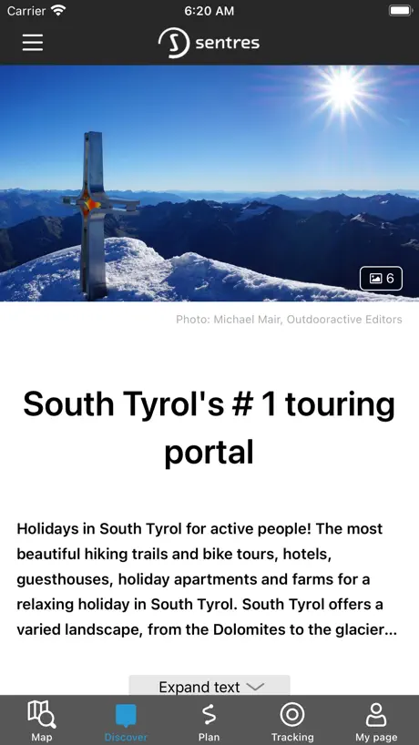
Sentres
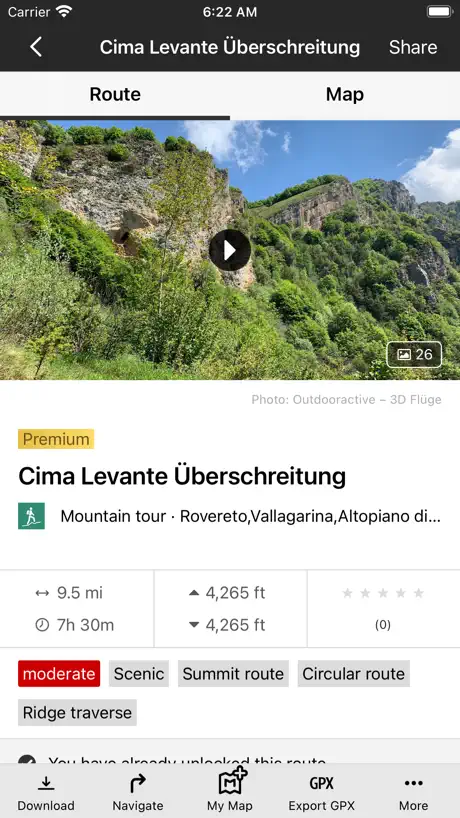
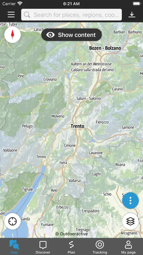
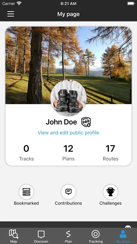
How much does Sentres cost?
Prices are current as of 14 Nov 2026.
Sentres has no in-app products on record in the United States.
10+ alternatives to Sentres
| Sentres |   KOMPASS Outdoor & Hiking Maps |   Outdoor Trentino |   Alto Adige Taxi Südtirol |   südtirolmobil |   TABACCOmapp |   AlpsGo |   MeranO, South Tyrol & Italy |   Timetable South Tyrol |   SkyAlps | |
|---|---|---|---|---|---|---|---|---|---|---|
| Rating / 5 | 4.1 | 4.2 | 4.7 | 4.7 | 2.4 | 2.3 | 4.7 | 4.5 | 3.9 | 4.5 |
| Reviews | 628 | 6.5K | 1.6K | 523 | 445 | 264 | 81 | 12 | 11 | 10 |
| Released | 2010 | 2013 | 2013 | 2022 | 2014 | 2012 | 2023 | 2023 | 2020 | 2026 |
| Monthly price | — | $6.99 | — | — | — | — | — | — | — | — |
| 3-month price | — | $12.99 | — | — | — | — | — | — | — | — |
| Annual price | — | $22.99 | — | — | — | — | — | — | — | — |
The going rate for each plan in United States, in its own currency, shaded from the cheapest price on the row to the dearest.
Sentres reviews
4.1 out of 5, based on 628 reviews.
What people like
- Dark mode makes text unreadable.
- Recent updates removed map details.
- App crashes frequently on devices.
- Does not work well on tablets.
What they complain about
- Easy to use and intuitive.
- Free version is very useful.
- Great for finding new hiking spots.
Super useful for Dolomites hiking!
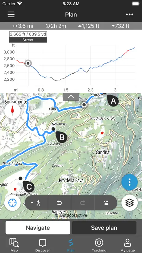
I used Sentres for navigation on the Alta Via 2 (AV2) for 10 days in the Dolomites this summer. Although I downloaded and mapped the routes on two other apps (AllTrails and Garmin), I ended up relying solely on Sentres because it’s so easy to use. I was able to share our routes with family members and felt confident no one would get lost, even if we got separated. The trail details—like Via Ferrata sections versus standard hiking paths—are clearly marked on the map. I especially loved being able to move along the elevation profile and see that exact spot updated on the map relative to my live GPS position. It made tracking my exact distance and elevation seamless! And it is FREE! Highly recommended.
Inutilizzabile
Dopo L’aggiornamento é diventata inutilizzabile, non si trovano i percorsi e non si capisce niente
Gut gemacht !
Leider nur für Smartphones , auf Tablet ˋs passt sich der Bildschirm nicht an .
Tutto troppo complicato
Ho usato questo sito per anni ma non riesco ad utilizzare l’app, tutto troppo complicato. Non si capisce come diventare premium
Super Wanderungen, leider jedoch App mit zu vielen Fehler
Die App ist wirklich super um schöne neue Wanderungen kennen zu lernen, besonders wenn man schon seit über 20 Jahren nach Südtirol fährt und schon vieles kennt. Leider jedoch funktioniert die App auf dem iPhone (11) nicht (mehr) vernünftig. Die Merkliste wird nicht gespeichert und die App stürzt häufig einfach ab. Würde mich sehr freuen, wenn dieses verbessert wird, denn ansonsten ist es eine super App und nur zu empfehlen !
Eccezionale
Funziona una meraviglia utilissima
Peggiorato
Dopo l’aggiornamento è peggiorata tantissimo..difficile da capire quasi tutto a pagamento
Info
Buona app ma purtroppo con mappe assai obsolete!
Deutlich verschlechtert
Die früher einfach zu bedienende, umfangreiche wirklich gute Sentres App ist durch dieses Update deutlich schlechter geworden. Vieles findet man gar nicht mehr, gespeicherte Pläne sind weg, offline Karten nicht mehr auffindbar (jedenfalls finde ich keinen Menüpunkt mehr dafür): Kein Mensch braucht dauernd Updates! Es gibt auch einfach Apps, die sind so wie sie sind: Perfekt. Sentres gehörte dazu: jetzt leider nicht mehr.
Please fix darkmode
The app is not usable if the phone has darkmode enabled. Black text behind black background everywhere.
Super
Super
Da Top a Flop
Prima dell’ultimo aggiornamento, l’app funzionava bene ed era veramente utile. Ora per monetizzare ( abbonamento totalemnte caro e fuori mercato vs altre app simili ) hanno distrutto quel buono che erano riuscito a fare !! Si ritorna su WIKILOC !!
Bella, utile ... ma ....
Ben fatta ma spesso incompleta di indicazioni utili (cime, tratti assicurati, baite...) Sicuramente si può migliorare.
Caotica
la versione precedente era fantastica. Ora l app la trovo molto più caotica
Kein Querformat
Gut, aber kein Querformat zur Planung am iPad oder Tablet verfügbar
Primo approccio
Al primo utilizzo per creare un percorso, l'ho trovata intuitiva, facile e completa.
La nuova versione è pessima
Fino alla precedente versione era la migliore app di tutto il Sudtirol, ora non si capisce più nulla: trovare un percorso è difficile, mancano le descrizioni di come raggiungere il sentiero (oppure sono solo in tedesco). Insomma, cari sviluppatori, con questo aggiornamento l’app è peggiorata tantissimo. Peccato. Ridateci la precedente versione!
App molto utile, ma con iPhone problemi di grafica
La trovo un app molto utile , l’abuso regolarmente per visitare molti posti in Alto Adige, peccato che sul mio iPhone 10 accanto alle foto delle diverse località non appaiano anche i nomi dei luoghi ( bassa atesina? Zona Merano ecc. ) non si potrebbero aggiungere ? Grazie !
Nuovo aggiornamento
Uso questa app da anni, vivo in montagna e L ho sempre trovata utilissima, chiara e veloce da consultare , consigliata a tutti negli anni. ora con il nuovo aggiornamento, inutilizzabile. i sentieri non si vedono e non si capisce più nulla. Mi dispiace ma da 5 stelle passa a 2.
Bella app ma qualche pecca
Bella app e completa , ha però sei problemi di compatibilità del layout con iPhone 11 ( la parte superiore si sovrappone con l’orologio ) e in modalità iPhone scura non si vede nulla, quindi bisogna passare alla modalità chiara durante l’utilizzo. Per il resto ok.
Fantastica
La migliore !
Nuova versione peggiorata notevolmente
Fino agli ultimi aggiornamenti l’app era indubbiamente la migliore per trovare escursioni alle varie cime in Alto Adige, ora è utilizzabile solo per pianificare per conto proprio i percorsi. Se riportassero l’app alle condizioni dell’anno scorso darei 5 stelle
Ottima ma ultimamente non funziona al meglio
Ho sempre usato l’app che considero una cosa geniale, ma ultimamente, da iPhone, se si usa la modalità scura dello schermo molto contenuti non si vedono
Anzeige fehlerhaft
Auf dem IPhone Mini wird die Beschreibung der Tour leider nicht angezeigt.
Da migliorare
In parte non funzionante con il modus “dark”,descrizione a volte scarsa,mappe scarse di dettagli. App comoda per avere delle idee per trovare una meta, comoda per verificare in tempo reale se uno si trova sulla strada giusta.
Ottimo
Utilissima anche la versione free
Da migliorare
Dopo gli ultimi aggiornamenti l’app è diventata complicata da capire. Ci vorrebbe un corso per utilizzarla. Prima era molto più intuitiva.
Achtung, im „Dunkel“ Modus nicht lesbar!
Gute App, aber im Dunkelmodus nicht lesbar
Datenbank ist nicht aktuell
Die App ist an und für sich in Ordnung, leider ist sie nicht brauchbar, denn die Inhalte entsprechen nicht denen der Onlineversion. So werden viele Touren einfach nicht gefunden, obwohl sie in der Onlineversion sehr wohl vorhanden sind. Anscheinend werden hier unterschiedliche Datenbanken verwendet.
Valutazione
Molto utile, ma da implementare in quanto non è presente val casies e non tutti i percorsi escursionistici
Find ich gut
Sehr hilfreich um schöne Wanderungen zu finden😃😃👍🏻👍🏻
Leider unbrauchbar geworden
Seit dem letzten Update ist die App einfach nur unübersichtlich und nicht mehr zu gebrauchen. Schade, habe sie früher IMMER verwendet um meine Touren zu planen.
Gute Touren, mäßiges Kartenmaterial
Die Wandertouren sind qualitativ und quantitativ top, leider fehlen im Kartenmaterial viele Details! Trotzdem super! Danke!
Darstellung fehlerhaft
Letzten Jahre oft genutze APP bei unseren Urlauben in Südtirol. Mit meinem neuen 12 pro quasi nicht nutzbar. Schwarze Schrift auf schwarzem Hintergrund ist nicht von Vorteil bei der Routenplaning.
An sich gut, aber Merkliste lässt App abstürzen
An sich eine gut gelungene App mit vielfältigen Möglichkeiten und Informationen, die im Urlaub schon sehr nützlich war. Der Aufruf der Merkliste lässt die App aber reproduzierbar abstürzen, daher zwei Sterne Abzug, weil dies eine wichtige Funktion ist.
Molto utile
App molto utile e ben fatta! Ho scoperto un sacco di posti in zone a me sconosciute... super consigliata.. aspettiamo nuove zone e nuovi percorsi!!
Era meglio la versione precedente
Purtroppo SENTRES non è piu quel punto di riferimento che avevamo per poter trovare con facilità un itinerario. Ora non è poi così, la mappa non è piú comoda da leggere con i numeri dei sentieri e i nomi dei luoghi, malghe e rifugi. Mi dispiace ma abbiamo perso un bel punto di riferimento che ci aiutava a conoscere i bei luoghi…..
Indispensabile, la migliore
La migliore per i Trekking in TAA, 5 stelle con il supporto ad Apple Watch, avete previsioni per questo? Grazie
Definizione delle mappe
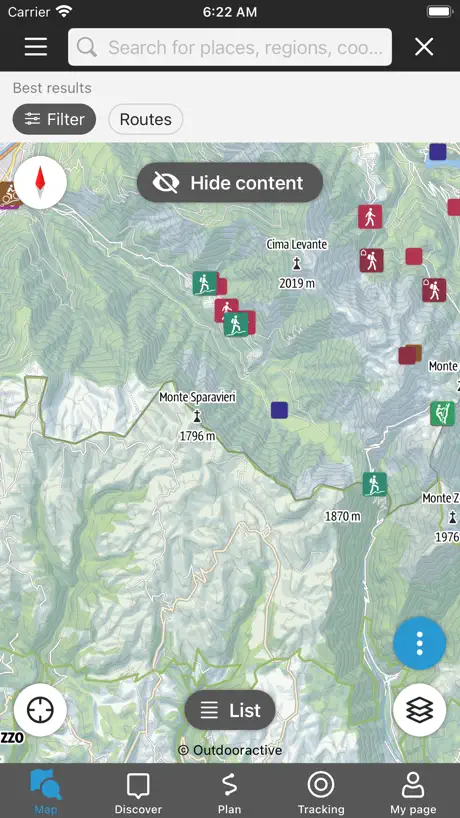
Con gli ultimi aggiornamenti le Mappe hanno perso un sacco di dettagli; non ci sono più rifugi, monti e altri punti di riferimento indispensabili per chi fa le escursioni. Rimettete la cartografia precedente. Inoltre in tutto il Trentino non è indicato nessun sentiero in rosso
Keine Hütten etc in der Karte - für normale Urlauber unbrauchbar (iPhone/iPad)
Keine Hütten bzw Sehenswürdigkeiten in der Grund-Karte sichtbar (iPhone/iPad) - eher schwache Leistung - sollte neu überdacht werden! Einblendungen werden bei Tourwechsel nicht behalten. Vermutlich muss ich eine andere App für meinen Südtirol Urlaub verwenden!
Fidata
Si scoprono percorsi da fare in zone favolose! Consigliatissima! Unico appunto per gli sviluppatori è sistemare il colore dei font nelle celle per la dark mode, al limite forzare tutto a light! :)
Nuova versione pessima!
Ho provato ad abituarmi alla nuova versione ma è davvero scandalosa. Potevate integrare senza cambiarla. Mi toccherà disinstallarla e cercarne un’altra, davvero peccato perché prima era fantastica.
App molto utile
Finalmente un’app veramente ben realizzata, facile da utilizzare e piena di contenuti molto interessanti e aggiornati con buona frequenza. Dispiace solo non copra tutte le Dolomiti ma solo quelle dell’Alto Adige... a quando la Regione Alpina con il Veneto ? ;)
Alla ricerca delle mappe
Dove trovo le mappe che scarico offline?
Buona applicazione
La versione precedente aveva le mappe più dettagliate. Mancano Malghe, Selle, e nomi di posizioni e dettagli vari. Se guardi la mappa non riesci a sapere dove sei rispetto ad un rifugio, baita o posto. Alla mappa precedente avrei dato 5 stelle.
Problema mappe
Buona sera, non di aprono più le mappe in modalità offline!
Nuovo aggiornamento pessimo
Peccato, era un’app fantastica fino a poco tempo fa, permetteva di programmare le escursioni in modo preciso ed efficace. In seguito all’ultimo aggiornamento non è più utile nè utilizzabile come prima. Speriamo che ricevendo svariati feedback di questo tipo si decida di tornare alla vecchia versione.
Treuer Begleiter
Ich nutze die App seit mehreren Jahren und freue mich jedes Jahr wieder, dass ich auf meinen Rucksack, jetzt Merkliste (wie langweilig) zurück greifen kann. Die App ist eben wie manches Wanderutensil, das man selten braucht, aber dann nicht missen will. Da ich nun ein Problem mit der App habe, wollte ich mir andere Bewertungen ansehen, ob das Problem auch andere haben und war überrascht, dass es so wenige Bewertungen gibt. Den Stern Abzug gibt es dafür, dass anscheinend die Synchronisation der Merkliste nicht richtig funktioniert, oder ist es gewollt, dass es nur mit einem Gerät funktioniert und das es immer noch keine Universal-App ist, ich wandere seit 5 Jahren mit dem IPad und will nicht mehr darauf verzichten.
Das Update war fatal
Ich nutze Sentres schon sehr lange und war auch immer sehr zufrieden! Für unterwegs in den heimischen Bergen immer eine Karte mit den Wanderwegen, Berggipfeln, Parkplätzen und Höhenlinien mit dabei zu haben war super! Doch seit dem Update wo Trentino hinzugefügt wurde fand ich die App um ein vielfaches schlechter wie davor! Das Layout der Karte wurde geändert! Viel weniger detailiert, man kann die Straßen und Wege kaum erkennen wennman hinein zoomt, Parkplätze werden nicht mehr angezeigt, die meisten Berggipfel werden nicht mehr angezeigt. Einfach allgemein eine viel schlechtere App! Bitte bringt das alte Layout zurück!
Gpx Download nicht möglich
Während ich auf der Website eine Tour als Gpx File herunterladen kann, geht das aus der App heraus nicht. Schade!!!
Sentres FAQ
- Is Sentres free?
- Yes. The app is free, in all 175 countries it sells in, and it sells nothing inside it.
- Does Sentres have a free trial?
- No. None of its offers (US) come with a free trial.
- What are the best alternatives to Sentres?
- KOMPASS Outdoor & Hiking Maps (4.2 from 6,545 reviews, premium from $6.99), Outdoor Trentino (4.7 from 1,582 reviews) and Alto Adige Taxi Südtirol (4.7 from 523 reviews).
Sentres download
Last updated 7 months ago.
Sentres sells in 175 countries. It was released 16 years and 1 month ago, on 6 Oct 2010. It holds a 4.1 rating from 628 reviews.
Supports 3 languages: English, German, Italian.
How much does Sentres make?
Third-party estimates for the last 30 days, worldwide — not the store's own figures, which Apple publishes for nobody.