Offline Map: GPS Route Tracker
GPS Tracker and Offline Maps
| Revenue % | |||||
|---|---|---|---|---|---|
| 6 months | 175 | $12.60 – $22.03 | 24.8% | +18.0% | |
| Monthly | 175 | $17.69 – $31.48 | 24.8% | +18.0% | |
| Weekly | 175 | $9.19 – $15.72 | 24.8% | +18.0% | |
| Annual | 175 | $28.56 – $47.23 | 24.8% | +18.0% |
Description
Record where you go, find your way back, and keep your maps with you even without signal.
Offline Map is built for the outdoors: hiking, trail running, cycling, hunting, fishing, boating, motorcycling and road trips. Press Start, do your thing, and the app draws your route, logs every waypoint and keeps your statistics for later.
WANT TO…
remember the trail you took and walk it back to your car?
mark a fishing spot, a reef, a camp or a hunting stand and return to it?
see your speed, distance, elevation and pace while you move?
follow a route a friend sent you as a GPX file?
FREE
Record tracks for any activity, with Live Activity on the Lock Screen and Dynamic Island
Save waypoints with photos, videos and notes
Compass navigation to any waypoint with distance, bearing and ETA
Apple maps (standard, satellite, hybrid)
Speed, distance, time, pace and elevation while recording
Import GPX, KML, KMZ and NMEA from Files, iCloud Drive, Google Drive or Dropbox
Deleted tracks wait 30 days in Recently Deleted, so a slip of the finger costs nothing
Apple Watch app that records on its own and saves workouts to Health
iCloud sync between your iPhone, iPad and Mac
No account, no login, no ads
PREMIUM (subscription)
Offline maps: download an area once and navigate with no signal
15 map sources: OpenStreetMap, topo, satellite, USGS, NOAA nautical charts, FAA aviation charts
Follow a saved track forward, or reverse it to get back to the start
Export tracks and waypoints as GPX, KML, KMZ or CSV
Full track report as a dark PDF or image: map, every number, speed and elevation charts, splits
Share a track as a 24-hour status card for WhatsApp and Instagram
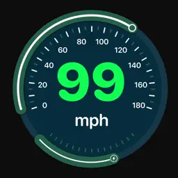
Six speedometer styles: classic, sport, racing, neon, marine, vintage
Live location sharing with a 6-letter code, no account needed
Route planner, range finder, area measurement
Pacesetter: race your own previous track
Elevation profile, splits and speed-coloured tracks
Weather at waypoints
Image overlays, custom tile servers, 220+ map datums, unlimited waypoints
MEASURE & CONVERT
Decimal, DMS, UTM and MGRS coordinates, convert between them any time
Distance, bearing and area between any points on the map
GPS averaging for more accurate waypoints
WORKS WITH
Live Activities and widgets
Siri Shortcuts to start, pause and stop a recording
Send a waypoint to Apple Maps, Google Maps or Waze
Files app: every saved track is also stored as a GPX file you own
Available in 32 languages.
Continued use of GPS in the background can decrease battery life.
Terms of Use (EULA): https://www.apple.com/legal/internet-services/itunes/dev/stdeula/
Privacy Policy: https://gpstrackapp.web.app/privacy
Last collected from the App Store on